Country:
 United Arab Emirates
Region:
City:
Latitude and Longitude:
Time Zone:
Postal Code:
IP information under different IP Channel
ip-api
Country
Region
City
ASN
Time Zone
ISP
Blacklist
Proxy
Latitude
Longitude
Postal
Route
IPinfo
Country
Region
City
ASN
Time Zone
ISP
Blacklist
Proxy
Latitude
Longitude
Postal
Route
MaxMind
Country
Region
City
ASN
Time Zone
ISP
Blacklist
Proxy
Latitude
Longitude
Postal
Route
Luminati
Country
AERegion
sh
City
sharjah
ASN
Time Zone
Asia/Dubai
ISP
Emirates Integrated Telecommunications Company PJSC
Latitude
Longitude
Postal
db-ip
Country
Region
City
ASN
Time Zone
ISP
Blacklist
Proxy
Latitude
Longitude
Postal
Route
ipdata
Country
Region
City
ASN
Time Zone
ISP
Blacklist
Proxy
Latitude
Longitude
Postal
Route
Popular places and events near this IP address
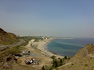
Dibba
Coastal area in within Oman and the UAE
Distance: Approx. 706 meters
Latitude and longitude: 25.61666667,56.26666667
Dibbā (Arabic: دِبَّا) is a coastal area at the northern tip of the eastern Arabian peninsula on the Gulf of Oman.
Dhanha
Distance: Approx. 9684 meters
Latitude and longitude: 25.587864,56.183078
Dhanha (Arabic: ظنحة, romanized: Dhanhah) is a village near Dibba in the United Arab Emirates. It is located in the western side of the city and it is the first village in the Dibba - Masafi Road.
Ras Dibba
Place in Fujairah, United Arab Emirates
Distance: Approx. 8625 meters
Latitude and longitude: 25.59444444,56.35416667
Ras Diba is the name of a cape in Fujairah.

Dibba Al-Hisn
Town in United Arab Emirates
Distance: Approx. 90 meters
Latitude and longitude: 25.61888889,56.27333333
Dibba Al-Hisn (Arabic: دبا الحصن, white Dibba) is a pene-exclave of the emirate of Al-Sharjah, one of the seven United Arab Emirates. It is bordered by the Gulf of Oman from the East, Dibba Al-Baya (a province of Oman in Musandam) from the North, and Dibba Al-Fujairah from the South. It is also geographically part of the Dibba region.
Dibba Al-Fujairah
Human settlement in United Arab Emirates
Distance: Approx. 4368 meters
Latitude and longitude: 25.58361111,56.25555556
Dibba Al-Fujairah (Arabic: دبا الفجيرة) is a city in the emirate of Fujairah, located on the northeast part of the United Arab Emirates. It is geographically part of the Dibba region. Dibba Al-Fujairah is considered to be the second largest city in the emirate of Fujairah after Fujairah City.
Dibba Al-Baya
Place in Musandam, Oman
Distance: Approx. 2356 meters
Latitude and longitude: 25.64,56.266667
Dibbā Al-Bayʿah (Arabic: دِبَّا ٱلْبَيْعَة) is geographically part of the Dibba region that faces the Arabian Sea, and is bordered by the United Arab Emirates to the south. It is a Wilayat in the Muhafazah of Musandam, Sultanate of Oman, on the east coast of the Arabian Peninsula.It is considered one of the most famous Omani cities known in the pre-Islamic days because it contains Dibba market, which is one of the most famous Arab markets that was known at that time, as merchants from different countries around the world such as India, Sindh and China used to come to it, and some historians, such as Al-Asmai, attribute this name to the locusts Creeping to express the large number of people in it, and the area of that city is approximately 37 km2.
Dibba Airport
Airport in Musandam Governorate, Oman
Distance: Approx. 2926 meters
Latitude and longitude: 25.61388889,56.24444444
Dibba Airport (IATA: BYB) is an airport serving Dibba Al-Baya, a city in the Musandam Governorate of Oman. Dibba is a harbor city on the Gulf of Oman, and is divided between Oman and United Arab Emirates. The airport is 3 kilometres (2 mi) inland from the Gulf.

Wadi Khabb Shamsi
River in Musandam, Oman
Distance: Approx. 3285 meters
Latitude and longitude: 25.64888889,56.26888889
The Wadi Khabb Shamsi (Arabic: وادي خب الشامسي, romanized: Wādī Khab ash Shāmsī), is a valley or dry river, with ephemeral or intermittent flow, flowing almost exclusively during the rainy season, located west of the Musandam Governorate, in the Sultanate of Oman. Wadi Khabb Shamsi drains the southeast of Ru'us al-Jibal, and is the main wadi of the drainage basin of Karsha, named after the port, beach and current residential area of the city of Dibba Al-Baya (Oman), into which it flows. The entire drainage basin of Karsha, formed by the Wadi Khabb Shamsi itself and its numerous tributaries and sub-tributaries, covers an approximate area of 133 km2 (51 sq mi).
Weather in this IP's area
overcast clouds
39 Celsius
46 Celsius
39 Celsius
39 Celsius
992 hPa
47 %
992 hPa
992 hPa
10000 meters
1.42 m/s
1.65 m/s
132 degree
100 %
05:40:00
19:02:33