Country:
 Lithuania
Region:
City:
Latitude and Longitude:
Time Zone:
Postal Code:
IP information under different IP Channel
ip-api
Country
Region
City
ASN
Time Zone
ISP
Blacklist
Proxy
Latitude
Longitude
Postal
Route
IPinfo
Country
Region
City
ASN
Time Zone
ISP
Blacklist
Proxy
Latitude
Longitude
Postal
Route
MaxMind
Country
Region
City
ASN
Time Zone
ISP
Blacklist
Proxy
Latitude
Longitude
Postal
Route
Luminati
Country
LTRegion
kl
City
silute
ASN
Time Zone
Europe/Vilnius
ISP
UAB Cgates
Latitude
Longitude
Postal
db-ip
Country
Region
City
ASN
Time Zone
ISP
Blacklist
Proxy
Latitude
Longitude
Postal
Route
ipdata
Country
Region
City
ASN
Time Zone
ISP
Blacklist
Proxy
Latitude
Longitude
Postal
Route
Popular places and events near this IP address

Šilutė
City in Lithuania Minor, Lithuania
Distance: Approx. 123 meters
Latitude and longitude: 55.35,21.48333333
Šilutė (; previously Šilokarčiama; German: Heydekrug) is a city in the south of the Klaipėda County in western Lithuania. The city was part of the Klaipėda Region and ethnographic Lithuania Minor. Šilutė was the interwar capital of Šilutė County and is currently the capital of Šilutė District Municipality.
Šilutė District Municipality
Municipality in Lithuania Minor/ Samogitia, Lithuania
Distance: Approx. 123 meters
Latitude and longitude: 55.35,21.48333333
Šilutė District Municipality is one of 60 municipalities in Lithuania. It is known for spring floods when ice on Nemunas River starts melting. This is the only municipality in Lithuania that gets flooded on regular basis.
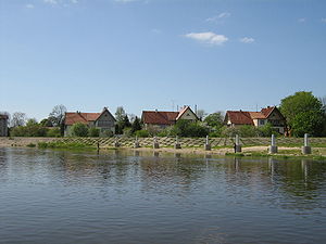
Rusnė
Town in Lithuania
Distance: Approx. 8809 meters
Latitude and longitude: 55.29722222,21.37777778
Rusnė (German: Ruß) is a border town in Šilutė district, Lithuania, located on the Rusnė Island in the Nemunas Delta, 9 km south-west from Šilutė.

Šilutė Stadium
Distance: Approx. 1362 meters
Latitude and longitude: 55.33666667,21.48305556
Šilutė Stadium is a multi-use stadium in Šilutė, Lithuania. It is currently used mostly for football matches by FK Šilutė. The capacity of the stadium is 3,000 people.
Krokų Lanka
Marine / lagoon lake in Lithuania
Distance: Approx. 9755 meters
Latitude and longitude: 55.36444444,21.33138889
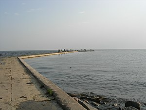
Krokų Lanka is the only lake of marine origin in Lithuania and the largest lake in the Šilutė District Municipality. It is located in the Nemunas Delta Regional Park on the Baltic Sea shore near Nemunas Delta and Ventė Cape. It covers a territory of 788 ha.
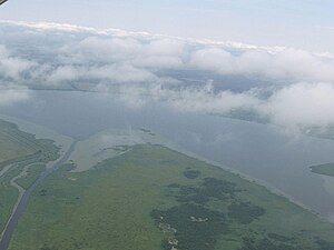
Nemunas Delta Regional Park
Distance: Approx. 7572 meters
Latitude and longitude: 55.3,21.4
Nemunas Delta Regional Park, established in 1994, is located in Lithuania within the Nemunas Delta where the Nemunas flows into the Baltic Sea. The park covers 29,013 ha. The park, a Ramsar Convention site, lies on the East Atlantic Flyway, a major bird migration route; over 70,000 migratory birds are ringed there annually.

Rusnė Island
Lithuania's largest island
Distance: Approx. 9166 meters
Latitude and longitude: 55.3,21.36666667
Rusnė Island is an island in Nemunas Delta, Šilutė District Municipality, Lithuania. It is located between Atmata and Skirvytė, distributaries of the Neman River, and the Curonian Lagoon. At 45 or 46 square kilometers, Rusnė is often considered Lithuania's largest island.

Šilutė Airfield
Airport
Distance: Approx. 3286 meters
Latitude and longitude: 55.33694444,21.53055556
Šilutė airfield (ICAO code: EYSI) is a former Lithuanian Air Force airfield located in Western Lithuania, 5 km (3.1 mi) east of Šilutė. It was used for glider pilot training since the 1950s; today it is mainly used by ultralight aircraft and gliders. The airfield has a concrete runway of 500 m (1,600 ft), which is used mainly by radio control modellers, and a grass strip of ~750 m (2,460 ft), which is regularly maintained and used all year round.
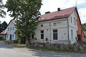
Macikai
Distance: Approx. 2465 meters
Latitude and longitude: 55.356,21.52
Macikai is a village in Šilutė District Municipality, Lithuania, 2 km east of Šilute. The village is within the Lithuanian Coastal Lowlands. The Šyša river flows around Macikai along its northwestern and northeastern edges.
Weather in this IP's area
overcast clouds
21 Celsius
21 Celsius
21 Celsius
21 Celsius
1015 hPa
65 %
1015 hPa
1014 hPa
10000 meters
3.38 m/s
4.67 m/s
159 degree
100 %
05:32:46
21:48:08