Country:
 Ukraine
Region:
City:
Latitude and Longitude:
Time Zone:
Postal Code:
IP information under different IP Channel
ip-api
Country
Region
City
ASN
Time Zone
ISP
Blacklist
Proxy
Latitude
Longitude
Postal
Route
IPinfo
Country
Region
City
ASN
Time Zone
ISP
Blacklist
Proxy
Latitude
Longitude
Postal
Route
MaxMind
Country
Region
City
ASN
Time Zone
ISP
Blacklist
Proxy
Latitude
Longitude
Postal
Route
Luminati
Country
UAASN
Time Zone
Europe/Kyiv
ISP
LLC ott Ukraine
Latitude
Longitude
Postal
db-ip
Country
Region
City
ASN
Time Zone
ISP
Blacklist
Proxy
Latitude
Longitude
Postal
Route
ipdata
Country
Region
City
ASN
Time Zone
ISP
Blacklist
Proxy
Latitude
Longitude
Postal
Route
Popular places and events near this IP address

Illich Steel and Iron Works
Metallurgical facility in Mariupol, Ukraine
Distance: Approx. 6733 meters
Latitude and longitude: 47.1475,37.57583333
Illich Iron & Steel Works (Ukrainian: Маріу́польський металургі́йний комбіна́т і́мені Ілліча́ – literally "Mariupol Metallurgical Plant named after Illich") is the second largest metallurgical enterprise in Ukraine, after Kryvorizhstal. It is located in Mariupol. According to NPR, the company had a workforce of 14,000 in early 2022.

Donetsk Academic Regional Drama Theater
Theatre in Mariupol, Ukraine
Distance: Approx. 8554 meters
Latitude and longitude: 47.09611111,37.54861111
Donetsk Academic Regional Drama Theatre (Ukrainian: Донецький академічний обласний драматичний театр, romanized: Donetskyi akademichnyi oblasnyi dramatychnyi teatr) was a theatre in Mariupol in southern Ukraine. The modern theatre was constructed in 1960 in the approximate location of the former Church of Mary Magdalene. The theatre was known as Donetsk Regional Drama Theatre before it was given academic status in November 2007.

Zakhidnyi Stadium
Distance: Approx. 4993 meters
Latitude and longitude: 47.12027778,37.51527778
Zakhidnyi Stadium is a multi-purpose stadium in Mariupol, Ukraine. It is currently used mostly for football matches, and is the home of youth squad of Illichivets (Illichivets-2 Mariupol). The stadium holds 3,206 spectators.

Mariupol State University
Ukrainian academic institution
Distance: Approx. 7182 meters
Latitude and longitude: 47.1019,37.5256
Mariupol State University (MSU; Ukrainian: Маріупольський Державний Університет, romanized: Mariupolskyi Derzhavnyi Universytet) is a university in the Ukrainian city of Mariupol.

Pryazovskyi State Technical University
Ukrainian university in Mariupol
Distance: Approx. 8525 meters
Latitude and longitude: 47.09361111,37.54138889
Pryazovskyi State Technical University (Ukrainian: Приазовський державний технічний університет) is a Ukrainian university in Mariupol. It is one of the oldest universities in the Donetsk Oblast.

Dnieper Metallurgical Combine
Distance: Approx. 6733 meters
Latitude and longitude: 47.1475,37.57583333
Dnieper Metallurgical Combine (Ukrainian: Дніпровський металургійний комбінат, romanized: Dniprovskyi Metalurhiynyi Kombinat) is one of the biggest metallurgical companies in Ukraine along with Kryvorizhstal and Illich Steel and Iron Works. It is located in Kamianske, Dnipropetrovsk Oblast.

Mariupol regional intensive care hospital
Hospital in Donetsk oblast, Ukraine
Distance: Approx. 5931 meters
Latitude and longitude: 47.11055556,37.51222222
The Mariupol Regional Intensive Care Hospital (Ukrainian: Обласна лікарня інтенсивного лікування м.Маріуполь), formerly known as Mariupol City Hospital No. 2 is the largest hospital in Mariupol and in the Donetsk region (Ukraine), designed to provide inpatient and outpatient tertiary level care to residents of the region and secondary to the population of the Central region of Mariupol.
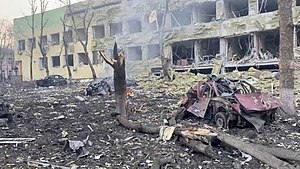
Mariupol hospital airstrike
Russian war crime during the Russian invasion of Ukraine
Distance: Approx. 7985 meters
Latitude and longitude: 47.09645,37.53373
On 9 March 2022, the Russian Air Force bombed Maternity Hospital No 3, a hospital complex functioning both as a children's hospital and maternity ward in Mariupol, Ukraine, during the Russian invasion of Ukraine, killing at least four people and injuring at least sixteen, and leading to at least one stillbirth. Ukrainian president Volodymyr Zelenskyy, Josep Borrell, the European Union head of Foreign Affairs, and British armed forces minister James Heappey described the bombing as a war crime. On 10 March, the Russian Minister of Foreign Affairs and the Ministry of Defence claimed that bombing of the hospital was justified by the supposed presence of Ukrainian armed forces at Mariupol Maternity Hospital No 1, as stated by Russian UN representative Vasily Nebenzya earlier, on 7 March.

Saints Constantine and Helen Church (Mariupol)
Destroyed Eastern Orthodox church in Mariupol, Ukraine
Distance: Approx. 8554 meters
Latitude and longitude: 47.09611111,37.54861111
The Saints Constantine and Helen Church (Ukrainian: церква Св. Костянтина і Єлени (Маріуполь)) was an Orthodox church in Mariupol, Ukraine.

Staryi Krym, Donetsk Oblast
Urban locality in Donetsk Oblast, Ukraine
Distance: Approx. 266 meters
Latitude and longitude: 47.15972222,37.48694444
Staryi Krym (Ukrainian: Старий Крим) is an rural settlement in Mariupol Raion, Donetsk Oblast, eastern Ukraine. The settlement is about 7 km (4.3 mi) from the city of Mariupol, located on the right bank of the Kalchyk River. The population is 5,734 (2022 estimate).

Cathedral of the Holy Virgin Protection, Mariupol
Church in Mariupol, Ukraine
Distance: Approx. 8377 meters
Latitude and longitude: 47.097895,37.548404
The Cathedral of the Holy Virgin Protection (Ukrainian: Храм Покрови Пресвятої Божої Матері) is a Ukrainian Orthodox church located in Mariupol, Ukraine.

Cathedral of St. Nicholas, Mariupol
Saint Nicholas's Cathedral Mariupol Ukraine
Distance: Approx. 7000 meters
Latitude and longitude: 47.11252,37.54727
Cathedral of Saint Nicholas (Ukrainian: Свято Микільський катедральний собор.) is a Ukrainian Orthodox church located in the Tsentralnyi borough, Mariupol, Ukraine.
Weather in this IP's area
clear sky
29 Celsius
28 Celsius
29 Celsius
29 Celsius
1018 hPa
27 %
1018 hPa
1012 hPa
10000 meters
1.94 m/s
2.9 m/s
117 degree
05:04:08
20:08:42