Country:
 Switzerland
Region:
City:
Latitude and Longitude:
Time Zone:
Postal Code:
IP information under different IP Channel
ip-api
Country
Region
City
ASN
Time Zone
ISP
Blacklist
Proxy
Latitude
Longitude
Postal
Route
IPinfo
Country
Region
City
ASN
Time Zone
ISP
Blacklist
Proxy
Latitude
Longitude
Postal
Route
MaxMind
Country
Region
City
ASN
Time Zone
ISP
Blacklist
Proxy
Latitude
Longitude
Postal
Route
Luminati
Country
CHRegion
vs
City
saillon
ASN
Time Zone
Europe/Zurich
ISP
netplus.ch SA
Latitude
Longitude
Postal
db-ip
Country
Region
City
ASN
Time Zone
ISP
Blacklist
Proxy
Latitude
Longitude
Postal
Route
ipdata
Country
Region
City
ASN
Time Zone
ISP
Blacklist
Proxy
Latitude
Longitude
Postal
Route
Popular places and events near this IP address

Bagnes
Former municipality in Valais, Switzerland
Distance: Approx. 1711 meters
Latitude and longitude: 46.08333333,7.21666667
Bagnes is a former municipality in the district of Entremont in the canton of Valais in Switzerland. On 1 January 2021 the former municipalities of Bagnes and Vollèges merged to form the new municipality of Val de Bagnes. With an area of 282 km2 (108.88 sq mi), Bagnes used to be the largest municipality of Switzerland until the formation of Glarus Süd in 2011.

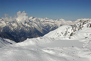
Verbier
Swiss village
Distance: Approx. 149 meters
Latitude and longitude: 46.1,7.21666667
Verbier (French pronunciation: [vɛʁbje]) is a village located in south-western Switzerland in the canton of Valais. It is a holiday resort and ski area in the Swiss Alps and is recognised as one of the premier off-piste resorts in the world. Some areas are covered with snow all year.

Vollèges
Former municipality in Valais, Switzerland
Distance: Approx. 4189 meters
Latitude and longitude: 46.08333333,7.16666667
Vollèges is a former municipality in the district of Entremont in the canton of Valais in Switzerland. On 1 January 2021 the former municipalities of Bagnes and Vollèges merged to form the new municipality of Val de Bagnes.

Col du Lein
Mountain pass in the Swiss Alps
Distance: Approx. 4694 meters
Latitude and longitude: 46.11333333,7.15916667
Col du Lein (el. 1623 m.) is a high mountain pass in the Alps in the canton of Valais in Switzerland. It connects Saxon in the valley of the Rhône with Vollèges in the Val de Bagnes.

La Tzoumaz
Ski resort in the Valais canton, Swiss Alps
Distance: Approx. 5283 meters
Latitude and longitude: 46.1447,7.23306
La Tzoumaz (formally known as Les Mayens-de-Riddes) is a ski resort in the Swiss Alps, in the canton of Valais. It is part of the "Four Valleys" ski area, which consists of various ski resorts, including Verbier, Nendaz, Veysonnaz, La Tzoumaz, and Thyon. As such it has direct access to over 400 km of runs.

Le Châble
Distance: Approx. 2119 meters
Latitude and longitude: 46.08333333,7.2
Le Châble is a village in Val de Bagnes, Valais, Switzerland, below the ski resort of Verbier. The local St. Bernard Express Train runs from Martigny and finishes in Le Châble.

Mont Gelé (Riddes)
Mountain in Switzerland
Distance: Approx. 4874 meters
Latitude and longitude: 46.09683333,7.27927778
Mont Gelé (3,022 metres (9,915 ft)) is a mountain of the Pennine Alps, part of the Municipality Riddes and overlooking Verbier in the Swiss canton of Valais. Located on the range north of Mont Fort, its summit is the tripoint between the municipalities (and valleys) of Bagnes, Riddes and Nendaz. It is one of the two mountains named Mont Gelé in the valley of Bagnes, the other being located on the Italian border.

Pierre Avoi
Mountain in Switzerland
Distance: Approx. 2491 meters
Latitude and longitude: 46.11811111,7.20013889
The Pierre Avoi is a mountain of the Swiss Pennine Alps, overlooking Saxon in the canton of Valais. It is located on the chain between the main Rhone valley and the valley of Bagnes. The closest locality is Verbier, from where several trails lead to the summit of Pierre Avoi.
Lac des Vaux
Distance: Approx. 4461 meters
Latitude and longitude: 46.10777778,7.2725
Lac des Vaux is a lake above La Tzoumaz and Verbier in the canton of Valais, Switzerland. The lake is located in the municipality of Riddes-La Tzoumaz.
Val de Bagnes, Switzerland
Municipality in Valais, Switzerland
Distance: Approx. 2080 meters
Latitude and longitude: 46.08027778,7.21166667
Val de Bagnes is a municipality in the district of Entremont in the canton of Valais in Switzerland. It is named after the eponymous Val de Bagnes.

Etiez railway station
Distance: Approx. 4493 meters
Latitude and longitude: 46.08278389,7.16271889
Etiez railway station (French: Gare d'Etiez) is a railway station in the municipality of Vollèges, in the Swiss canton of Valais. It is located on the standard gauge Martigny–Orsières line of Transports de Martigny et Régions.

Le Châble railway station
Railway station in Switzerland
Distance: Approx. 2207 meters
Latitude and longitude: 46.07888806,7.21509
Le Châble railway station (French: Gare du Châble), also known as Le Châble VS, is a railway station in the municipality of Bagnes, in the Swiss canton of Valais. It is the eastern terminus of the standard gauge Martigny–Orsières line of Transports de Martigny et Régions. In January 2019, the new station was opened after an extensive reconstruction, which lowered the tracks and platforms by 4.5 meters, bringing them underground.
Weather in this IP's area
clear sky
14 Celsius
13 Celsius
13 Celsius
16 Celsius
1026 hPa
83 %
1026 hPa
863 hPa
10000 meters
1.03 m/s
06:09:57
21:05:02