Country:
 Italy
ItalyRegion:
City:
Latitude and Longitude:
Time Zone:
Postal Code:
IP information under different IP Channel
ip-api
Country
Region
City
ASN
Time Zone
ISP
Blacklist
Proxy
Latitude
Longitude
Postal
Route
IPinfo
Country
Region
City
ASN
Time Zone
ISP
Blacklist
Proxy
Latitude
Longitude
Postal
Route
MaxMind
Country
Region
City
ASN
Time Zone
ISP
Blacklist
Proxy
Latitude
Longitude
Postal
Route
Luminati
Country
ITASN
Time Zone
Europe/Rome
ISP
SEEWEB s.r.l.
Latitude
Longitude
Postal
db-ip
Country
Region
City
ASN
Time Zone
ISP
Blacklist
Proxy
Latitude
Longitude
Postal
Route
ipdata
Country
Region
City
ASN
Time Zone
ISP
Blacklist
Proxy
Latitude
Longitude
Postal
Route
Popular places and events near this IP address

Benetton Group
Global fashion brand
Distance: Approx. 1184 meters
Latitude and longitude: 45.7081087,12.2179756
Benetton Group S.r.l. (Italian pronunciation: [benetˈton]) is a global fashion brand based in Ponzano Veneto, Italy, founded in 1965. Benetton Group has a network of about 5,000 stores worldwide.

Pinarello
Italian bicycle manufacturer
Distance: Approx. 2129 meters
Latitude and longitude: 45.6982616,12.2529689
Cicli Pinarello S.p.A. is an Italian bicycle manufacturer based in Treviso, Italy. Founded in 1953, it supplies mostly handmade bicycles for the road, track, E-bikes(NYTRO), mountain bikes and cyclo-cross.

Province of Treviso
Province of Italy
Distance: Approx. 3239 meters
Latitude and longitude: 45.67222222,12.24222222
The province of Treviso (Italian: provincia di Treviso) is a province in the Veneto region of Italy. Its capital is the city of Treviso. The province is surrounded by Belluno in the north, Vicenza in the west, Padua in southwest, Venice in the south-east and Friuli-Venezia Giulia in the east.

Stadio Omobono Tenni
Distance: Approx. 3985 meters
Latitude and longitude: 45.67,12.25583333
Stadio Omobono Tenni (Italian pronunciation: [ˈstaːdjo omoˈbɔːno 'tɛnni]) is a football stadium in Treviso, Italy. It is currently the home of Treviso FBC 1993. The stadium was built in 1933 and holds 10,001.

Stadio Comunale di Monigo
Rugby union stadium in Treviso, Italy
Distance: Approx. 2284 meters
Latitude and longitude: 45.6803,12.2132
Stadio Comunale di Monigo is a sports stadium in the Treviso frazione of Monigo, Italy. The stadium is used for rugby union, and is the home ground for Benetton. The stadium has a total capacity of 5,000, divided between the two covered stands: the Tribuna Ovest (West Stand), seated with 2,700 seats, and the Tribuna Est (East Stand), seated with 2,300 seats.
Treviso Cathedral
Distance: Approx. 3858 meters
Latitude and longitude: 45.66638889,12.24277778
Treviso Cathedral (Italian: Duomo di Treviso, Cattedrale di San Pietro Apostolo) is a Roman Catholic cathedral in Treviso, Veneto, northern Italy, dedicated to Saint Peter. It is the seat of the bishop of Treviso.

Monigo concentration camp
Italian concentration camp
Distance: Approx. 2372 meters
Latitude and longitude: 45.6816,12.2078
The Monigo concentration camp was a prison camp opened during World War II aimed at civilian prisoners (mostly Slovenes and Croats). It was located in Monigo, a suburb of the town of Treviso. The camp was active between 1942 and 1943.

Piazza dei Signori, Treviso
Distance: Approx. 3987 meters
Latitude and longitude: 45.665894,12.245501
Piazza dei Signori is a city square in Treviso, north-eastern Italy. It takes its name (meaning "Lords Square" in Italian) from the palaces of lords the former seignory of Treviso which face it. They include: Palazzo del Podestà with the Civic tower (13th century), which was the lordship's seat Palazzo dei Trecento Palazzo Pretorio (with a 17th century façade) Original seat of the Municipal Library and the Municipal Gallery (1847) The Square also features several sculptures of Lion of Saint Mark, a symbol of the former domination of the Republic of Venice on Treviso.

Fontana Delle Tette
Fountain in Treviso, Italy
Distance: Approx. 3930 meters
Latitude and longitude: 45.6663,12.245
The Fountana de łe tete is an old fountain in Treviso, Italy. Under the Venetian Republic it poured white and red wine during special celebrations. The name translates into English as "The Fountain of Tits" and is usually translated in Italian as "Fontana delle tette".
Carabinieri Mobile Units Division
Military unit
Distance: Approx. 2714 meters
Latitude and longitude: 45.6887,12.2573
The Carabinieri Mobile Units Division (Italian: Divisione Unità Mobili Carabinieri) is the Carabinieri formation, established in 2001, dedicated to the performance of military duties abroad, the military police tasks when abroad, the support to Territorial Organization, the participation in civil protection operations and to ensure the emergency reserve for the General Command.
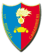
11th Carabinieri Mechanized Brigade
Italian military brigade
Distance: Approx. 2714 meters
Latitude and longitude: 45.6887,12.2573
The 11th Carabinieri Mechanized Brigade (Italian: 11° Brigata Meccanizzata Carabinieri) was the Carabinieri formation, established in 1963 and disestablished in 2001, dedicated to the performance of military duties, the support to Territorial Organization, the participation in civil protection operations and to ensure the emergency reserve for the General Command.

Teatro Mario Del Monaco
Opera house and theatre in Treviso, Italy
Distance: Approx. 3778 meters
Latitude and longitude: 45.66944444,12.24972222
The Teatro Mario Del Monaco is an opera house and theatre in Treviso, Italy. It was previously known as the Teatro Onigo from 1692 to 1846, the Teatro Sociale from 1847 to 1930, and the Teatro Comunale from 1931 to 2011. In 2011, it was renamed in honour of the Italian tenor Mario Del Monaco who lived in Treviso from 1975 until his death in 1982.
Weather in this IP's area
clear sky
28 Celsius
29 Celsius
26 Celsius
28 Celsius
1018 hPa
59 %
1018 hPa
1015 hPa
10000 meters
2.06 m/s
50 degree
05:51:08
20:43:47