Country:
 USA
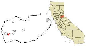
USARegion:
City:
Latitude and Longitude:
Time Zone:
Postal Code:
IP information under different IP Channel
ip-api
Country
Region
City
ASN
Time Zone
ISP
Blacklist
Proxy
Latitude
Longitude
Postal
Route
IPinfo
Country
Region
City
ASN
Time Zone
ISP
Blacklist
Proxy
Latitude
Longitude
Postal
Route
MaxMind
Country
Region
City
ASN
Time Zone
ISP
Blacklist
Proxy
Latitude
Longitude
Postal
Route
Luminati
Country
USRegion
ca
City
auburn
ASN
Time Zone
America/Los_Angeles
ISP
F2W-AS
Latitude
Longitude
Postal
db-ip
Country
Region
City
ASN
Time Zone
ISP
Blacklist
Proxy
Latitude
Longitude
Postal
Route
ipdata
Country
Region
City
ASN
Time Zone
ISP
Blacklist
Proxy
Latitude
Longitude
Postal
Route
Popular places and events near this IP address

Cameron Park, California
CDP in California, United States
Distance: Approx. 2482 meters
Latitude and longitude: 38.66888889,-120.98722222
Cameron Park is a census-designated place (CDP) in El Dorado County, California, United States and is part of the Greater Sacramento Area. The population was 19,171 in the 2020 census, up from 18,228 in 2010. Cameron Park is a community located in the Northern California Gold Country of the Sierra Nevada foothills, approximately 30 miles (50 km) east of Sacramento and 70 miles (110 km) west of South Lake Tahoe.
Shingle Springs, California
Census-designated place in California, United States
Distance: Approx. 3302 meters
Latitude and longitude: 38.66583333,-120.92611111
Shingle Springs (formerly, Shingle Spring and Shingle) is a census-designated place (CDP) in El Dorado County, California, United States. The population was 4,432 at the 2010 census, up from 2,643 at the 2000 census. It is located about 40 miles (64 km) from Sacramento in the Gold Country foothills and sits directly on Highway 50.
Ponderosa High School (California)
Public school in Shingle Springs, California, United States
Distance: Approx. 2469 meters
Latitude and longitude: 38.67305556,-120.94222222
Ponderosa High School is a public high school in Shingle Springs, California. Opened in 1963, it is a member of the El Dorado Union High School District in El Dorado County, California. In the 2018–19 school year, there were 1,865 students enrolled.
Rescue, California
Unincorporated community in California, United States
Distance: Approx. 6097 meters
Latitude and longitude: 38.71166667,-120.95138889
Rescue is an unincorporated community in El Dorado County, California. It is located north-northwest of Shingle Springs and north-northeast of Cameron Park. The zip code is 95672, and Rescue is located in area code 530.
Buckeye Flat, California
Human settlement in El Dorado County, California, United States of America
Distance: Approx. 4504 meters
Latitude and longitude: 38.66944444,-120.91305556
Buckeye Flat is a former mining town in El Dorado County, California, located a mile east of Shingle Springs at an elevation of about 1,400 ft (400 m). The town was named after its first settlers, who came from the state of Ohio, known as the Buckeye State. At its peak, from 1852 to 1856, Buckeye Flat had several stores and at least two hotels.
Clarksville, California
Unincorporated community in California, United States
Distance: Approx. 7820 meters
Latitude and longitude: 38.655,-121.0525
Clarksville (Tong Ranch) is an unincorporated community in El Dorado County, California. It is located 14 miles (23 km) west-southwest of Placerville, at an elevation of 676 feet (206 m). Clarksville was established during the California gold rush and at one point had over a thousand residents and several businesses.
Frenchtown, El Dorado County, California
Unincorporated community in California, United States
Distance: Approx. 4804 meters
Latitude and longitude: 38.64138889,-120.91138889
Frenchtown (formerly, French Creek) is an unincorporated community in El Dorado County, California. It is located on French Creek 2 miles (3.2 km) south-southeast of Shingle Springs, at an elevation of 1165 feet (355 m). The place was originally a mining camp set up by French Canadian and French miners.
Green Springs Ranch
Distance: Approx. 7959 meters
Latitude and longitude: 38.70166667,-121.03472222
Green Springs Ranch is a ranch in El Dorado County, California. It lies at an elevation of 1040 feet (317 m). Formerly The Hitchcock Ranch, California, its postal zip code is 95672 Rescue, California.
Jayhawk, California
Unincorporated community in California, United States
Distance: Approx. 8221 meters
Latitude and longitude: 38.73138889,-120.96638889
Jayhawk (formerly, Jay Hawk) was a former settlement in El Dorado County, California. It was located 6.5 miles (10 km) southwest of Coloma, at an elevation of 1161 feet (354 m). A post office operated at Jay Hawk from 1860 to 1865.

Pine Hill Ecological Reserve
California nature reserve
Distance: Approx. 7300 meters
Latitude and longitude: 38.71944444,-120.99055556
Pine Hill Ecological Reserve is a nature reserve of 403 acres (1.63 km2) located due east of Folsom Lake in the Sierra Nevada foothills, in El Dorado County, California. The reserve was established in 1979, and is managed by the Bureau of Land Management. The Pine Hill Ecological Reserve is one unit of the much larger Pine Hill Preserve system that consists of five separate units of varying size that total more than 4,000 acres (16 km2) and protects eight rare plants and their gabbro soil habitat.
Coloma Road, Rescue
Historical Landmark in Rescue, California, United States
Distance: Approx. 6026 meters
Latitude and longitude: 38.7111,-120.952
Coloma Road in Rescue, California is a historical road in El Dorado County, California. A Historical Landmark was built at 4222 Green Valley Road in Rescue, California at the Rescue Junction General Store. The old Coloma Road opened in 1847, it ran from Sutter's Fort to the city of Coloma.

Pleasant Grove House
Historical Landmark in Rescue, California, United States
Distance: Approx. 6642 meters
Latitude and longitude: 38.697,-121.02
Pleasant Grove House Pony Express Station is a historical building in Rescue, California built in 1850. The site of the Pleasant Grove House Pony Express Station is a California Historical Landmark No. 703.
Weather in this IP's area
clear sky
15 Celsius
14 Celsius
11 Celsius
19 Celsius
1013 hPa
78 %
1013 hPa
965 hPa
10000 meters
1.1 m/s
1.16 m/s
212 degree
06:02:19
20:18:07