Country:
 Romania
Region:
City:
Latitude and Longitude:
Time Zone:
Postal Code:
IP information under different IP Channel
ip-api
Country
Region
City
ASN
Time Zone
ISP
Blacklist
Proxy
Latitude
Longitude
Postal
Route
IPinfo
Country
Region
City
ASN
Time Zone
ISP
Blacklist
Proxy
Latitude
Longitude
Postal
Route
MaxMind
Country
Region
City
ASN
Time Zone
ISP
Blacklist
Proxy
Latitude
Longitude
Postal
Route
Luminati
Country
RORegion
b
City
bucharest
ASN
Time Zone
Europe/Bucharest
ISP
Vodafone Romania S.A.
Latitude
Longitude
Postal
db-ip
Country
Region
City
ASN
Time Zone
ISP
Blacklist
Proxy
Latitude
Longitude
Postal
Route
ipdata
Country
Region
City
ASN
Time Zone
ISP
Blacklist
Proxy
Latitude
Longitude
Postal
Route
Popular places and events near this IP address

Fieni
Town in Dâmbovița, Romania
Distance: Approx. 8320 meters
Latitude and longitude: 45.12222222,25.41833333
Fieni is a town in Dâmbovița County, Muntenia, Romania, on the Ialomița River, having a population of 6,378 as of 2021. It administers two villages, Berevoești and Costești. The town is situated in a hilly area south of the Bucegi Mountains, on the banks of the Ialomița River.

Adunați
Commune in Prahova, Romania
Distance: Approx. 7517 meters
Latitude and longitude: 45.18333333,25.6
Adunați is a commune in Prahova County, Muntenia, Romania. It is composed of three villages: Adunați, Ocina de Jos, and Ocina de Sus. The commune is located in the western part of the county, 50 km (31 mi) northwest of the county seat, Ploiești.
Ialomicioara (right tributary)
River in Dâmbovița County, Romania
Distance: Approx. 8606 meters
Latitude and longitude: 45.1167,25.4178
The Ialomicioara is a right tributary of the river Ialomița in Romania. It discharges into the Ialomița at Fieni. The upper reach of the river is also known as Vaca.

Bezdead
Commune in Dâmbovița, Romania
Distance: Approx. 3 meters
Latitude and longitude: 45.15,25.51666667
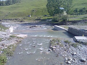
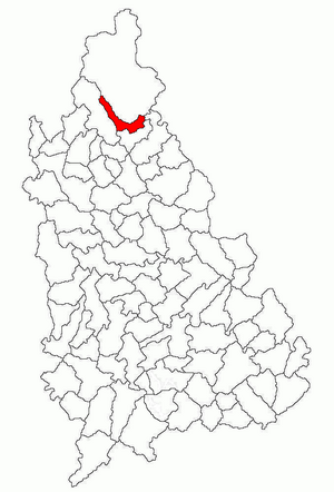
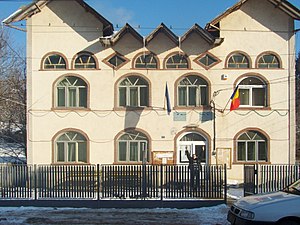
Bezdead is a commune in the northeast of Dâmbovița County, Muntenia, Romania. It is composed of six villages: Bezdead, Broșteni, Costișata, Măgura, Tunari and Valea Morii. In 2011, Bezdead had a population of 4,595.
Țâța
River in Romania
Distance: Approx. 5103 meters
Latitude and longitude: 45.1613,25.4537
The Țâța is a right tributary of the river Ialomița in Romania. It flows into the Ialomița in Dealu Mare. Its length is 16 km (9.9 mi) and its basin size is 17 km2 (6.6 sq mi).

Buciumeni, Dâmbovița
Commune in Dâmbovița, Romania
Distance: Approx. 5237 meters
Latitude and longitude: 45.15,25.45
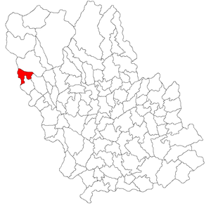
Buciumeni is a commune in Dâmbovița County, Muntenia, Romania. It is composed of three villages: Buciumeni, Dealu Mare and Valea Leurzii.

Moțăieni
Commune in Dâmbovița, Romania
Distance: Approx. 9629 meters
Latitude and longitude: 45.1,25.41666667
Moțăieni is a commune in Dâmbovița County, Muntenia, Romania with a population of 2,307 people. It is composed of two villages, Cucuteni and Moțăieni.
Pietroșița
Commune in Dâmbovița, Romania
Distance: Approx. 7522 meters
Latitude and longitude: 45.18333333,25.43333333
Pietroșița is a commune in Dâmbovița County, Muntenia, Romania with a population of 3,270 people. It is composed of two villages, Dealu Frumos and Pietroșița. The name is derived from the compound Piatra (meaning stone) and șița (meaning slate).
Vârfuri
Commune in Dâmbovița, Romania
Distance: Approx. 5566 meters
Latitude and longitude: 45.1,25.51666667
Vârfuri is a commune in Dâmbovița County, Muntenia, Romania, with a population of 1,842 people. It is composed of seven villages: Cârlănești, Cojoiu, Merișoru, Stătești, Șuvița, Ulmetu, and Vârfuri. It is located outside the town of Pucioasa.

Vișinești
Commune in Dâmbovița, Romania
Distance: Approx. 6150 meters
Latitude and longitude: 45.1,25.55
Vișinești is a commune in Dâmbovița County, Muntenia, Romania with a population of 1,974 people. It is composed of four villages: Dospinești, Sultanu, Urseiu, and Vișinești. The commune is located in the northeastern part of the county, on the border with Prahova County.

Provița de Sus
Commune in Prahova, Romania
Distance: Approx. 9344 meters
Latitude and longitude: 45.13333333,25.63333333
Provița de Sus is a commune in Prahova County, Muntenia, Romania. It is composed of four villages: Izvoru, Plaiu, Provița de Sus and Valea Bradului.
Talea, Prahova
Commune in Prahova, Romania
Distance: Approx. 7868 meters
Latitude and longitude: 45.21666667,25.55
Talea is a commune in Prahova County, Muntenia, Romania. It is composed of two villages, Plaiu and Talea.
Weather in this IP's area
clear sky
24 Celsius
24 Celsius
24 Celsius
24 Celsius
1018 hPa
59 %
1018 hPa
957 hPa
10000 meters
2.93 m/s
3.04 m/s
346 degree
05:58:28
20:50:09