Country:
 Switzerland
Region:
City:
Latitude and Longitude:
Time Zone:
Postal Code:
IP information under different IP Channel
ip-api
Country
Region
City
ASN
Time Zone
ISP
Blacklist
Proxy
Latitude
Longitude
Postal
Route
IPinfo
Country
Region
City
ASN
Time Zone
ISP
Blacklist
Proxy
Latitude
Longitude
Postal
Route
MaxMind
Country
Region
City
ASN
Time Zone
ISP
Blacklist
Proxy
Latitude
Longitude
Postal
Route
Luminati
Country
CHASN
Time Zone
Europe/Zurich
ISP
netplus.ch SA
Latitude
Longitude
Postal
db-ip
Country
Region
City
ASN
Time Zone
ISP
Blacklist
Proxy
Latitude
Longitude
Postal
Route
ipdata
Country
Region
City
ASN
Time Zone
ISP
Blacklist
Proxy
Latitude
Longitude
Postal
Route
Popular places and events near this IP address

Swiss Life Arena
Ice hockey arena in Zürich, Switzerland
Distance: Approx. 2448 meters
Latitude and longitude: 47.39536944,8.48003056
The Swiss Life Arena is an ice hockey and entertainment arena the Altstetten quarter of Zürich, Switzerland. It is located approximately seven kilometers west of downtown Zürich. The arena officially opened in October 2022.

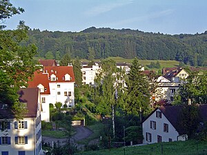
Schlieren, Switzerland
Municipality in Zurich, Switzerland
Distance: Approx. 409 meters
Latitude and longitude: 47.4,8.45
Schlieren (Zürich German Schlierä) is a municipality in the district of Dietikon in the canton of Zürich in Switzerland.

Unterengstringen
Municipality in Zurich, Switzerland
Distance: Approx. 2230 meters
Latitude and longitude: 47.41666667,8.45
Unterengstringen is a municipality in the district of Dietikon in the canton of Zürich in Switzerland, located in the Limmat Valley (German: Limmattal).
Urdorf
Municipality in Zurich, Switzerland
Distance: Approx. 1836 meters
Latitude and longitude: 47.38333333,8.43333333
Urdorf is a municipality in the district of Dietikon in the canton of Zürich in Switzerland, located in the Limmat Valley (German: Limmattal).
Weiningen
Municipality in Zurich, Switzerland
Distance: Approx. 2469 meters
Latitude and longitude: 47.41666667,8.43333333
Weiningen is a municipality in the district of Dietikon in the canton of Zürich in Switzerland. It is located in the Limmat Valley (German: Limmattal). The municipality was first mentioned in 870 as Winingon.

Altstetten (Zürich)
Quarter in Zürich, Switzerland
Distance: Approx. 2583 meters
Latitude and longitude: 47.384969,8.477175
Altstetten is a quarter in district 9 of the city of Zürich in Switzerland. It was formerly a municipality in its own right, but was incorporated into Zürich in 1934.
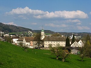
Fahr Convent
Distance: Approx. 1450 meters
Latitude and longitude: 47.40845,8.4393
Fahr Convent (German: Kloster Fahr) is a Benedictine convent located in an exclave of the canton of Aargau, surrounded by the municipality of Unterengstringen (canton of Zürich). It is located 8 km to the north of Zürich's city centre. Located in different cantons, Einsiedeln Abbey and Fahr Convent form a double monastery, overseen by the male Abbot of Einsiedeln, no converse arrangement appears to be available for the Abbess of Fahr.

Glanzenberg Castle
Distance: Approx. 2013 meters
Latitude and longitude: 47.40217,8.42214
Glanzenberg Castle (German: Burg Glanzenberg or Ruine Glanzenberg) is a ruined castle in the municipality of Unterengstringen in the Swiss canton of Zurich. It is a Swiss heritage site of national significance.

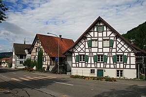
Schlieren railway station
Distance: Approx. 207 meters
Latitude and longitude: 47.39855278,8.44786389
Schlieren railway station (German: Bahnhof Schlieren) is a railway station in Switzerland, situated in the municipality of Schlieren. The station is located on the Zürich–Baden railway line and is a stop of the Zurich S-Bahn served by lines S11 and S12. The former Schlieren carriage works of the Schweizerische Wagons- und Aufzügefabrik AG Schlieren-Zürich were once situated adjacent to the station.

Urdorf railway station
Distance: Approx. 1165 meters
Latitude and longitude: 47.390789,8.434839
Urdorf is a railway station in the Swiss canton of Zurich. The station is situated close to the boundary of the municipalities of Schlieren and Urdorf and, whilst it is actually in the former, it takes its name from the latter. The station is located on the Zurich to Zug via Affoltern am Albis railway line.

Urdorf Weihermatt railway station
Distance: Approx. 2188 meters
Latitude and longitude: 47.380958,8.430207
Urdorf Weihermatt is a railway station in the municipality of Urdorf, in the Swiss canton of Zurich. The station is located on the Zurich to Zug via Affoltern am Albis railway line. Urdorf Weihermatt railway station should not be confused with Urdorf railway station, situated some 1.25 kilometres (0.78 mi) away on the same line and served by the same trains.

Glanzenberg railway station
Distance: Approx. 1989 meters
Latitude and longitude: 47.39865,8.42136389
Glanzenberg railway station (German: Bahnhof Glanzenberg) is a railway station in Switzerland, situated in the city of Dietikon. The station is located on the Zurich to Olten main line and is a stop of the Zürich S-Bahn served by line S11 and S12.
Weather in this IP's area
few clouds
19 Celsius
19 Celsius
17 Celsius
19 Celsius
1024 hPa
83 %
1024 hPa
977 hPa
10000 meters
3.6 m/s
350 degree
20 %
06:00:51
21:04:17