Country:
 Russian Federation
Region:
City:
Latitude and Longitude:
Time Zone:
Postal Code:
IP information under different IP Channel
ip-api
Country
Region
City
ASN
Time Zone
ISP
Blacklist
Proxy
Latitude
Longitude
Postal
Route
IPinfo
Country
Region
City
ASN
Time Zone
ISP
Blacklist
Proxy
Latitude
Longitude
Postal
Route
MaxMind
Country
Region
City
ASN
Time Zone
ISP
Blacklist
Proxy
Latitude
Longitude
Postal
Route
Luminati
Country
RUASN
Time Zone
Europe/Moscow
ISP
Joint Stock Company TransTeleCom
Latitude
Longitude
Postal
db-ip
Country
Region
City
ASN
Time Zone
ISP
Blacklist
Proxy
Latitude
Longitude
Postal
Route
ipdata
Country
Region
City
ASN
Time Zone
ISP
Blacklist
Proxy
Latitude
Longitude
Postal
Route
Popular places and events near this IP address

Tura, Krasnoyarsk Krai
Settlement in Krasnoyarsk Krai, Russia
Distance: Approx. 1610 meters
Latitude and longitude: 64.28333333,100.21666667
Tura (Russian: Тура́; Evenki: Typy, Turu) is a rural locality (a settlement) and the administrative center of Evenkiysky District of Krasnoyarsk Krai, Russia, located in the Syverma Plateau, at the confluence of the Kochechum and the Nizhnyaya Tunguska Rivers. Population: 5,535 (2010 Russian census); 5,836 (2002 Census); 7,474 (1989 Soviet census).
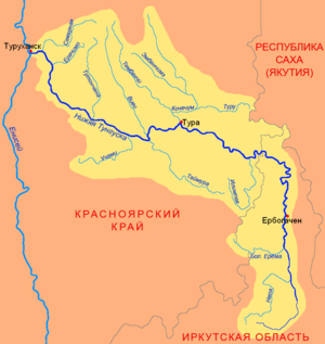
Kochechum
River in Krasnoyarsk Krai, Russia
Distance: Approx. 1610 meters
Latitude and longitude: 64.28333333,100.21666667
The Kochechum (Russian: Кочечум) is a river in Siberia, Russia. It flows through the Syverma Plateau in Krasnoyarsk Krai. It is a right and most significant tributary of the Nizhnyaya Tunguska.
Weather in this IP's area
overcast clouds
19 Celsius
18 Celsius
19 Celsius
19 Celsius
1014 hPa
54 %
1014 hPa
979 hPa
10000 meters
2.36 m/s
4.52 m/s
120 degree
100 %
03:18:12
21:32:29