Country:
 France
Region:
City:
Latitude and Longitude:
Time Zone:
Postal Code:
IP information under different IP Channel
ip-api
Country
Region
City
ASN
Time Zone
ISP
Blacklist
Proxy
Latitude
Longitude
Postal
Route
IPinfo
Country
Region
City
ASN
Time Zone
ISP
Blacklist
Proxy
Latitude
Longitude
Postal
Route
MaxMind
Country
Region
City
ASN
Time Zone
ISP
Blacklist
Proxy
Latitude
Longitude
Postal
Route
Luminati
Country
FRRegion
idf
City
draveil
ASN
Time Zone
Europe/Paris
ISP
ADISTA SAS
Latitude
Longitude
Postal
db-ip
Country
Region
City
ASN
Time Zone
ISP
Blacklist
Proxy
Latitude
Longitude
Postal
Route
ipdata
Country
Region
City
ASN
Time Zone
ISP
Blacklist
Proxy
Latitude
Longitude
Postal
Route
Popular places and events near this IP address

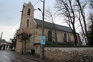
Savigny-le-Temple
Commune in Île-de-France, France
Distance: Approx. 1113 meters
Latitude and longitude: 48.5841,2.5832
Savigny-le-Temple (French: [saviɲi lə tɑ̃pl] ) is a commune in the Seine-et-Marne Department of France in the Île-de-France in north-central France. It is located in the south-eastern suburbs of Paris, 33.2 km (20.6 mi) from the center of Paris. It is the largest commune in the "new town" of Sénart, created in the 1970s.
Le Mée-sur-Seine
Commune in Île-de-France, France
Distance: Approx. 5667 meters
Latitude and longitude: 48.5333,2.6289
Le Mée-sur-Seine (French pronunciation: [lə me syʁ sɛn] , literally Le Mée on Seine) is a commune in the Seine-et-Marne department in the Île-de-France region in north-central France, next to Melun. It is located in the south-eastern suburbs of Paris 41.1 km (25.5 mi) from the center.
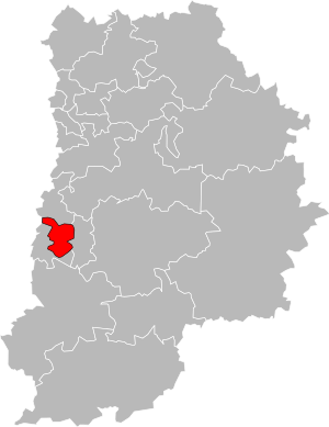
Canton of Savigny-le-Temple
Canton in Île-de-France, France
Distance: Approx. 1237 meters
Latitude and longitude: 48.57416667,2.56611111
The canton of Savigny-le-Temple is a French administrative division that is in the arrondissement of Melun, in the Seine-et-Marne département (Île-de-France région).

Boissise-la-Bertrand
Commune in Île-de-France, France
Distance: Approx. 5204 meters
Latitude and longitude: 48.5275,2.5886
Boissise-la-Bertrand (French pronunciation: [bwasiz la bɛʁtʁɑ̃] ) is a commune in the Seine-et-Marne department in the Île-de-France region in north-central France.

Boissise-le-Roi
Commune in Île-de-France, France
Distance: Approx. 5068 meters
Latitude and longitude: 48.529,2.5735
Boissise-le-Roi (French pronunciation: [bwasiz lə ʁwa] ) is a commune in the Seine-et-Marne department in the Île-de-France region in north-central France. The church, the château and its park are listed monuments.

Cesson
Commune in Île-de-France, France
Distance: Approx. 2042 meters
Latitude and longitude: 48.5633,2.6053
Cesson (French pronunciation: [sɛsɔ̃] ) is a commune in the Seine-et-Marne department in the Île-de-France region in north-central France.

Nandy, Seine-et-Marne
Commune in Île-de-France, France
Distance: Approx. 1576 meters
Latitude and longitude: 48.5811,2.5643
Nandy (French: [nɑ̃di] ) is a commune in the Seine-et-Marne department in the Île-de-France region in north-central France.

Seine-Port
Commune in Île-de-France, France
Distance: Approx. 2869 meters
Latitude and longitude: 48.5569,2.5539
Seine-Port (French pronunciation: [sɛn pɔʁ] ) is a commune in the Seine-et-Marne department in the Île-de-France region in north-central France.
Vert-Saint-Denis
Commune in Île-de-France, France
Distance: Approx. 2552 meters
Latitude and longitude: 48.565,2.6147
Vert-Saint-Denis (French pronunciation: [vɛʁ sɛ̃ dəni] ) is a commune in the Seine-et-Marne department in the Île-de-France region in north-central France.
Sénart
Distance: Approx. 5322 meters
Latitude and longitude: 48.61666667,2.55
Sénart (formerly Melun-Sénart) is a new town in southern Île-de-France, covering parts of the departments of Seine-et-Marne and Essonne.

Canton of Saint-Fargeau-Ponthierry
Canton in Île-de-France, France
Distance: Approx. 5148 meters
Latitude and longitude: 48.5333,2.55
The canton of Saint-Fargeau-Ponthierry is a French administrative division, located in the arrondissement of Melun, in the Seine-et-Marne département (Île-de-France région).

Sainte-Assise transmitter
Radio transmitter in France
Distance: Approx. 3305 meters
Latitude and longitude: 48.54475,2.57613889
The Sainte-Assise transmitter (French: Émetteur de Sainte-Assise) is a very low frequency (VLF) radio transmitter and military installation located on the grounds of the Château de Sainte-Assise in the communes of Seine-Port, Boissise-la-Bertrand, and Cesson in the Seine-et-Marne department of the Île-de-France region of France. The transmitter's original equipment was inaugurated on 9 January 1921, at the time being the most powerful radio transmitter on Earth. On 26 November 1921 the first French radio program was transmitted from Sainte-Assise.
Weather in this IP's area
clear sky
17 Celsius
17 Celsius
16 Celsius
18 Celsius
1025 hPa
77 %
1025 hPa
1016 hPa
10000 meters
1.03 m/s
06:19:02
21:33:03