Country:
 France
Region:
City:
Latitude and Longitude:
Time Zone:
Postal Code:
IP information under different IP Channel
ip-api
Country
Region
City
ASN
Time Zone
ISP
Blacklist
Proxy
Latitude
Longitude
Postal
Route
IPinfo
Country
Region
City
ASN
Time Zone
ISP
Blacklist
Proxy
Latitude
Longitude
Postal
Route
MaxMind
Country
Region
City
ASN
Time Zone
ISP
Blacklist
Proxy
Latitude
Longitude
Postal
Route
Luminati
Country
FRRegion
idf
City
draveil
ASN
Time Zone
Europe/Paris
ISP
ADISTA SAS
Latitude
Longitude
Postal
db-ip
Country
Region
City
ASN
Time Zone
ISP
Blacklist
Proxy
Latitude
Longitude
Postal
Route
ipdata
Country
Region
City
ASN
Time Zone
ISP
Blacklist
Proxy
Latitude
Longitude
Postal
Route
Popular places and events near this IP address

Savigny-le-Temple
Commune in Île-de-France, France
Distance: Approx. 4849 meters
Latitude and longitude: 48.5841,2.5832
Savigny-le-Temple (French: [saviɲi lə tɑ̃pl] ) is a commune in the Seine-et-Marne Department of France in the Île-de-France in north-central France. It is located in the south-eastern suburbs of Paris, 33.2 km (20.6 mi) from the center of Paris. It is the largest commune in the "new town" of Sénart, created in the 1970s.
Combs-la-Ville
Commune in Île-de-France, France
Distance: Approx. 5760 meters
Latitude and longitude: 48.67,2.56
Combs-la-Ville (French pronunciation: [kɔ̃b la vil]) is a commune in the south-eastern suburbs of Paris, in the Seine-et-Marne department in the Île-de-France in north-central France. It is located 25.5 km (15.8 mi) from the center of Paris, in the "new town" of Sénart, created in the 1970s.
Moissy-Cramayel
Commune in Île-de-France, France
Distance: Approx. 604 meters
Latitude and longitude: 48.6269,2.5931
Moissy-Cramayel (French pronunciation: [mwasi kʁamajɛl] ) is a commune in the Seine-et-Marne department in the Île-de-France region in north-central France. It is part of the urban unit (agglomeration) of Paris, 33 km (21 mi) southeast of the center of Paris, in the "new town" of Sénart, created in the 1970s. Its inhabitants are called Moisséens.
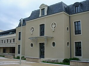
Château de Grégy
Distance: Approx. 4734 meters
Latitude and longitude: 48.66694444,2.61861111
The Château de Grègy is a château in Évry-Grégy-sur-Yerre, Seine-et-Marne, France. The first château was built in 1620 by Antoine de Brennes; two towers remain. Antoine de Clairambault rebuilt the central portion at the beginning of the 19th century, and added wings connecting the tower of a former church to the main building.

Canton of Combs-la-Ville
Canton in Île-de-France, France
Distance: Approx. 1547 meters
Latitude and longitude: 48.63388889,2.58388889
The canton of Combs-la-Ville is a French administrative division, located in the arrondissement of Melun, in the Seine-et-Marne département (Île-de-France région).

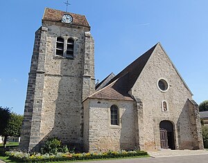
Évry-Grégy-sur-Yerre
Commune in Île-de-France, France
Distance: Approx. 3622 meters
Latitude and longitude: 48.6516,2.6316
Évry-Grégy-sur-Yerre (French pronunciation: [evʁi ɡʁeʒi syʁ jɛʁ]) is a commune in the Seine-et-Marne department in the Île-de-France region in north-central France. It was established on 1 January 1973 from the amalgamation of the communes of Évry-les-Châteaux and Grégy-sur-Yerre.

Lieusaint, Seine-et-Marne
Commune in Île-de-France, France
Distance: Approx. 3854 meters
Latitude and longitude: 48.6333,2.55
Lieusaint (French: [ljøsɛ̃] ) is a commune in the Seine-et-Marne department in the Île-de-France region in north-central France.
Limoges-Fourches
Commune in Île-de-France, France
Distance: Approx. 4740 meters
Latitude and longitude: 48.6269,2.6656
Limoges-Fourches is a commune in the Seine-et-Marne department in the Île-de-France region in north-central France.

Nandy, Seine-et-Marne
Commune in Île-de-France, France
Distance: Approx. 5689 meters
Latitude and longitude: 48.5811,2.5643
Nandy (French: [nɑ̃di] ) is a commune in the Seine-et-Marne department in the Île-de-France region in north-central France.

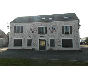
Réau
Commune in Île-de-France, France
Distance: Approx. 1687 meters
Latitude and longitude: 48.6213,2.623
Réau (French pronunciation: [ʁeo] ) is a commune in the Seine-et-Marne department in the Île-de-France region in north-central France.
Sénart
Distance: Approx. 3908 meters
Latitude and longitude: 48.61666667,2.55
Sénart (formerly Melun-Sénart) is a new town in southern Île-de-France, covering parts of the departments of Seine-et-Marne and Essonne.

Musée aéronautique et spatial Safran
Aviation museum in Melun, Seine-et-Marne
Distance: Approx. 5532 meters
Latitude and longitude: 48.6066,2.6704
The Musée aéronautique et spatial Safran (English: Aeronautics and Space Museum Safran) is a French private aviation museum located in Melun, Seine-et-Marne. Established in May 1989 the museum contains a large collection of historic and modern aircraft engines. These engines have been produced by various French engine manufacturers such as Gnome et Rhône and Snecma which are now part of the present day Safran company.
Weather in this IP's area
clear sky
21 Celsius
21 Celsius
20 Celsius
22 Celsius
1025 hPa
68 %
1025 hPa
1014 hPa
10000 meters
3.09 m/s
80 degree
06:18:46
21:33:10