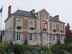
Country:
Region:
City:
Latitude and Longitude:
Time Zone:
Postal Code:
IP information under different IP Channel
ip-api
Country
Region
City
ASN
Time Zone
ISP
Blacklist
Proxy
Latitude
Longitude
Postal
Route
IPinfo
Country
Region
City
ASN
Time Zone
ISP
Blacklist
Proxy
Latitude
Longitude
Postal
Route
MaxMind
Country
Region
City
ASN
Time Zone
ISP
Blacklist
Proxy
Latitude
Longitude
Postal
Route
Luminati
Country
Region
naq
City
bruges
ASN
Time Zone
Europe/Paris
ISP
ADISTA SAS
Latitude
Longitude
Postal
db-ip
Country
Region
City
ASN
Time Zone
ISP
Blacklist
Proxy
Latitude
Longitude
Postal
Route
ipdata
Country
Region
City
ASN
Time Zone
ISP
Blacklist
Proxy
Latitude
Longitude
Postal
Route
Popular places and events near this IP address

Saran, Loiret
Commune in Centre-Val de Loire, France
Distance: Approx. 174 meters
Latitude and longitude: 47.9514,1.8747
Saran (French pronunciation: [saʁɑ̃]) is a commune in the Loiret department in north-central France. Saran has, considering its size, many sports facilities including two stadiums, indoor and outdoor tennis courts, one swimming pool and four gymnasiums.

Arrondissement of Orléans
Arrondissement in Centre-Val de Loire, France
Distance: Approx. 4130 meters
Latitude and longitude: 47.91666667,1.9
The arrondissement of Orléans is an arrondissement of France in the Loiret department in the Centre-Val de Loire region. It has 121 communes. Its population is 440,562 (2016), and its area is 2,925.4 km2 (1,129.5 sq mi).

Fleury-les-Aubrais
Commune in Centre-Val de Loire, France
Distance: Approx. 3961 meters
Latitude and longitude: 47.9312,1.921
Fleury-les-Aubrais (French pronunciation: [fløʁi le.z‿obʁɛ]) is a commune in the Loiret department, Centre-Val de Loire, France. It is a northern suburb of Orléans. As a part of German-occupied France, its railway station was destroyed in 1944 by the Combined Bomber Offensive.
Cercottes
Commune in Centre-Val de Loire, France
Distance: Approx. 4047 meters
Latitude and longitude: 47.9861,1.8836
Cercottes (French pronunciation: [sɛʁkɔt]) is a commune in the Loiret department in north-central France. Cercottes station has rail connections to Orléans, Étampes and Paris.

Ingré
Commune in Centre-Val de Loire, France
Distance: Approx. 4989 meters
Latitude and longitude: 47.9211,1.825
Ingré (French pronunciation: [ɛ̃ɡʁe]) is a commune in the Loiret department, central France. It is part of the urban area of Orléans.

Ormes, Loiret
Commune in Centre-Val de Loire, France
Distance: Approx. 4155 meters
Latitude and longitude: 47.9417,1.8217
Ormes (French pronunciation: [ɔʁm]) is a commune in the Loiret department in north-central France.

Saint-Jean-de-la-Ruelle
Commune in Centre-Val de Loire, France
Distance: Approx. 4031 meters
Latitude and longitude: 47.9139,1.8745
Saint-Jean-de-la-Ruelle (pronounced [sɛ̃ ʒɑ̃ d(ə) la ʁɥɛl]) is a commune in the Loiret department in the administrative region of Centre-Val de Loire, France. It is located about 3.5 km (2.2 mi) from Orléans.

Les Aubrais station
Distance: Approx. 3471 meters
Latitude and longitude: 47.9266,1.9066
The gare des Aubrais (before 2014: gare des Aubrais-Orléans) is a main-line railway station located in the town of Fleury-les-Aubrais in Loiret, central France, and serving the greater Orléans district. It is situated on the Paris to Bordeaux railway and is also the northern terminus of the Orléans to Montauban line. TGV and most other long-distance trains serve only the Gare des Aubrais, and not the more central Gare d'Orléans.
Cercottes station
Distance: Approx. 4031 meters
Latitude and longitude: 47.98583333,1.88472222
Cercottes is a railway station in Cercottes, Centre-Val de Loire, France. The station was opened on 5 May 1843, and is located on the Paris–Bordeaux railway line.
Canton of Fleury-les-Aubrais
Distance: Approx. 3972 meters
Latitude and longitude: 47.93,1.92
The canton of Fleury-les-Aubrais is an administrative division of the Loiret department, central France. Its borders were modified at the French canton reorganisation which came into effect in March 2015. Its seat is in Fleury-les-Aubrais.
Canton of Orléans-3
Distance: Approx. 3799 meters
Latitude and longitude: 47.92,1.9
The canton of Orléans-3 is an administrative division of the Loiret department, central France. It was created at the French canton reorganisation which came into effect in March 2015. Its seat is in Orléans.
Canton of Saint-Jean-de-la-Ruelle
Distance: Approx. 4486 meters
Latitude and longitude: 47.91,1.87
The canton of Saint-Jean-de-la-Ruelle is an administrative division of the Loiret department, central France. Its borders were modified at the French canton reorganisation which came into effect in March 2015. Its seat is in Saint-Jean-de-la-Ruelle.
Weather in this IP's area
scattered clouds
22 Celsius
22 Celsius
22 Celsius
22 Celsius
1024 hPa
61 %
1024 hPa
1010 hPa
10000 meters
4.34 m/s
5.2 m/s
74 degree
39 %
06:24:02
21:33:42
