Country:
Region:
City:
Latitude and Longitude:
Time Zone:
Postal Code:
IP information under different IP Channel
ip-api
Country
Region
City
ASN
Time Zone
ISP
Blacklist
Proxy
Latitude
Longitude
Postal
Route
IPinfo
Country
Region
City
ASN
Time Zone
ISP
Blacklist
Proxy
Latitude
Longitude
Postal
Route
MaxMind
Country
Region
City
ASN
Time Zone
ISP
Blacklist
Proxy
Latitude
Longitude
Postal
Route
Luminati
Country
Region
naq
City
bruges
ASN
Time Zone
Europe/Paris
ISP
ADISTA SAS
Latitude
Longitude
Postal
db-ip
Country
Region
City
ASN
Time Zone
ISP
Blacklist
Proxy
Latitude
Longitude
Postal
Route
ipdata
Country
Region
City
ASN
Time Zone
ISP
Blacklist
Proxy
Latitude
Longitude
Postal
Route
Popular places and events near this IP address
Bruges, Gironde
Commune in Nouvelle-Aquitaine, France
Distance: Approx. 3781 meters
Latitude and longitude: 44.8836,-0.6114
Bruges (French pronunciation: [bʁyʒ] ; Occitan: Bruge) is a commune in the French department of Gironde, region of Nouvelle-Aquitaine (formerly Aquitaine), southwestern France. It is located north of Bordeaux.

Blanquefort, Gironde
Commune in Nouvelle-Aquitaine, France
Distance: Approx. 123 meters
Latitude and longitude: 44.9114,-0.6364
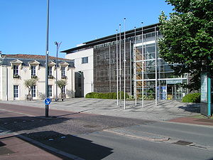
Blanquefort (French pronunciation: [blɑ̃kfɔʁ]; Gascon: Blancahòrt) is a commune in the Gironde department in Nouvelle-Aquitaine in southwestern France. Blanquefort is an outlying commune of the Bordeaux metropolitan area. The commune consists of historic Blanquefort and Caychac, which is further out from central Bordeaux and was formerly a commune in its own right.
Le Haillan
Commune in Nouvelle-Aquitaine, France
Distance: Approx. 5421 meters
Latitude and longitude: 44.8725,-0.6758
Le Haillan (French pronunciation: [lə ajɑ̃]; Occitan: Halhan) is a commune in the Gironde department in south-western France. It is a suburb of the city of Bordeaux, and is adjacent to it on the northwest side.

Eysines
Commune in Nouvelle-Aquitaine, France
Distance: Approx. 3207 meters
Latitude and longitude: 44.8853,-0.65
Eysines (French pronunciation: [ɛzin]; Occitan: Aisinas) is a commune in the Gironde department in southwestern France.

Parempuyre
Commune in Nouvelle-Aquitaine, France
Distance: Approx. 4906 meters
Latitude and longitude: 44.95,-0.6039
Parempuyre (French pronunciation: [paʁɑ̃pɥiʁ]; Occitan: Parampuira) is a commune in the Gironde department in Nouvelle-Aquitaine in southwestern France.

Le Taillan-Médoc
Commune in Nouvelle-Aquitaine, France
Distance: Approx. 2647 meters
Latitude and longitude: 44.9053,-0.6686
Le Taillan-Médoc (French pronunciation: [lə tajɑ̃ medɔk], lit. "The Taillan Médoc"; Occitan: Lo Telhan de Medòc, lit. "The Taillan of Médoc") is a commune in the Gironde department in the Nouvelle-Aquitaine region in Southwestern France.

Château Dillon
Distance: Approx. 1028 meters
Latitude and longitude: 44.92083333,-0.64222222
Château Dillon is Bordeaux wine producer from the Haut Médoc appellation of Bordeaux. The château is located in the commune of Blanquefort. Château Dillon is used as a school of agriculture, together with Château La Tour Blanche in Sauternes, Château Réal Caillou in Lalande de Pomerol and Château Grand Baril in Montagne Saint Emilion.

Château Bel Air (Le Haillan)
Château in France, France
Distance: Approx. 5023 meters
Latitude and longitude: 44.874475,-0.670901
Château Bel Air, also called the Château du Haillan, is a château in Le Haillan in the outskirts of Bordeaux, Aquitaine, France. The 1820 building is the administrative headquarters of the FC Girondins de Bordeaux, a football club.

Château de Blanquefort
Distance: Approx. 1370 meters
Latitude and longitude: 44.90111111,-0.63
Château de Blanquefort is a ruined castle in the commune of Blanquefort in the Gironde département of France.

Château Lescombes
Distance: Approx. 3772 meters
Latitude and longitude: 44.88083333,-0.65361111
The Château Lescombes is a château in Eysines, Gironde, Nouvelle-Aquitaine, France. It dates to the 17th century. The dovecote was listed as a monument historique in 1992.
Canton of Les Portes du Médoc
Distance: Approx. 3769 meters
Latitude and longitude: 44.88,-0.65
The canton of Les Portes du Médoc is an administrative division of the Gironde department, southwestern France. It was created at the French canton reorganisation which came into effect in March 2015. Its seat is in Eysines.

Eysines Cantinolle tram stop
Tram station in France
Distance: Approx. 3335 meters
Latitude and longitude: 44.89202,-0.66746694
Eysines Cantinolle tram stop is a stop on the Bordeaux tramway in the commune of Eysines, France. It is the current northwestern terminus of Bordeaux Tramway Line D and opened on 29 February 2020.
Weather in this IP's area
clear sky
26 Celsius
26 Celsius
24 Celsius
27 Celsius
1019 hPa
65 %
1019 hPa
1016 hPa
10000 meters
3.09 m/s
80 degree
06:43:53
21:33:58

