Country:
 France
Region:
City:
Latitude and Longitude:
Time Zone:
Postal Code:
IP information under different IP Channel
ip-api
Country
Region
City
ASN
Time Zone
ISP
Blacklist
Proxy
Latitude
Longitude
Postal
Route
IPinfo
Country
Region
City
ASN
Time Zone
ISP
Blacklist
Proxy
Latitude
Longitude
Postal
Route
MaxMind
Country
Region
City
ASN
Time Zone
ISP
Blacklist
Proxy
Latitude
Longitude
Postal
Route
Luminati
Country
FRRegion
nor
City
caen
ASN
Time Zone
Europe/Paris
ISP
ADISTA SAS
Latitude
Longitude
Postal
db-ip
Country
Region
City
ASN
Time Zone
ISP
Blacklist
Proxy
Latitude
Longitude
Postal
Route
ipdata
Country
Region
City
ASN
Time Zone
ISP
Blacklist
Proxy
Latitude
Longitude
Postal
Route
Popular places and events near this IP address

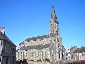
Flers, Orne
Commune in Orne, France
Distance: Approx. 1931 meters
Latitude and longitude: 48.7518,-0.5605
Flers (French pronunciation: [flɛʁ]) is a commune in the Orne department in Normandy, France. The inhabitants are called Flériens.

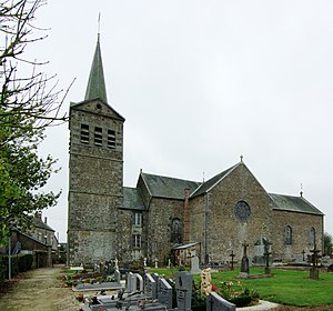
La Lande-Patry
Commune in Normandy, France
Distance: Approx. 3371 meters
Latitude and longitude: 48.7636,-0.5972
La Lande-Patry (French pronunciation: [la lɑ̃d patʁi] ) is a commune in the Orne department in north-western France. The commune is known for its Ifs millénaires (thousand year old yews), designated as an intangible cultural heritage in France.

La Selle-la-Forge
Commune in Normandy, France
Distance: Approx. 2645 meters
Latitude and longitude: 48.734,-0.539
La Selle-la-Forge (French pronunciation: [la sɛl la fɔʁʒ] ) is a commune in the Orne department in north-western France.
Saint-Paul, Orne
Commune in Normandy, France
Distance: Approx. 4223 meters
Latitude and longitude: 48.7436,-0.6314
Saint-Paul (French pronunciation: [sɛ̃ pɔl] ) is a commune in the Orne department in north-western France.

Saint-Georges-des-Groseillers
Commune in the Orne department of France
Distance: Approx. 3778 meters
Latitude and longitude: 48.7711,-0.5722
Saint-Georges-des-Groseillers (French pronunciation: [sɛ̃ ʒɔʁʒ de ɡʁozɛje] ) is a commune in the Orne department in north-western France.

Aubusson, Orne
Commune in Normandy, France
Distance: Approx. 5589 meters
Latitude and longitude: 48.785,-0.5514
Aubusson (French pronunciation: [obysɔ̃] ) is a commune in the Orne department in northwestern France.
Messei
Commune in Normandy, France
Distance: Approx. 3988 meters
Latitude and longitude: 48.7122,-0.5358
Messei (French pronunciation: [mɛsɛ] ) is a commune in the Orne department in north-western France.

La Chapelle-au-Moine
Commune in Normandy, France
Distance: Approx. 3210 meters
Latitude and longitude: 48.7089,-0.5831
La Chapelle-au-Moine (French pronunciation: [la ʃapɛl o mwan] ) is a commune in the Orne department in north-western France.
La Chapelle-Biche
Commune in Normandy, France
Distance: Approx. 4828 meters
Latitude and longitude: 48.7119,-0.6281
La Chapelle-Biche (French pronunciation: [la ʃapɛl biʃ] ) is a commune in the Orne department in north-western France.
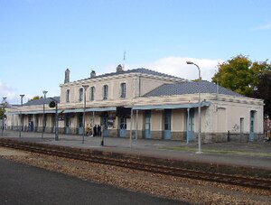
Flers station
Distance: Approx. 813 meters
Latitude and longitude: 48.74444444,-0.57333333
Gare de Flers is a railway station serving the town Flers, Orne department, northwestern France. The station was inaugurated in 1866.
Canton of Flers-1
Distance: Approx. 1466 meters
Latitude and longitude: 48.75,-0.57
The canton of Flers-1 is an administrative division of the Orne department, northwestern France. It was created at the French canton reorganisation which came into effect in March 2015. Its seat is in Flers.
Canton of Flers-2
Distance: Approx. 1787 meters
Latitude and longitude: 48.75,-0.56
The canton of Flers-2 is an administrative division of the Orne department, northwestern France. It was created at the French canton reorganisation which came into effect in March 2015. Its seat is in Flers.
Weather in this IP's area
overcast clouds
20 Celsius
20 Celsius
20 Celsius
20 Celsius
1025 hPa
50 %
1025 hPa
1001 hPa
10000 meters
3.2 m/s
4.27 m/s
86 degree
96 %
06:31:05
21:46:15