Country:
 France
Region:
City:
Latitude and Longitude:
Time Zone:
Postal Code:
IP information under different IP Channel
ip-api
Country
Region
City
ASN
Time Zone
ISP
Blacklist
Proxy
Latitude
Longitude
Postal
Route
IPinfo
Country
Region
City
ASN
Time Zone
ISP
Blacklist
Proxy
Latitude
Longitude
Postal
Route
MaxMind
Country
Region
City
ASN
Time Zone
ISP
Blacklist
Proxy
Latitude
Longitude
Postal
Route
Luminati
Country
FRRegion
ara
City
chamalieres
ASN
Time Zone
Europe/Paris
ISP
ADISTA SAS
Latitude
Longitude
Postal
db-ip
Country
Region
City
ASN
Time Zone
ISP
Blacklist
Proxy
Latitude
Longitude
Postal
Route
ipdata
Country
Region
City
ASN
Time Zone
ISP
Blacklist
Proxy
Latitude
Longitude
Postal
Route
Popular places and events near this IP address

Saverne
Subprefecture and commune in Grand Est, France
Distance: Approx. 2107 meters
Latitude and longitude: 48.74,7.36
Saverne (French: Saverne, pronounced [savɛʁn] ; Alsatian: Zàwere [ˈd̥sɐːvəʁə]; German: Zabern [ˈtsaːbɐn]) is a commune in the Bas-Rhin department in Grand Est in north-eastern France. It is situated on the Rhine-Marne canal at the foot of a pass over the Vosges Mountains, and 45 km (27 mi) northwest of Strasbourg. In 2018, the commune of Saverne had a population of 11,289, and its urban area, of 18,740.
Saint-Jean-Saverne
Commune in Grand Est, France
Distance: Approx. 2109 meters
Latitude and longitude: 48.7711,7.3619
Saint-Jean-Saverne (French pronunciation: [sɛ̃ ʒɑ̃ savɛʁn] ; German: Sankt Johann bei Zabern; Alsatian: Sànt Johànn) is a commune in the Bas-Rhin department in Grand Est in north-eastern France.
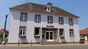
Ottersthal
Commune in Grand Est, France
Distance: Approx. 1901 meters
Latitude and longitude: 48.7553,7.3514
Ottersthal (French pronunciation: [ɔtəʁstal]; German: Otterstal) is a commune in the Bas-Rhin department in Grand Est in north-eastern France.
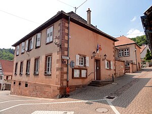
Monswiller
Commune in Grand Est, France
Distance: Approx. 243 meters
Latitude and longitude: 48.7553,7.3806
Monswiller (German: Monsweiler) is a commune in the Bas-Rhin department in Grand Est in north-eastern France.

Eckartswiller
Commune in Grand Est, France
Distance: Approx. 2039 meters
Latitude and longitude: 48.7667,7.3558
Eckartswiller (French pronunciation: [ɛkaʁt͡svilɛʁ]; German: Eckartsweiler) is a commune, in the Bas-Rhin department in Grand Est in north-eastern France.
Rohan Castle
18th-century neoclassical palace in the city of Saverne in Alsace, France
Distance: Approx. 1762 meters
Latitude and longitude: 48.74222222,7.36333333
Rohan Castle (French: Château des Rohan, German: Rohan-Schloss), also known as Château Neuf (New Castle), is an eighteenth-century neoclassical palace in the city of Saverne in Alsace, France. It was one of the residences of Archbishops of Strasbourg, rulers of the Prince-Bishopric of Strasbourg, which was an ecclesiastical principality of the Holy Roman Empire from the 13th century until 1803. A series of members of the House of Rohan held the see in the 18th century.

Jardin botanique du col de Saverne
Distance: Approx. 2724 meters
Latitude and longitude: 48.75,7.341
The Jardin botanique du col de Saverne (2.5 hectares), also known as the Jardin botanique de Saverne, is a botanical garden and arboretum located along the Col de Saverne near Saverne, Bas-Rhin, Alsace, France. It is open on weekends, and daily in the warmer months; an admission fee is charged. The garden was established in 1931 by naturalists including botanist Emile Walter (1873-1953).

Oberhof (château)
Distance: Approx. 1793 meters
Latitude and longitude: 48.7415,7.3642
The Château d'Oberhof is a castle situated in the commune of Saverne in the département of Bas-Rhin. It was mentioned in 1417 as the residence of the bishop of Strasbourg. Since 1852, it houses the sous-préfecture of the arrondissement of Saverne.

Saverne station
French railway station
Distance: Approx. 1614 meters
Latitude and longitude: 48.74472222,7.36194444
Saverne station (French: Gare de Saverne) is a French railway station located on the Noisy-le-Sec–Strasbourg railway. It is located within the commune of Saverne, in departement Bas-Rhin, in northeastern France. The station was put in operation in 1851 by the Strasbourg–Basel railway company, which operates the section between the cities of Strasbourg and Sarrebourg on request by the Paris–Strasbourg railway company.

Notre-Dame-de-la-Nativité (Saverne)
Distance: Approx. 1830 meters
Latitude and longitude: 48.7412,7.364
Notre-Dame-de-la-Nativité is the main church in Saverne, Bas-Rhin, France. It was first built in the 12th century as a parish church before being re-consecrated to saint Bartholomew in the late 13th century. It was converted into a collegiate church of Augustinian Canons Regular in the 14th and 15th century and held that status by 1485 at the latest.

Canton of Saverne
Canton in Grand Est, France
Distance: Approx. 2107 meters
Latitude and longitude: 48.74,7.36
The canton of Saverne is an administrative division of the Bas-Rhin department, northeastern France. Its borders were modified at the French canton reorganisation which came into effect in March 2015. Its seat is in Saverne.

Municipal Museum (Saverne)
Museum in Bas-Rhin, France
Distance: Approx. 1762 meters
Latitude and longitude: 48.74222222,7.36333333
The municipal museum of Saverne, a small town in the Bas-Rhin department of France, is the oldest museum in the historic Alsace region outside of Strasbourg and Colmar, having been founded in 1858. It is located in the former Rohan Castle since 1952. The museum is divided into three sections.
Weather in this IP's area
clear sky
23 Celsius
23 Celsius
21 Celsius
23 Celsius
1025 hPa
53 %
1025 hPa
1004 hPa
10000 meters
1.8 m/s
1.86 m/s
14 degree
5 %
05:59:11
21:14:33