Country:
 France
Region:
City:
Latitude and Longitude:
Time Zone:
Postal Code:
IP information under different IP Channel
ip-api
Country
Region
City
ASN
Time Zone
ISP
Blacklist
Proxy
Latitude
Longitude
Postal
Route
IPinfo
Country
Region
City
ASN
Time Zone
ISP
Blacklist
Proxy
Latitude
Longitude
Postal
Route
MaxMind
Country
Region
City
ASN
Time Zone
ISP
Blacklist
Proxy
Latitude
Longitude
Postal
Route
Luminati
Country
FRRegion
ara
City
chamalieres
ASN
Time Zone
Europe/Paris
ISP
ADISTA SAS
Latitude
Longitude
Postal
db-ip
Country
Region
City
ASN
Time Zone
ISP
Blacklist
Proxy
Latitude
Longitude
Postal
Route
ipdata
Country
Region
City
ASN
Time Zone
ISP
Blacklist
Proxy
Latitude
Longitude
Postal
Route
Popular places and events near this IP address

Clermont-Ferrand
Prefecture and commune in Auvergne-Rhône-Alpes, France
Distance: Approx. 1715 meters
Latitude and longitude: 45.7831,3.0824
Clermont-Ferrand (UK: , US: ; French: [klɛʁmɔ̃ fɛʁɑ̃] ) is a city and commune of France, in the Auvergne-Rhône-Alpes region, with a population of 147,284 (2020). Its metropolitan area (aire d'attraction) had 504,157 inhabitants at the 2018 census. It is the prefecture (capital) of the Puy-de-Dôme département.
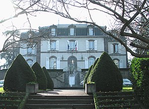
Chamalières
Commune in Auvergne-Rhône-Alpes, France
Distance: Approx. 389 meters
Latitude and longitude: 45.7744,3.0678
Chamalières (French pronunciation: [ʃamaljɛʁ]; Auvergnat: Chamaleiras) is a commune in the Puy-de-Dôme department, Auvergne-Rhône-Alpes, central France. With 17,276 inhabitants (2019), Chamalières is the fourth-largest town in the department. It lies adjacent to the west of Clermont-Ferrand and about 241 kilometres (150 mi) from Lyon.

Arrondissement of Clermont-Ferrand
Arrondissement in Auvergne-Rhône-Alpes, France
Distance: Approx. 1859 meters
Latitude and longitude: 45.76666667,3.08333333
The arrondissement of Clermont-Ferrand is an arrondissement of France in the Puy-de-Dôme department in the Auvergne-Rhône-Alpes region. It has 73 communes. Its population is 360,276 (2016), and its area is 884.4 km2 (341.5 sq mi).

Royat
Commune in Auvergne-Rhône-Alpes, France
Distance: Approx. 1558 meters
Latitude and longitude: 45.765,3.05
Royat (French pronunciation: [ʁwaja]; Occitan: Roiat) is a commune in the Puy-de-Dôme department in Auvergne-Rhône-Alpes in central France. As of 2019, its population was 4,359. Since Roman times, its thermal springs have made it a spa town, and the remains of the Roman baths are still visible.

Clermont-Ferrand Cathedral
Cathedral in Clermont-Ferrand, Auvergne, France
Distance: Approx. 1794 meters
Latitude and longitude: 45.778727,3.085766
Clermont-Ferrand Cathedral, or the Cathedral of Our Lady of the Assumption of Clermont-Ferrand (French: Cathédrale Notre-Dame-de-l'Assomption de Clermont-Ferrand), is a Gothic cathedral and French national monument located in the city of Clermont-Ferrand in the Auvergne. It is the seat of the Archbishops of Clermont (bishops until 2002). It is built entirely in black lava stone, which makes it highly distinctive, and visible from a great distance.
Jaude Centre
Shopping mall in Clermont-Ferrand, France
Distance: Approx. 1612 meters
Latitude and longitude: 45.7745,3.0838
Jaude Centre is one of the most prominent shopping malls in Clermont-Ferrand, France. It is located in extreme south-East in the Jaude Square, in the city centre.

Place de Jaude
Public square in Auvergne, France
Distance: Approx. 1476 meters
Latitude and longitude: 45.77659,3.08206
Jaude Square (French: Place de Jaude) is a major city square and meeting place in the centre of Clermont-Ferrand, France. It is bordered by Rue Blatin on the North and Avenue Julien on the south. The square is home to many attractions, such as the Opera Theatre, the Jaude Shopping Mall and Saint-Pierre-des-Minimes Church.

List of Roman theatres
Distance: Approx. 1810 meters
Latitude and longitude: 45.76055556,3.07194444
Roman theatres built during the Roman period may be found all over the Roman Empire. Some were older theatres that were re-worked.
Cantons of Clermont-Ferrand
Distance: Approx. 1401 meters
Latitude and longitude: 45.78,3.08
The cantons of Clermont-Ferrand are administrative divisions of the Puy-de-Dôme department, in central France. Since the French canton reorganisation which came into effect in March 2015, the city of Clermont-Ferrand is subdivided into 6 cantons. Their seat is in Clermont-Ferrand.
Canton of Chamalières
Distance: Approx. 546 meters
Latitude and longitude: 45.78,3.06
The canton of Chamalières is an administrative division of the Puy-de-Dôme department, central France. Its borders were modified at the French canton reorganisation which came into effect in March 2015. Its seat is in Chamalières.

Clermont Auvergne Métropole
Métropole in Auvergne-Rhône-Alpes, France
Distance: Approx. 1401 meters
Latitude and longitude: 45.78,3.08
Clermont Auvergne Métropole is the métropole, an intercommunal structure, centred on the city of Clermont-Ferrand. It is located in the Puy-de-Dôme department, in the Auvergne-Rhône-Alpes region, central France. It was created in January 2018, replacing the communauté urbaine that had replaced the previous communauté d'agglomération Clermont-Communauté in January 2017.
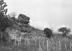
Roman theater of Montaudou
Performance building built in Gaul, in the city of Arveni
Distance: Approx. 1810 meters
Latitude and longitude: 45.76055556,3.07194444
The Roman theater of Montaudou is a performance building built in Gaul, in the city of Arveni, in the present-day commune of Ceyrat in the Puy-de-Dôme département. Its remains have been described since the early 19th century, thanks to the presence of a long wall some fifty meters long, known locally as the Saracen Wall. First interpreted as a sanctuary dedicated to Mercury, then as a Roman villa, the hypothesis of an ancient Roman theater emerged in the second half of the 20th century.
Weather in this IP's area
overcast clouds
18 Celsius
19 Celsius
18 Celsius
18 Celsius
1022 hPa
88 %
1022 hPa
975 hPa
10000 meters
2.57 m/s
320 degree
100 %
06:26:25
21:21:50