Country:
 France
Region:
City:
Latitude and Longitude:
Time Zone:
Postal Code:
IP information under different IP Channel
ip-api
Country
Region
City
ASN
Time Zone
ISP
Blacklist
Proxy
Latitude
Longitude
Postal
Route
IPinfo
Country
Region
City
ASN
Time Zone
ISP
Blacklist
Proxy
Latitude
Longitude
Postal
Route
MaxMind
Country
Region
City
ASN
Time Zone
ISP
Blacklist
Proxy
Latitude
Longitude
Postal
Route
Luminati
Country
FRRegion
ara
City
chamalieres
ASN
Time Zone
Europe/Paris
ISP
ADISTA SAS
Latitude
Longitude
Postal
db-ip
Country
Region
City
ASN
Time Zone
ISP
Blacklist
Proxy
Latitude
Longitude
Postal
Route
ipdata
Country
Region
City
ASN
Time Zone
ISP
Blacklist
Proxy
Latitude
Longitude
Postal
Route
Popular places and events near this IP address
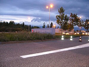
Bardonnex
Municipality in Geneva, Switzerland
Distance: Approx. 3776 meters
Latitude and longitude: 46.13333333,6.1
Bardonnex is a municipality in the canton of Geneva in Switzerland.
Salève
Mountain in France
Distance: Approx. 1957 meters
Latitude and longitude: 46.09416667,6.14027778
The Salève (French pronunciation: [salɛv]), or Mont Salève, is a mountain of the French Prealps located in the department of Haute-Savoie in Auvergne-Rhône-Alpes. It is also called the "Balcony of Geneva" (French: Balcon de Genève).

Archamps
Commune in Auvergne-Rhône-Alpes, France
Distance: Approx. 4061 meters
Latitude and longitude: 46.1364,6.1331
Archamps (French pronunciation: [aʁʃɑ̃]) is a commune in the Haute-Savoie department in the Auvergne-Rhône-Alpes region in south-eastern France. As of 2020, it is the commune with the second highest median per capita income (€53,330 per year) in France.
Vovray-en-Bornes
Commune in Auvergne-Rhône-Alpes, France
Distance: Approx. 4403 meters
Latitude and longitude: 46.0664,6.1433
Vovray-en-Bornes is a commune in the Haute-Savoie department in the Auvergne-Rhône-Alpes region in south-eastern France. It sits on the eastern flank of Salève, near the river Usses. It is located on the D15 route, 25 km south of Geneva, 25 km north of Annecy and 20 km west of Bonneville.
Beaumont, Haute-Savoie
Commune in Auvergne-Rhône-Alpes, France
Distance: Approx. 1364 meters
Latitude and longitude: 46.0956,6.1019
Beaumont (French pronunciation: [bomɔ̃] ; Arpitan: Bômon) is a commune in the Haute-Savoie department and the Auvergne-Rhône-Alpes region, southeastern France.

Feigères
Commune in Auvergne-Rhône-Alpes, France
Distance: Approx. 3076 meters
Latitude and longitude: 46.1136,6.0814
Feigères (French pronunciation: [fɛʒɛʁ]; Arpitan: Fiogiéres) is a commune in the Haute-Savoie department in the Auvergne-Rhône-Alpes region in south-eastern France.
Le Sappey
Commune in Auvergne-Rhône-Alpes, France
Distance: Approx. 4048 meters
Latitude and longitude: 46.0894,6.1667
Le Sappey (French pronunciation: [lə sapɛ]; Arpitan: L Sapè) is a commune in the Haute-Savoie department in the Auvergne-Rhône-Alpes region in southeastern France.

Neydens
Commune in Auvergne-Rhône-Alpes, France
Distance: Approx. 2482 meters
Latitude and longitude: 46.1222,6.105
Neydens (French pronunciation: [nɛdɑ̃]; Arpitan: Nédin) is a commune in the Haute-Savoie department in the Auvergne-Rhône-Alpes region in south-eastern France. Due to its close proximity to Geneva (Switzerland), Neydens is a popular tourist destination.

Saint-Blaise, Haute-Savoie
Commune in Auvergne-Rhône-Alpes, France
Distance: Approx. 4501 meters
Latitude and longitude: 46.0661,6.0894
Saint-Blaise (French pronunciation: [sɛ̃ blɛz]; Arpitan: San Blyé) is a commune in the Haute-Savoie department in the Auvergne-Rhône-Alpes region in south-eastern France.

Présilly, Haute-Savoie
Commune in Auvergne-Rhône-Alpes, France
Distance: Approx. 3108 meters
Latitude and longitude: 46.0939,6.0786
Présilly (French pronunciation: [pʁeziji]; Arpitan: Prézlyi) is a commune in the Haute-Savoie department in the Auvergne-Rhône-Alpes region in south-eastern France.
Pomier Charterhouse
Distance: Approx. 2368 meters
Latitude and longitude: 46.08194444,6.10555556
Pomier Charterhouse (Chartreuse de Pomier) was a Carthusian monastery in Pomier, Présilly near Annecy, Haute-Savoie, in France, close to the Swiss border. It is situated on the foot of the Salève, and on the Way of St. James.
Maurice-Tièche Comprehensive School
School in France
Distance: Approx. 4934 meters
Latitude and longitude: 46.1359,6.1578
L’Ensemble Scolaire Maurice-Tièche or Maurice Tièche Comprehensive School is a K-13 co-educational, Christian private school owned by the Seventh-day Adventist Church in the region Collonges-sous-Salève of France. It teaches pupils of primary, junior high and senior high school age. The school also has a nursery school offering care to 2 year-olds.
Weather in this IP's area
clear sky
25 Celsius
25 Celsius
25 Celsius
26 Celsius
1022 hPa
51 %
1022 hPa
941 hPa
10000 meters
3.09 m/s
50 degree
06:13:10
21:10:39