Country:
 France
Region:
City:
Latitude and Longitude:
Time Zone:
Postal Code:
IP information under different IP Channel
ip-api
Country
Region
City
ASN
Time Zone
ISP
Blacklist
Proxy
Latitude
Longitude
Postal
Route
IPinfo
Country
Region
City
ASN
Time Zone
ISP
Blacklist
Proxy
Latitude
Longitude
Postal
Route
MaxMind
Country
Region
City
ASN
Time Zone
ISP
Blacklist
Proxy
Latitude
Longitude
Postal
Route
Luminati
Country
FRRegion
naq
City
floirac
ASN
Time Zone
Europe/Paris
ISP
ADISTA SAS
Latitude
Longitude
Postal
db-ip
Country
Region
City
ASN
Time Zone
ISP
Blacklist
Proxy
Latitude
Longitude
Postal
Route
ipdata
Country
Region
City
ASN
Time Zone
ISP
Blacklist
Proxy
Latitude
Longitude
Postal
Route
Popular places and events near this IP address
Ansan, Gers
Commune in Occitania, France
Distance: Approx. 5648 meters
Latitude and longitude: 43.6914,0.7753
Ansan (French pronunciation: [ɑ̃sɑ̃]) is a commune in the Gers department in southwestern France.

Aubiet
Commune in Occitania, France
Distance: Approx. 5076 meters
Latitude and longitude: 43.6469,0.7844
Aubiet (French pronunciation: [objɛ]) is a commune in the Gers department in southwestern France.

Blanquefort, Gers
Commune in Occitania, France
Distance: Approx. 7236 meters
Latitude and longitude: 43.6756,0.8094
Blanquefort (French pronunciation: [blɑ̃kfɔʁ]; Occitan: Blancafòrt) is a commune in the Gers department in southwestern France.

L'Isle-Arné
Commune in Occitania, France
Distance: Approx. 6032 meters
Latitude and longitude: 43.6164,0.7719
L'Isle-Arné (French pronunciation: [lil aʁne]; Occitan: La Ileta e Arnès) is a commune in the Gers department in southwestern France.

Lahitte
Commune in Occitania, France
Distance: Approx. 3406 meters
Latitude and longitude: 43.6611,0.6811
Lahitte (French pronunciation: [la.it]; Occitan: La Hita) is a commune in the Gers department in southwestern France.

Leboulin
Commune in Occitania, France
Distance: Approx. 5077 meters
Latitude and longitude: 43.6708,0.6628
Leboulin (French pronunciation: [ləbulɛ̃]; Occitan: Lo Bolin) is a commune in the Gers department in southwestern France.

Lussan, Gers
Commune in Occitania, France
Distance: Approx. 3599 meters
Latitude and longitude: 43.6264,0.7353
Lussan (French pronunciation: [lysɑ̃]; Occitan: Luçan) is a commune in the Gers department in southwestern France.

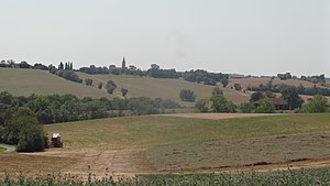
Marsan
Commune in Occitania, France
Distance: Approx. 0 meters
Latitude and longitude: 43.6575,0.7231
Marsan (French pronunciation: [maʁsɑ̃]; Occitan: Marçan, [marsa]) is a commune in the Gers department, southwestern France.

Montaut-les-Créneaux
Commune in Occitania, France
Distance: Approx. 6642 meters
Latitude and longitude: 43.6947,0.6586
Montaut-les-Créneaux (French pronunciation: [mɔ̃to le kʁeno]; Occitan: Montaut) is a commune in the Gers department in southwestern France.

Montégut, Gers
Commune in Occitania, France
Distance: Approx. 6197 meters
Latitude and longitude: 43.6531,0.6464
Montégut (French pronunciation: [mɔ̃teɡy]; Gascon: Montagut) is a commune in the Gers department in southwestern France.

Nougaroulet
Commune in Occitania, France
Distance: Approx. 4146 meters
Latitude and longitude: 43.6942,0.7319
Nougaroulet (French pronunciation: [nuɡaʁulɛ]; Occitan: Nogarolet) is a commune in the Gers department in southwestern France.

Pessan
Commune in Occitania, France
Distance: Approx. 7202 meters
Latitude and longitude: 43.6211,0.6492
Pessan (French pronunciation: [pesɑ̃]) is a commune in the Gers department in southwestern France.
Weather in this IP's area
light rain
26 Celsius
26 Celsius
25 Celsius
27 Celsius
1019 hPa
99 %
1019 hPa
996 hPa
10000 meters
3.02 m/s
3.99 m/s
97 degree
74 %
06:42:08
21:24:50