Country:
 France
Region:
City:
Latitude and Longitude:
Time Zone:
Postal Code:
IP information under different IP Channel
ip-api
Country
Region
City
ASN
Time Zone
ISP
Blacklist
Proxy
Latitude
Longitude
Postal
Route
IPinfo
Country
Region
City
ASN
Time Zone
ISP
Blacklist
Proxy
Latitude
Longitude
Postal
Route
MaxMind
Country
Region
City
ASN
Time Zone
ISP
Blacklist
Proxy
Latitude
Longitude
Postal
Route
Luminati
Country
FRRegion
naq
City
floirac
ASN
Time Zone
Europe/Paris
ISP
ADISTA SAS
Latitude
Longitude
Postal
db-ip
Country
Region
City
ASN
Time Zone
ISP
Blacklist
Proxy
Latitude
Longitude
Postal
Route
ipdata
Country
Region
City
ASN
Time Zone
ISP
Blacklist
Proxy
Latitude
Longitude
Postal
Route
Popular places and events near this IP address
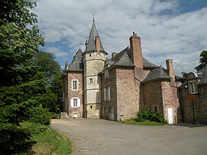
Bruz
Commune in Brittany, France
Distance: Approx. 180 meters
Latitude and longitude: 48.0256,-1.7447
Bruz (French pronunciation: [bʁy] or [bʁyz]) is a commune in the Ille-et-Vilaine department in Brittany in northwestern France.

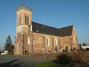
Pont-Péan
Commune in Brittany, France
Distance: Approx. 3384 meters
Latitude and longitude: 48.0136,-1.7033
Pont-Péan (French pronunciation: [pɔ̃ peɑ̃]; Breton: Pont-Pagan; Gallo: Pont-Riaunt) is a commune in the Ille-et-Vilaine department of Brittany in northwestern France.

Chavagne
Commune in Brittany, France
Distance: Approx. 4391 meters
Latitude and longitude: 48.0547,-1.7833
Chavagne (French pronunciation: [ʃavaɲ]; Breton: Kavan; Gallo: Chavayn) is a commune in the Ille-et-Vilaine department of Brittany in northwestern France.

Chartres-de-Bretagne
Commune in Brittany, France
Distance: Approx. 3675 meters
Latitude and longitude: 48.0403,-1.7028
Chartres-de-Bretagne (French pronunciation: [ʃaʁtʁ də bʁətaɲ]; Breton: Karnod, Gallo: Chartr) is a commune in the Ille-et-Vilaine department of Brittany in northwestern France. Inhabitants of Chartres-de-Bretagne are called Chartrains in French.
Saint-Jacques-de-la-Lande
Commune in Brittany, France
Distance: Approx. 5037 meters
Latitude and longitude: 48.0656,-1.7186
Saint-Jacques-de-la-Lande (French pronunciation: [sɛ̃ ʒak də la lɑ̃d]; Breton: Sant-Jakez-al-Lann; Gallo: Saent-Jaq) is a commune of Rennes Métropole in the Ille-et-Vilaine department of Brittany in northwestern France.

Meu
River in France
Distance: Approx. 2437 meters
Latitude and longitude: 48.03166667,-1.77666667
The Meu (French pronunciation: [mø]) is an 84.1 km (52.3 mi) long river in the Côtes-d'Armor and Ille-et-Vilaine départements, north western France. Its source is at Saint-Vran, 2.4 km (1.5 mi) west of the village. It flows generally southeast.
Catholic University of Rennes
Distance: Approx. 2728 meters
Latitude and longitude: 48.0487,-1.7449
The Catholic University of Rennes (Institut catholique de Rennes or ICR) is a Catholic university in Rennes, France. It was founded in 1989, and is located at the Campus de Ker Lann (Rue Blaise Pascal), about 10 km from Rennes in Bruz.
Stellantis Rennes Plant
French car manufacturing and assembly plant
Distance: Approx. 4496 meters
Latitude and longitude: 48.05833333,-1.71361111
The Stellantis Rennes Plant is one of the principal car plants in France, producing approximately 340,000 cars in 2005. The Rennes plant was acquired by the PSA Group in 1976 when Peugeot took a majority stake in the Citroën company which had built the plant. Stellantis Rennes is the largest private employer in the Rennes conurbation, with approximately 2,000 people as of 2021.
École normale supérieure de Rennes
Distance: Approx. 2393 meters
Latitude and longitude: 48.0457,-1.7456
The École normale supérieure de Rennes, also called ENS Rennes is a French scientific grande école, belonging to the network of écoles normales supérieures established according to the model of the École normale supérieure in Paris. Like its sister universities, its mandate lies in training students with a view to careers in academia, engineering and government. Established by a decree of the 17 October 2013 of the Prime Minister, the ENS Rennes is placed under the direct authority of the Ministry of Higher Education and Research, and is a founder of the European University of Brittany.

Catastrophe du Boël
Landslide in France
Distance: Approx. 3552 meters
Latitude and longitude: 47.99277778,-1.75416667
The catastrophe du Boël (disaster of Boël) was a landslide that occurred on June 6, 1884, in a quarry at a place named Le Boël in Bruz, Ille-et-Vilaine, in the west of France. The landslide killed eight people including two children. Groundwater that weakened the cliff and damage caused by explosives used to remove red shale (found as a construction material in the local churches) from the quarry were the principal causes of the accident.

Seiche (river)
River in France
Distance: Approx. 3088 meters
Latitude and longitude: 47.9972,-1.7554
The Seiche is a 97.3 km (60.5 mi) long river in western France located in the departments of Mayenne (Pays de la Loire) and Ille-et-Vilaine (Brittany). It is a left tributary of the river Vilaine. It flows into the Vilaine near Bruz, south of Rennes.

École nationale de la statistique et de l'analyse de l'information
French engineering school
Distance: Approx. 2895 meters
Latitude and longitude: 48.05,-1.741
École nationale de la statistique et de l'analyse de l'information (ENSAI) a French engineering College created in 1994. The school is the only engineering school entirely dedicated to the jobs of statistical engineering and information processing. Located in Rennes since 1996, the ENSAI is a public higher education institution.
Weather in this IP's area
clear sky
16 Celsius
16 Celsius
15 Celsius
16 Celsius
1024 hPa
77 %
1024 hPa
1019 hPa
10000 meters
2.06 m/s
40 degree
06:38:17
21:48:26