Country:
 Venezuela
Region:
City:
Latitude and Longitude:
Time Zone:
Postal Code:
IP information under different IP Channel
ip-api
Country
IPinfo
Country
MaxMind
Country
Luminati
Country
VEASN
Time Zone
America/Caracas
ISP
TELEFONICA VENEZOLANA, C.A.
Latitude
Longitude
Postal
db-ip
Country
ipdata
Country
Popular places and events near this IP address

Vargas (state)
State of Venezuela
Distance: Approx. 6688 meters
Latitude and longitude: 10.572,-66.88
La Guaira State (Spanish: Estado La Guaira; Estado Vargas, IPA: [esˈtaðo ˈβaɾɣas]), known until 2019 as Vargas State is one of the 23 states of Venezuela. Formerly named after Venezuela's first civilian president, José María Vargas, Vargas comprises a coastal region in the north of Venezuela, bordering Aragua to the west, Miranda to the east, the Caribbean Sea to the north and the Capital District to the south. It is home to both the country's largest seaport and airport.

Maiquetía
Place in Vargas, Venezuela
Distance: Approx. 4677 meters
Latitude and longitude: 10.59583333,-66.97722222
Maiquetía is a city located in the Central Region of Venezuela, in the state of Vargas. It is at approximately 19 m above sea level on a small shelf between the Caribbean and the mountains behind it. Caracas, the Venezuelan capital, is approximately 37 km to the southeast.

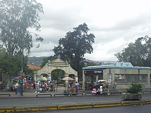
La Guaira
Place in Vargas, Venezuela
Distance: Approx. 202 meters
Latitude and longitude: 10.6,-66.93305556
La Guaira (Spanish: [la ˈɣwajɾa] ) is the capital city of the Venezuelan state of the same name (formerly named Vargas) and the country's main port. It was founded in 1577 as an outlet for Caracas, 30 kilometres (19 mi) to the southeast. The town and the port were badly damaged during the December 1999 floods and mudslides that affected much of the region.

Macuto, Vargas
Place in Vargas, Venezuela
Distance: Approx. 4685 meters
Latitude and longitude: 10.60666667,-66.8925
Macuto is a seaside city in Vargas state, Venezuela. The city has a long history of attracting Venezuelan political leaders and artists, and popular tourist site today.

Simón Bolívar International Airport (Venezuela)
International airport in Maiquetía, Venezuela
Distance: Approx. 6139 meters
Latitude and longitude: 10.60305556,-66.99055556
Maiquetía "Simón Bolívar" International Airport (IATA: CCS, ICAO: SVMI, Spanish: Aeropuerto Internacional de Maiquetía "Simón Bolívar") is an international airport located in Maiquetía, Vargas, Venezuela, about 21 kilometres (13 mi) west of downtown Caracas, the capital of the country. Simply called Maiquetía by the local population, it is the main international air passenger gateway to Venezuela. It handles flights to destinations in the Americas, Europe and the Middle East.

Roman Catholic Diocese of La Guaira
Roman Catholic diocese in Venezuela
Distance: Approx. 436 meters
Latitude and longitude: 10.6012,-66.9313
The Roman Catholic Diocese of La Guaira (Latin: Dioecesis Guairiensis) is a diocese located in the city of La Guaira in the ecclesiastical province of Caracas in Venezuela.

1812 Caracas earthquake
Magnitude 7.7 earthquake in Venezuela
Distance: Approx. 3788 meters
Latitude and longitude: 10.6,-66.9
The 1812 Caracas earthquake took place in Venezuela on March 26 (on Maundy Thursday) at 4:37 p.m. It measured 7.7 on the Richter magnitude scale. It caused extensive damage in Caracas, La Guaira, Barquisimeto, San Felipe, and Mérida.

Battle of La Guaira
1743 battle
Distance: Approx. 202 meters
Latitude and longitude: 10.6,-66.93305556
The Battle of La Guaira or La Guayra, took place on 2 March 1743 in the Caribbean, off the coast of La Guaira, present day Venezuela. La Guaira was a port of the Royal Gipuzkoan Company of Caracas, whose ships had rendered great assistance to the Spanish navy during War of Jenkins' Ear in carrying troops, arms, stores and ammunition from Spain to her colonies, and its destruction would be a severe blow both to the Company and the Spanish Government. A British expeditionary fleet under Sir Charles Knowles was defeated, and the expedition ended in failure.

Battle of La Guaira (1812)
Distance: Approx. 202 meters
Latitude and longitude: 10.6,-66.93305556
The Battle of La Guaira was a naval engagement fought in the Caribbean Sea on 11 December 1812 during the war between Britain and the United States. An American privateer captured a British letter of marque at the Spanish port of La Guaira in Venezuela.
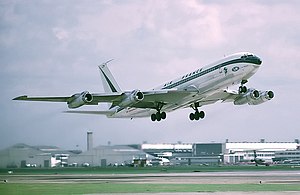
Air France Flight 212 (1969)
1969 aviation accident
Distance: Approx. 1689 meters
Latitude and longitude: 10.6,-66.95
Air France Flight 212 was a passenger flight operated by a Boeing 707, registration F-BHSZ, that crashed on 3 December 1969. None of the 62 people on board survived.
Gato Negro station
Caracas metro station
Distance: Approx. 9306 meters
Latitude and longitude: 10.51572222,-66.942
Gato Negro is a Caracas Metro station on Line 1. It was opened on 2 January 1983 as part of the inaugural section of Line 1 between Propatria and La Hoyada. The station is between Plaza Sucre and Agua Salud.
Estadio Fórum La Guaira
Venezuelan baseball stadium
Distance: Approx. 3170 meters
Latitude and longitude: 10.6029,-66.9059
Estadio Jorge Luis García Carneiro (formerly Estadio Fórum La Guaira) is a baseball stadium located in Macuto, Vargas, Venezuela and the current home of the Tiburones de La Guaira. It has a capacity of 14,300, along with 1200 parking spaces. The stadium had long been planned as the Tiburones had been playing in Estadio Universitario de Caracas, which is not located in La Guaira, sharing games there with the Leones del Caracas.
Weather in this IP's area
broken clouds
27 Celsius
31 Celsius
27 Celsius
27 Celsius
1014 hPa
85 %
1014 hPa
1008 hPa
10000 meters
2.66 m/s
3.81 m/s
115 degree
71 %
06:11:19
18:54:03