Country:
 Brazil
Region:
City:
Latitude and Longitude:
Time Zone:
Postal Code:
IP information under different IP Channel
ip-api
Country
Region
City
ASN
Time Zone
ISP
Blacklist
Proxy
Latitude
Longitude
Postal
Route
IPinfo
Country
Region
City
ASN
Time Zone
ISP
Blacklist
Proxy
Latitude
Longitude
Postal
Route
MaxMind
Country
Region
City
ASN
Time Zone
ISP
Blacklist
Proxy
Latitude
Longitude
Postal
Route
Luminati
Country
BRRegion
rs
City
portoalegre
ASN
Time Zone
America/Sao_Paulo
ISP
BR.Digital Provider
Latitude
Longitude
Postal
db-ip
Country
Region
City
ASN
Time Zone
ISP
Blacklist
Proxy
Latitude
Longitude
Postal
Route
ipdata
Country
Region
City
ASN
Time Zone
ISP
Blacklist
Proxy
Latitude
Longitude
Postal
Route
Popular places and events near this IP address

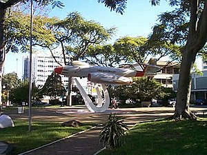
Salgado Filho Porto Alegre International Airport
Brazilian airport
Distance: Approx. 4759 meters
Latitude and longitude: -29.99472222,-51.17111111
Porto Alegre–Salgado Filho International Airport (IATA: POA, ICAO: SBPA) is the airport serving Porto Alegre and the region of Greater Porto Alegre, Brazil. Since October 12, 1951, it is named after the Senator and first Minister of the Brazilian Air Force Joaquim Pedro Salgado Filho (1888–1950). It is operated by Fraport Brasil.
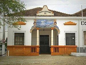
Canoas
Municipality in South, Brazil
Distance: Approx. 5139 meters
Latitude and longitude: -29.92,-51.18
Canoas (Portuguese pronunciation: [kaˈnoɐs]) is a municipality in the state of Rio Grande do Sul, Brazil, forming part of the Greater Porto Alegre area. It is the largest municipality of the metropolitan region of Porto Alegre and the third largest municipality of Rio Grande do Sul. Officially declared a city on June 27, 1939, after its separation from São Sebastião do Caí and Gravataí, Canoas derives its name from the historical crafting of canoes in the area.

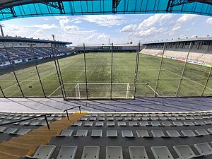
Arena do Grêmio
Stadium in Rio Grande do Sul, Brazil
Distance: Approx. 1518 meters
Latitude and longitude: -29.97344444,-51.19440278
Arena do Grêmio is a multi-use stadium in Porto Alegre, Rio Grande do Sul. It was inaugurated on December 8, 2012. It is used mostly for football matches and as the home stadium of Grêmio Foot-Ball Porto Alegrense, replacing the Estádio Olímpico Monumental.

Gravataí River
River in Brazil
Distance: Approx. 597 meters
Latitude and longitude: -29.96666667,-51.2
Gravataí River (Portuguese pronunciation: [ɡɾavataˈi]) is a river that runs along Gravataí (a city located in the metropolitan area of Porto Alegre city).
Arquipélago
Neighborhood in Porto Alegre, Brazil
Distance: Approx. 4031 meters
Latitude and longitude: -29.99222222,-51.22527778
Arquipélago (meaning Archipelago in Portuguese) is a neighbourhood in the city of Porto Alegre, the state capital of Rio Grande do Sul, Brazil. It was created by Law 2022 on December 7, 1959. The neighbourhood comprises 16 islands that are also part of Jacuí Delta State Park.
Anchieta, Porto Alegre
Neighbourhood in Porto Alegre, Brazil
Distance: Approx. 4098 meters
Latitude and longitude: -29.98465758,-51.16929056
Anchieta is a neighbourhood (bairro) in the city of Porto Alegre, the state capital of Rio Grande do Sul, in Brazil. Created by Law 2022 from December 7, 1959, it was named after José de Anchieta. The neighbourhood is close to the municipality of Canoas.
Farrapos, Rio Grande do Sul
Distance: Approx. 2098 meters
Latitude and longitude: -29.98,-51.19694444
Farrapos (meaning Ragamuffins in English, in allusion to the Ragamuffin War) is a neighbourhood (bairro) in the city of Porto Alegre, the state capital of Rio Grande do Sul, in Brazil. It was created by Law 6218 from November 17, 1988.
Santa Maria Goretti, Rio Grande do Sul
Distance: Approx. 5552 meters
Latitude and longitude: -30.00583333,-51.17555556
Santa Maria Goretti is a neighbourhood (bairro) in the city of Porto Alegre, the state capital of Rio Grande do Sul, in Brazil. It was created by Law 2688 from December 25, 1963.

Pepsi on Stage
Distance: Approx. 3800 meters
Latitude and longitude: -29.9875,-51.17666667
Pepsi on Stage is a music venue in the city of Porto Alegre, Brazil. It is located in the neighborhood of São João, near the Salgado Filho International Airport.

Rio dos Sinos
River in Brazil
Distance: Approx. 4421 meters
Latitude and longitude: -29.934444,-51.235833
Rio dos Sinos is a river in the state of Rio Grande do Sul, southern Brazil. It rises in the hills east of Caraá (130 kilometres (81 mi) away from Porto Alegre) at elevations above 600 metres (2,000 ft) and covers a distance of about 190 kilometres (120 mi), flowing into the delta Jacuí in Canoas, at an elevation of only 5 metres (16 ft). The river basin contains the São Francisco de Paula National Forest, a 1,616-hectare (3,990-acre) sustainable use conservation area created in 1968.
Estádio Passo D'Areia
Multi-use stadium in Porto Alegre, Brazil
Distance: Approx. 5722 meters
Latitude and longitude: -30.00664444,-51.17359167
Estádio Francisco Novelletto Neto, better known as Estádio Passo D'Areia is a multi-use stadium located in Porto Alegre, Brazil. It is used mostly for football matches and hosts the home matches of Esporte Clube São José. The stadium has a maximum capacity of 16,000 people and was built in 1940.

Jacuí Delta
Brazilian hydrographic complex
Distance: Approx. 4557 meters
Latitude and longitude: -29.97111111,-51.24861111
The Jacuí Delta (Portuguese: Delta do Jacuí) is a hydrographic complex of islands (archipelago), canals, swamps and ponds in Rio Grande do Sul, Brazil, formed by the meeting of the Jacuí, Caí, Sinos and Gravataí rivers, whose waters constitute Lake Guaíba. Politically, the delta is a state environmental protection area that overlaps with a state conservation unit, the Jacuí Delta State Park. The Jacuí Delta Environmental Protection Area (APAEDJ) is located in the municipalities of Porto Alegre, Canoas, Nova Santa Rita, Triunfo, Charqueadas and Eldorado do Sul and totals 22,826.39 ha, while the park totals 14,242 hectares.
Weather in this IP's area
broken clouds
14 Celsius
14 Celsius
12 Celsius
14 Celsius
1023 hPa
94 %
1023 hPa
1022 hPa
3000 meters
5.36 m/s
12.96 m/s
198 degree
75 %
07:11:49
17:50:30