Country:
 Great Britain
Region:
City:
Latitude and Longitude:
Time Zone:
Postal Code:
IP information under different IP Channel
ip-api
Country
Region
City
ASN
Time Zone
ISP
Blacklist
Proxy
Latitude
Longitude
Postal
Route
IPinfo
Country
Region
City
ASN
Time Zone
ISP
Blacklist
Proxy
Latitude
Longitude
Postal
Route
MaxMind
Country
Region
City
ASN
Time Zone
ISP
Blacklist
Proxy
Latitude
Longitude
Postal
Route
Luminati
Country
GBRegion
eng
City
littleport
ASN
Time Zone
Europe/London
ISP
EE Limited
Latitude
Longitude
Postal
db-ip
Country
Region
City
ASN
Time Zone
ISP
Blacklist
Proxy
Latitude
Longitude
Postal
Route
ipdata
Country
Region
City
ASN
Time Zone
ISP
Blacklist
Proxy
Latitude
Longitude
Postal
Route
Popular places and events near this IP address

Witcham
Human settlement in England
Distance: Approx. 2336 meters
Latitude and longitude: 52.399,0.15
Witcham is a small village near Ely in Cambridgeshire, England. The village is surrounded by fenland farms and has a village hall and a 13th-century church dedicated to St Martin. It has a pub called the White Horse, which was the winner of the Ely and District CAMRA Rural Pub of the Year Award 2006, 2010, 2011 and Overall Pub of the Year Award 2011.
Sutton-in-the-Isle
Human settlement in England
Distance: Approx. 2099 meters
Latitude and longitude: 52.38737,0.116
Sutton or Sutton-in-the-Isle is a village and civil parish in the county of Cambridgeshire in England, near the city of Ely. The "in-the-Isle" suffix refers to the fact that the village is part of the Isle of Ely, once an island in the Fens and also an administrative county until 1965. The village location on the high ground of the Isle of Ely provides commanding views across the surrounding low-lying fens.

Mepal
Human settlement in England
Distance: Approx. 52 meters
Latitude and longitude: 52.406,0.117
Mepal is a village in Cambridgeshire, England. Mepal is part of the East Cambridgeshire district, and is located just north of the A142 road between Ely and Chatteris. First listed as Mepahala in the 12th century, the village name meant 'Nook of land of a man named Mēapa' in Old English.
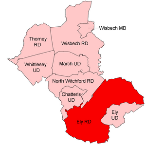
Ely Rural District
Distance: Approx. 3099 meters
Latitude and longitude: 52.415,0.161
Ely Rural District was a rural district in England from 1894 to 1974. It was named after Ely, but did not include the city itself, instead covering the rural area to the west and north of it. It formed part of the administrative county of the Isle of Ely from 1894 to 1965, when this was merged into Cambridgeshire and Isle of Ely.

Haddenham, Cambridgeshire
Human settlement in England
Distance: Approx. 5772 meters
Latitude and longitude: 52.358,0.149
Haddenham is a village and civil parish in Cambridgeshire, England. In the 2001 census the parish had a population of 3,228. The 2011 census reported a population of 3,344, a figure which includes the hamlet of Aldreth.

Coveney, Cambridgeshire
Village in England
Distance: Approx. 5796 meters
Latitude and longitude: 52.42,0.2
Coveney is a village and civil parish northwest of Ely, in the East Cambridgeshire district, in Cambridgeshire, England. In 2011 the parish had a population of 424. Coveney is on a small Fen 'island' rising to 43 feet (13 m) above sea level, some 3.5 miles (6 km) west from Ely city as the crow flies, but nearly twice that distance by the main road.
Sutton railway station (Cambridgeshire)
Former railway station in England
Distance: Approx. 2492 meters
Latitude and longitude: 52.3858,0.1328
Sutton railway station was a station in Sutton, Cambridgeshire on the Ely and St Ives Railway. The first station opened in 1866 but it became the goods station in 1878 when a new station was built on the new alignment for the extension to St. Ives.

Haddenham railway station (Cambridgeshire)
Railway station in Haddenham, Cambridgeshire
Distance: Approx. 5092 meters
Latitude and longitude: 52.3654,0.1516
Haddenham railway station was a station in Haddenham, Cambridgeshire. It was first opened in 1866 by the Ely, Haddenham and Sutton Railway. It closed to passengers in 1931 through it continued to be served by occasional passenger excursion trains until 1958 and goods trains until full closure in 1964.

Wentworth, Cambridgeshire
Human settlement in England
Distance: Approx. 4529 meters
Latitude and longitude: 52.3849,0.1745
Wentworth is a small village near Ely in Cambridgeshire, England. It is in the Isle of Ely, adjacent to Grunty Fen, Wentworth lies south of the A142 between Witchford and Sutton, approximately 5 miles west of Ely. The village is centred on St Peter’s Church and a number of listed buildings at the junction of Main Street and Church Road.
Wardy Hill
Human settlement in England
Distance: Approx. 3431 meters
Latitude and longitude: 52.4172,0.1649
Wardy Hill is a hamlet in Coveney civil parish, part of East Cambridgeshire, England.

Tracked Hovercraft
Distance: Approx. 3025 meters
Latitude and longitude: 52.38964,0.082397
Tracked Hovercraft was an experimental high-speed train developed in the United Kingdom during the 1960s. It combined two British inventions, the hovercraft and linear induction motor, in an effort to produce a train system that would provide 250 mph (400 km/h) inter-city service with lowered capital costs compared to other high-speed solutions. Substantially similar to the French Aérotrain and other hovertrain systems of the 1960s, Tracked Hovercraft suffered a similar fate to these projects when it was cancelled as a part of wide budget cuts in 1973.

Elean power station
Distance: Approx. 1300 meters
Latitude and longitude: 52.39837,0.131902
Elean power station is a straw-fired biomass power station in Cambridgeshire, England. At a capacity of 38 MW, it was the largest straw-fired power plant in the world at the time of its completion. The power station was constructed between 1998 and 2000 by FLS Miljo and is operated by EPR Ely Ltd.
Weather in this IP's area
overcast clouds
23 Celsius
22 Celsius
22 Celsius
23 Celsius
1014 hPa
47 %
1014 hPa
1013 hPa
10000 meters
3.13 m/s
7.15 m/s
324 degree
90 %
05:12:25
20:59:24