Country:
 USA
USARegion:
City:
Latitude and Longitude:
Time Zone:
Postal Code:
IP information under different IP Channel
ip-api
Country
Region
City
ASN
Time Zone
ISP
Blacklist
Proxy
Latitude
Longitude
Postal
Route
IPinfo
Country
Region
City
ASN
Time Zone
ISP
Blacklist
Proxy
Latitude
Longitude
Postal
Route
MaxMind
Country
Region
City
ASN
Time Zone
ISP
Blacklist
Proxy
Latitude
Longitude
Postal
Route
Luminati
Country
USASN
Time Zone
America/Chicago
ISP
CL-1379-14537
Latitude
Longitude
Postal
db-ip
Country
Region
City
ASN
Time Zone
ISP
Blacklist
Proxy
Latitude
Longitude
Postal
Route
ipdata
Country
Region
City
ASN
Time Zone
ISP
Blacklist
Proxy
Latitude
Longitude
Postal
Route
Popular places and events near this IP address
Atlantic City Convention Center
Distance: Approx. 52 meters
Latitude and longitude: 39.3634,-74.43911
The Atlantic City Convention Center is a large convention center located in Atlantic City, New Jersey. Opened on May 1, 1997, the center includes 500,000 sq ft (46,000 m2) of showroom space, 5 exhibit halls, 45 meeting rooms with 109,000 sq ft (10,100 m2) of space, a garage with 1,400 parking spaces, and an adjacent Sheraton hotel.

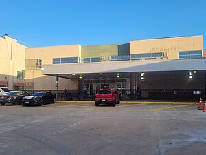
Atlantic City Rail Terminal
NJ Transit rail station
Distance: Approx. 199 meters
Latitude and longitude: 39.3635,-74.442
The Atlantic City Rail Terminal is Atlantic City, New Jersey's train station, located inside of the Atlantic City Convention Center. It has five tracks served by three platforms and functions as the easternmost terminus of the NJ Transit Atlantic City Line to and from Philadelphia. The station was also served by the Atlantic City Express Service (ACES) from 2009 until it was formally discontinued on March 9, 2012.

Tanger Outlets Atlantic City
Shopping mall in New Jersey, United States
Distance: Approx. 346 meters
Latitude and longitude: 39.361,-74.437
Tanger Outlets Atlantic City, formerly known as The Walk, is a 109-store open-air outlet mall in Atlantic City, New Jersey. It is the only outlet mall in Atlantic County. The mall opened in August 2003 and spans 3 city blocks, featuring a unique layout in outlet mall construction.
Atlantic City Bus Terminal
Distance: Approx. 558 meters
Latitude and longitude: 39.359912,-74.434929
The Atlantic City Bus Terminal is a regional bus station and a major stop for New Jersey Transit buses in Atlantic City, New Jersey. Located at the 1900 block of Atlantic Avenue, the station is now only half its original size, as part of it was carved out for a Polo Ralph Lauren store along the Atlantic City Outlets The Walk. The terminal contains vending machines, restrooms, a seating area, and ticket offices for New Jersey Transit.

1906 Atlantic City train wreck
Rail accident in 1906
Distance: Approx. 520 meters
Latitude and longitude: 39.36444444,-74.44555556
The 1906 Atlantic City train wreck occurred in Atlantic City, New Jersey, on Sunday October 28, 1906, when a West Jersey and Seashore Railroad electric train fell off a draw (swing) bridge, drowning 53 people.
Atlantic City Armory
Distance: Approx. 52 meters
Latitude and longitude: 39.3634,-74.43911
Atlantic City Armory is an armory at 1008 Absecon Boulevard in Atlantic City, New Jersey. For the 1944 season the New York Yankees held spring training in Atlantic City. They made the 300-room Senator Hotel their headquarters, trained indoors at the armory and played at Bader Field.
White House Sub Shop
Restaurant in New Jersey, United States
Distance: Approx. 465 meters
Latitude and longitude: 39.35918,-74.44062
White House Sub Shop is a submarine sandwich deli founded in 1946 at Atlantic City, New Jersey, United States, which sells various specialty sandwiches. The deli is considered a historic landmark and has served multiple celebrities.

Dante Hall Theater
Distance: Approx. 560 meters
Latitude and longitude: 39.35827,-74.43998
Dante Hall Theater of the Arts is a theatre and cultural center in Atlantic City, New Jersey located in the Ducktown neighbourhood, which has traditionally been the city's Little Italy. It is now part of Stockton University. Dante Hall Theater was originally built in 1926 by St.
Paradise Club (Atlantic City, New Jersey)
Distance: Approx. 504 meters
Latitude and longitude: 39.36388889,-74.43388889
The Paradise Club or Club Paradise was a nightclub and jazz club at 220 North Illinois Avenue in Atlantic City, New Jersey. It was one of two major black jazz clubs in Atlantic City during its heyday from the 1920s through 1950s, the other being Club Harlem. Entertaining a predominantly white clientele, it was known for its raucous floor shows featuring gyrating black dancers accompanied by high-energy jazz bands led by the likes of Count Basie, Jimmie Lunceford, and Lucky Millinder.
Beach Bridge
Bridge
Distance: Approx. 494 meters
Latitude and longitude: 39.3643,-74.44529
Beach Bridge, or Beach Drawbridge, is a railroad swing bridge over Beach Thorofare Waterway in Atlantic City, Atlantic County, New Jersey, United States just west of the Atlantic City Rail Terminal. It carries the New Jersey Transit Rail Operations (NJT) Atlantic City Line at milepoint mile 68.9 and is parallel to the Atlantic City Expressway. Built in 1922, the swing bridge was rehabilitated in 1988 and 2004.
Atlantic City Rescue Mission
Distance: Approx. 191 meters
Latitude and longitude: 39.365,-74.44001
Atlantic City Rescue Mission (ACRM) is a rescue mission founded in 1964 by John Fink with the purpose of supporting residents in South Jersey in the United States. The rescue mission provides food banks, a soup kitchen and homeless shelter. ACRM assists over 3,300 homeless and people in need of assistance per year.

Atlantic City Union Station
Former railway station in Atlantic City, New Jersey (closed 1964)
Distance: Approx. 410 meters
Latitude and longitude: 39.3598,-74.4382
Atlantic City Union Station was an intercity passenger rail station located at 2121-2125 Arctic Avenue in Atlantic City, New Jersey. It was opened in 1934 by the Pennsylvania-Reading Seashore Lines (PRSL) and consolidated the operations of the two previously competing rail lines. In 1964, construction of the Atlantic City Expressway severed the rail connection to the station.
Weather in this IP's area
few clouds
20 Celsius
20 Celsius
18 Celsius
22 Celsius
1020 hPa
91 %
1020 hPa
1020 hPa
10000 meters
0.45 m/s
1.34 m/s
337 degree
23 %
05:54:24
20:13:52