Country:
 Gambia
Region:
City:
Latitude and Longitude:
Time Zone:
Postal Code:
IP information under different IP Channel
ip-api
Country
Region
City
ASN
Time Zone
ISP
Blacklist
Proxy
Latitude
Longitude
Postal
Route
IPinfo
Country
Region
City
ASN
Time Zone
ISP
Blacklist
Proxy
Latitude
Longitude
Postal
Route
MaxMind
Country
Region
City
ASN
Time Zone
ISP
Blacklist
Proxy
Latitude
Longitude
Postal
Route
Luminati
Country
GMRegion
m
City
janjanbureh
ASN
Time Zone
Africa/Banjul
ISP
QCell
Latitude
Longitude
Postal
db-ip
Country
Region
City
ASN
Time Zone
ISP
Blacklist
Proxy
Latitude
Longitude
Postal
Route
ipdata
Country
Region
City
ASN
Time Zone
ISP
Blacklist
Proxy
Latitude
Longitude
Postal
Route
Popular places and events near this IP address
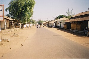
Janjanbureh
Place in Central River Division, The Gambia
Distance: Approx. 334 meters
Latitude and longitude: 13.53413056,-14.76615278
Janjanbureh or Jangjangbureh is a town, founded in 1823, on Janjanbureh Island, also known as MacCarthy Island, in the Gambia River in eastern Gambia. Until 1995, it was known as Georgetown and was the second largest town in the country. It is the capital of Janjanbureh Local Government Area (formerly the Central River Division), and the Janjanbureh district.

MacCarthy Island
Distance: Approx. 419 meters
Latitude and longitude: 13.53333333,-14.76666667
MacCarthy Island, originally known as Lemain Island and officially named Janjanbureh Island, is an island located approximately 170 miles (272 km) upriver from the mouth of the Gambia River, in eastern Gambia, in the Janjanbureh District. Located on the island is the second-largest town in the country, Janjanbureh, but on many maps it still appears by its European name of Georgetown. In addition to being a destination for some wildlife tourists, the island is also the home of Gambia's largest prison.

Fulladu West
District of the Gambia
Distance: Approx. 4504 meters
Latitude and longitude: 13.5,-14.75
Fulladu West is one of the ten districts of the Central River Division of the Gambia.
Kunkilling Forest Park
Forest park in the Gambia
Distance: Approx. 6307 meters
Latitude and longitude: 13.52361111,-14.71
Kunkilling Forest Park is a forest park in the Gambia. Established on January 1, 1954, it covers 142 hectares. The forest park is located in a village called Kerr Serrekunda on the southern bank of the River Gambia.
Madina Demba Forest Park
Distance: Approx. 8044 meters
Latitude and longitude: 13.46666667,-14.75
Madina Demba Forest Park is a forest park in the Gambia. Established on January 1, 1954, it covers 2373 hectares. Madina Demba Forest Park has an elevation of 50 metres.

Armitage High School
High school in The Gambia
Distance: Approx. 603 meters
Latitude and longitude: 13.542407,-14.767725
Armitage Senior Secondary School is a high school located in Janjanbureh, in the Gambia. Armitage a boarding school, is one of the oldest schools in the Gambia. It was established in 1927 by Governor Cecil Hamilton Armitage in Georgetown.
Weather in this IP's area
broken clouds
30 Celsius
36 Celsius
30 Celsius
30 Celsius
1010 hPa
78 %
1010 hPa
1009 hPa
10000 meters
1.43 m/s
1.54 m/s
121 degree
81 %
06:48:17
18:50:08