Country:
 France
Region:
City:
Latitude and Longitude:
Time Zone:
Postal Code:
IP information under different IP Channel
ip-api
Country
Region
City
ASN
Time Zone
ISP
Blacklist
Proxy
Latitude
Longitude
Postal
Route
IPinfo
Country
Region
City
ASN
Time Zone
ISP
Blacklist
Proxy
Latitude
Longitude
Postal
Route
MaxMind
Country
Region
City
ASN
Time Zone
ISP
Blacklist
Proxy
Latitude
Longitude
Postal
Route
Luminati
Country
 CH
CHASN
Time Zone
Europe/Zurich
ISP
VTX Services SA
Latitude
Longitude
Postal
db-ip
Country
Region
City
ASN
Time Zone
ISP
Blacklist
Proxy
Latitude
Longitude
Postal
Route
ipdata
Country
Region
City
ASN
Time Zone
ISP
Blacklist
Proxy
Latitude
Longitude
Postal
Route
Popular places and events near this IP address
Patek Philippe
Swiss luxury watch and clock manufacturer
Distance: Approx. 3683 meters
Latitude and longitude: 46.16629,6.11211
Patek Philippe SA (French: [paˈtɛk fiˈlip]) is a Swiss luxury watch and clock manufacturer, located in the Canton of Geneva and the Vallée de Joux. Established in 1839, it is named after two of its founders, Antoni Patek and Adrien Philippe. Since 1932, the company has been owned by the Stern family in Switzerland and remains the last family-owned independent watch manufacturer in Geneva.
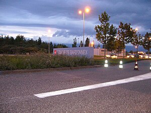
Bardonnex
Municipality in Geneva, Switzerland
Distance: Approx. 2562 meters
Latitude and longitude: 46.13333333,6.1
Bardonnex is a municipality in the canton of Geneva in Switzerland.
Plan-les-Ouates
Municipality in Geneva, Switzerland
Distance: Approx. 3584 meters
Latitude and longitude: 46.16666667,6.11666667
Plan-les-Ouates (French pronunciation: [plɑ̃ le wat]) is a municipality of the canton of Geneva in Switzerland.

Troinex
Municipality in Geneva, Switzerland
Distance: Approx. 1999 meters
Latitude and longitude: 46.15,6.15
Troinex is a municipality of the Canton of Geneva, Switzerland.

Adventist University of France
Distance: Approx. 1941 meters
Latitude and longitude: 46.13694444,6.15805556
Adventist University of France also called in French: Campus Adventiste du Salève, formerly named Salève Adventist University, belongs to the Seventh-day Adventist Church and is affiliated with Partnership of Adventist Colleges in Europe, (PACE). The university is located about five miles from Geneva across the Swiss-French border. The campus itself is part way up Le Salève, the summit of which is at an elevation of over 1,300 metres (4,300 feet).

Archamps
Commune in Auvergne-Rhône-Alpes, France
Distance: Approx. 19 meters
Latitude and longitude: 46.1364,6.1331
Archamps (French pronunciation: [aʁʃɑ̃]) is a commune in the Haute-Savoie department in the Auvergne-Rhône-Alpes region in south-eastern France. As of 2020, it is the commune with the second highest median per capita income (€53,330 per year) in France.

Collonges-sous-Salève
Commune in Auvergne-Rhône-Alpes, France
Distance: Approx. 1163 meters
Latitude and longitude: 46.1419,6.1458
Collonges-sous-Salève (French pronunciation: [kɔlɔ̃ʒ su salɛv], literally Collonges under Salève; Arpitan: Colonges), popularly known as Collonges, is a commune in the Haute-Savoie department in the Auvergne-Rhône-Alpes region in Eastern France. It is located on the Swiss border, between Geneva to the north and Mont Salève to the south, after which it is named.

Bossey
Commune in Auvergne-Rhône-Alpes, France
Distance: Approx. 2746 meters
Latitude and longitude: 46.1525,6.16
Bossey (French pronunciation: [bɔsɛ]; Arpitan: Bossè) is a commune in the Haute-Savoie department in the Auvergne-Rhône-Alpes region in Eastern France. Located on the Swiss border, it had a population of 1,031 as of 2018.

Neydens
Commune in Auvergne-Rhône-Alpes, France
Distance: Approx. 2677 meters
Latitude and longitude: 46.1222,6.105
Neydens (French pronunciation: [nɛdɑ̃]; Arpitan: Nédin) is a commune in the Haute-Savoie department in the Auvergne-Rhône-Alpes region in south-eastern France. Due to its close proximity to Geneva (Switzerland), Neydens is a popular tourist destination.
Maurice-Tièche Comprehensive School
School in France
Distance: Approx. 1922 meters
Latitude and longitude: 46.1359,6.1578
L’Ensemble Scolaire Maurice-Tièche or Maurice Tièche Comprehensive School is a K-13 co-educational, Christian private school owned by the Seventh-day Adventist Church in the region Collonges-sous-Salève of France. It teaches pupils of primary, junior high and senior high school age. The school also has a nursery school offering care to 2 year-olds.

Compesières Commandry
Distance: Approx. 1965 meters
Latitude and longitude: 46.15194444,6.12055556
The Compesières Commandry is the main Commandry of the Order of Malta in the Canton of Geneva in Switzerland. The Commandry is located in the municipality of Bardonnex.
Saconnex d'Arve
Distance: Approx. 2343 meters
Latitude and longitude: 46.157,6.126
Saconnex d'Arve is a hamlet in Plan-les-Ouates, Geneva canton, Switzerland. It is divided in two, Saconnex d'Arve Dessous and Saconnex d'Arve Dessus.
Weather in this IP's area
clear sky
17 Celsius
17 Celsius
17 Celsius
18 Celsius
1022 hPa
86 %
1022 hPa
962 hPa
10000 meters
0.51 m/s
06:14:10
21:09:29