Country:
 Switzerland
Region:
City:
Latitude and Longitude:
Time Zone:
Postal Code:
IP information under different IP Channel
ip-api
Country
Region
City
ASN
Time Zone
ISP
Blacklist
Proxy
Latitude
Longitude
Postal
Route
IPinfo
Country
Region
City
ASN
Time Zone
ISP
Blacklist
Proxy
Latitude
Longitude
Postal
Route
MaxMind
Country
Region
City
ASN
Time Zone
ISP
Blacklist
Proxy
Latitude
Longitude
Postal
Route
Luminati
Country
CHASN
Time Zone
Europe/Zurich
ISP
VTX Services SA
Latitude
Longitude
Postal
db-ip
Country
Region
City
ASN
Time Zone
ISP
Blacklist
Proxy
Latitude
Longitude
Postal
Route
ipdata
Country
Region
City
ASN
Time Zone
ISP
Blacklist
Proxy
Latitude
Longitude
Postal
Route
Popular places and events near this IP address
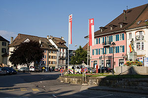
Bulle
Municipality in Fribourg, Switzerland
Distance: Approx. 602 meters
Latitude and longitude: 46.61666667,7.05
Bulle (French: [byl] ; Arpitan: Bulo [ˈbylo] ) is a municipality in the district of Gruyère in the canton of Fribourg in Switzerland. In January 2006 Bulle incorporated the formerly independent municipality of La Tour-de-Trême.

Le Pâquier, Fribourg
Municipality in Fribourg, Switzerland
Distance: Approx. 2230 meters
Latitude and longitude: 46.6,7.05
Le Pâquier (French: [lə pɑkje]; Arpitan: Le Pâquiér [lə paˈci] ) is a municipality in the district of Gruyère in the canton of Fribourg in Switzerland.
Morlon
Municipality in Fribourg, Switzerland
Distance: Approx. 2553 meters
Latitude and longitude: 46.63333333,7.08333333
Morlon (French: [mɔʁlɔ̃], Franco-Provençal: [mɔʁˈlɔ̃] ) is a municipality in the district of Gruyère in the canton of Fribourg in Switzerland.
Stade de Bouleyres
Multi-use stadium
Distance: Approx. 841 meters
Latitude and longitude: 46.6162,7.0666
Stade de Bouleyres is a multi-use stadium in Bulle, Switzerland. It is currently used mostly for football matches and is the home ground of FC Bulle. The stadium holds 5,000 people.
Riaz
Municipality in Fribourg, Switzerland
Distance: Approx. 2507 meters
Latitude and longitude: 46.64166667,7.0625
Riaz (French: [ʁija]; Arpitan: Rua, pronounced [ˈʁija] or [ʁja]) is a municipality in the district of Gruyère in the canton of Fribourg in Switzerland.

Baillival Castle (Bulle)
Distance: Approx. 234 meters
Latitude and longitude: 46.61757,7.057924
Baillival Castle (Bulle) is a bailiff's castle in the municipality of Bulle of the Canton of Fribourg in Switzerland. It is a Swiss heritage site of national significance.
Musée gruérien
Distance: Approx. 348 meters
Latitude and longitude: 46.61666667,7.05861111
The Musée gruérien is a museum dedicated to the ethnography and history of the Gruyère District of the Canton of Fribourg, Switzerland. It is located in Bulle. Its collection of over 25,000 objects includes prints, drawings, paintings, sculpture, textiles, tools, woodwork, ceramics, furniture, photographs, and so on.

Bulle railway station
Railway station in Bulle, Switzerland
Distance: Approx. 285 meters
Latitude and longitude: 46.61919444,7.053
Bulle railway station (French: Gare de Bulle, German: Bahnhof Bulle) is a railway station in the municipality of Bulle, in the Swiss canton of Fribourg. It is located at the junction of three railway lines: the Bulle–Romont, Bulle–Broc, and Palézieux–Bulle–Montbovon lines. All three are owned by Transports publics Fribourgeois.

La Tour-de-Trême railway station
Railway station in Bulle, Switzerland
Distance: Approx. 1303 meters
Latitude and longitude: 46.60888889,7.06388889
La Tour-de-Trême railway station (French: Gare de La Tour-de-Trême), is a railway station in the municipality of Bulle, in the Swiss canton of Fribourg. It is an intermediate stop on the standard gauge Bulle–Broc railway line of Transports publics Fribourgeois.

Vuadens-Sud railway station
Railway station in Vuadens, Switzerland
Distance: Approx. 2811 meters
Latitude and longitude: 46.61805556,7.02
Vuadens-Sud railway station (French: Gare de Vuadens-Sud), is a railway station in the municipality of Vuadens, in the Swiss canton of Fribourg. It is an intermediate stop on the 1,000 mm (3 ft 3+3⁄8 in) metre gauge Palézieux–Bulle–Montbovon railway line of Transports publics Fribourgeois.
La Tour-de-Trême Ronclina railway station
Railway station in Bulle, Switzerland
Distance: Approx. 1528 meters
Latitude and longitude: 46.60611111,7.06111111
La Tour-de-Trême Ronclina railway station (French: Gare de La Tour-de-Trême Ronclina), is a railway station in the municipality of Bulle, in the Swiss canton of Fribourg. It is an intermediate stop on the 1,000 mm (3 ft 3+3⁄8 in) metre gauge Palézieux–Bulle–Montbovon railway line of Transports publics Fribourgeois.

Le Pâquier-Montbarry railway station
Railway station in Le Pâquier, Switzerland
Distance: Approx. 2739 meters
Latitude and longitude: 46.595,7.06
Le Pâquier-Montbarry railway station (French: Gare de Le Pâquier-Montbarry), is a railway station in the municipality of Le Pâquier, in the Swiss canton of Fribourg. It is an intermediate stop on the 1,000 mm (3 ft 3+3⁄8 in) metre gauge Palézieux–Bulle–Montbovon railway line of Transports publics Fribourgeois.
Weather in this IP's area
few clouds
16 Celsius
16 Celsius
15 Celsius
18 Celsius
1023 hPa
70 %
1023 hPa
936 hPa
10000 meters
1.55 m/s
1.64 m/s
119 degree
15 %
06:08:56
21:07:19