Country:
 Netherlands
Region:
City:
Latitude and Longitude:
Time Zone:
Postal Code:
IP information under different IP Channel
ip-api
Country
Region
City
ASN
Time Zone
ISP
Blacklist
Proxy
Latitude
Longitude
Postal
Route
IPinfo
Country
Region
City
ASN
Time Zone
ISP
Blacklist
Proxy
Latitude
Longitude
Postal
Route
MaxMind
Country
Region
City
ASN
Time Zone
ISP
Blacklist
Proxy
Latitude
Longitude
Postal
Route
Luminati
Country
NLRegion
nb
City
rijen
ASN
Time Zone
Europe/Amsterdam
ISP
SURF B.V.
Latitude
Longitude
Postal
db-ip
Country
Region
City
ASN
Time Zone
ISP
Blacklist
Proxy
Latitude
Longitude
Postal
Route
ipdata
Country
Region
City
ASN
Time Zone
ISP
Blacklist
Proxy
Latitude
Longitude
Postal
Route
Popular places and events near this IP address

Dongen
Municipality in North Brabant, Netherlands
Distance: Approx. 5250 meters
Latitude and longitude: 51.63333333,4.93333333
Dongen (Dutch pronunciation: [ˈdɔŋə(n)] ) is a municipality and village in North Brabant, in the southern Netherlands. In the past it had a profitable leather industry, and a few old shoe factories in the town's older sections remain. The town is near a small river called the Donge, the water of which was used extensively for the leather industry.

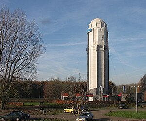
Oosterhout
Municipality in North Brabant, Netherlands
Distance: Approx. 1385 meters
Latitude and longitude: 51.63333333,4.86666667
Oosterhout (Dutch pronunciation: [ˈoːstərɦʌut] ; from ooster, "eastern", and hout, "woods") is a municipality and a city in southern Netherlands. The municipality had a population of 56,206 in 2021.

Donge (river)
River in North Brabant, Netherlands
Distance: Approx. 5002 meters
Latitude and longitude: 51.6775,4.90972222
The Donge is a small river in the Dutch province of North Brabant. It rises from springs east of Baarle-Nassau as a stream called Leij. Near Tilburg the name changes to Donge.

Made, Netherlands
Village in North Brabant, Netherlands
Distance: Approx. 5809 meters
Latitude and longitude: 51.67638889,4.7925
Made is a town in the Dutch province of North Brabant. It is located in the municipality of Drimmelen, about 10 km northeast of Breda.

Raamsdonk
Village in North Brabant, Netherlands
Distance: Approx. 5816 meters
Latitude and longitude: 51.68777778,4.90805556
Raamsdonk is a village in the province of North Brabant, Netherlands. It is located in the municipality of Geertruidenberg, about 15 km northeast of Breda.

Teteringen
City district / Village in North Brabant, Netherlands
Distance: Approx. 3642 meters
Latitude and longitude: 51.61666667,4.83333333
Teteringen is a city district / village in the northeast of Breda in the Dutch province of North Brabant. It is located in the municipality of Breda, about 4 km north of the city centre. Teteringen was a separate municipality until 1997, when it became part of Breda.
Heikant, Oosterhout
Hamlet in Oosterhout, the Netherlands
Distance: Approx. 2047 meters
Latitude and longitude: 51.63666667,4.88611111
Heikant is a hamlet in the municipality of Oosterhout, in the Dutch province of North Brabant. It is located about 3 km southeast of the centre of Oosterhout.
Raamsdonksveer
Town in North Brabant, Netherlands
Distance: Approx. 4294 meters
Latitude and longitude: 51.68333333,4.86666667
Raamsdonksveer is a town in the Dutch municipality of Geertruidenberg, North Brabant. It lies on the east side of the Donge opposite Geertruidenberg. It is a regional center of commerce and industry.
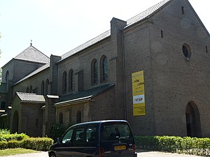
St. Paul's Abbey, Oosterhout
Distance: Approx. 1327 meters
Latitude and longitude: 51.63818056,4.87546111
St. Paul's Abbey, Oosterhout, also Oosterhout Abbey (Dutch: Sint-Paulusabdij) is a former Benedictine abbey in Oosterhout, North Brabant, the Netherlands.
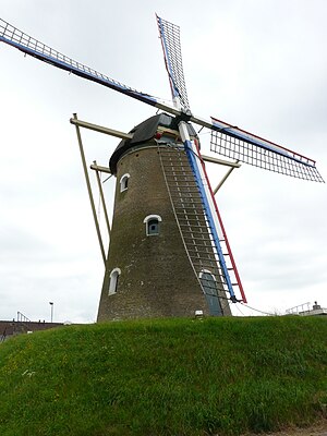
De Hoop, Den Hout
Dutch windmill
Distance: Approx. 3669 meters
Latitude and longitude: 51.656111,4.809689
De Hoop is a gristmill in Den Hout, Netherlands. The mill was built in 1837. In 1975, the owner sold the mill to the municipality, which had it restored in 1985.
Den Hout
Village in North Brabant, Netherlands
Distance: Approx. 3610 meters
Latitude and longitude: 51.65777778,4.81166667
Den Hout is a village in the Dutch province of North Brabant. It is located in the municipality of Oosterhout. The village was first mentioned in 1311 as "Rolinus dictus van den Houte", and means deciduous forest.
Baarschot, Oosterhout
Hamlet in North Brabant, Netherlands
Distance: Approx. 5054 meters
Latitude and longitude: 51.6,4.85
Baarschot (Dutch pronunciation: [ˈbaːr.sxɔt]; Brabantian: Baorschot) is a hamlet in the municipality of Oosterhout in the province of North Brabant in the Netherlands. It is located in the south of the municipality between Breda and Dorst, the latter of which it is a part administratively. It has approximately 50 inhabitants.
Weather in this IP's area
clear sky
19 Celsius
19 Celsius
18 Celsius
21 Celsius
1025 hPa
73 %
1025 hPa
1024 hPa
10000 meters
2.57 m/s
300 degree
05:58:10
21:35:42