Country:
 Brazil
Region:
City:
Latitude and Longitude:
Time Zone:
Postal Code:
IP information under different IP Channel
ip-api
Country
Region
City
ASN
Time Zone
ISP
Blacklist
Proxy
Latitude
Longitude
Postal
Route
IPinfo
Country
Region
City
ASN
Time Zone
ISP
Blacklist
Proxy
Latitude
Longitude
Postal
Route
MaxMind
Country
Region
City
ASN
Time Zone
ISP
Blacklist
Proxy
Latitude
Longitude
Postal
Route
Luminati
Country
BRRegion
al
City
piranhas
ASN
Time Zone
America/Maceio
ISP
ALOO TELECOM - FSF TECNOLOGIA SA
Latitude
Longitude
Postal
db-ip
Country
Region
City
ASN
Time Zone
ISP
Blacklist
Proxy
Latitude
Longitude
Postal
Route
ipdata
Country
Region
City
ASN
Time Zone
ISP
Blacklist
Proxy
Latitude
Longitude
Postal
Route
Popular places and events near this IP address

Piranhas, Alagoas
Municipality in Alagoas, Brazil
Distance: Approx. 5371 meters
Latitude and longitude: -9.62388889,-37.75694444
Piranhas is a historic municipality near the western limit of the State of Alagoas, in the Northeast Region of Brazil. Located on the banks of the São Francisco River, on the border with the State of Sergipe, Piranhas was founded in 1891 and originally named Floriano Peixoto (in honor of the Army General who was one of the founders of the Republic and was later elected President). It was also known as Porto de Piranhas, because fishermen caught piranhas (a carnivorous predator fish) there.
Canindé de São Francisco
Municipality in Northeast, Brazil
Distance: Approx. 2018 meters
Latitude and longitude: -9.64194444,-37.78777778
Canindé de São Francisco is a municipality located in the Brazilian state of Sergipe. Its population was 30,402 (2020) and its area is 902.2 km2 (348.3 sq mi).

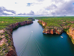
Xingó Dam
Dam in Near Piranhas on border of Alagoas and Sergipe, Brazil
Distance: Approx. 4407 meters
Latitude and longitude: -9.62055556,-37.79277778
The Xingó Dam is a concrete face rock-fill dam on the São Francisco River on the border of Alagoas and Sergipe, near Piranhas, Brazil. The dam was built for navigation, water supply and hydroelectric power generation as it supports a 3,162 megawatts (4,240,000 hp) power station. It was constructed between 1987 and 1994 and the last of its generators was commissioned in 1997.
Weather in this IP's area
scattered clouds
33 Celsius
33 Celsius
33 Celsius
33 Celsius
1016 hPa
36 %
1016 hPa
997 hPa
10000 meters
5.96 m/s
5.51 m/s
104 degree
35 %
05:47:06
17:27:55