Country:
 Russian Federation
Region:
City:
Latitude and Longitude:
Time Zone:
Postal Code:
IP information under different IP Channel
ip-api
Country
Region
City
ASN
Time Zone
ISP
Blacklist
Proxy
Latitude
Longitude
Postal
Route
IPinfo
Country
Region
City
ASN
Time Zone
ISP
Blacklist
Proxy
Latitude
Longitude
Postal
Route
MaxMind
Country
Region
City
ASN
Time Zone
ISP
Blacklist
Proxy
Latitude
Longitude
Postal
Route
Luminati
Country
RUASN
Time Zone
Europe/Moscow
ISP
Limited Liability Company TTK-Svyaz
Latitude
Longitude
Postal
db-ip
Country
Region
City
ASN
Time Zone
ISP
Blacklist
Proxy
Latitude
Longitude
Postal
Route
ipdata
Country
Region
City
ASN
Time Zone
ISP
Blacklist
Proxy
Latitude
Longitude
Postal
Route
Popular places and events near this IP address
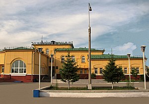
Shimanovsk
Town in Amur Oblast, Russia
Distance: Approx. 0 meters
Latitude and longitude: 52,127.7
Shimanovsk (Russian: Шимано́вск) is a town in Amur Oblast, Russia, located on the Bolshaya Pyora River (a right-hand tributary of the Zeya), 250 kilometers (160 mi) northwest of Blagoveshchensk. Population: 19,815 (2010 Russian census); 22,267 (2002 Census); 26,274 (1989 Soviet census).
Shimanovsk Airport
Airport in Shimanovsk
Distance: Approx. 4228 meters
Latitude and longitude: 51.985,127.64333333
Shimanovsk Airport is an airport in Russia located 4 km southwest of Shimanovsk, Amur Oblast. It primarily services general aviation and is a minor facility.

Shimanovsky District
District in Amur Oblast, Russia
Distance: Approx. 2285 meters
Latitude and longitude: 52,127.66666667
Shimanovsky District (Russian: Шимано́вский райо́н) is an administrative and municipal district (raion), one of the twenty in Amur Oblast, Russia. The area of the district is 14,554 square kilometers (5,619 sq mi). Its administrative center is the town of Shimanovsk (which is not administratively a part of the district).
Weather in this IP's area
scattered clouds
28 Celsius
29 Celsius
28 Celsius
28 Celsius
999 hPa
52 %
999 hPa
970 hPa
10000 meters
1.2 m/s
1.29 m/s
97 degree
45 %
04:46:19
20:24:49