Country:
 Russian Federation
Region:
City:
Latitude and Longitude:
Time Zone:
Postal Code:
IP information under different IP Channel
ip-api
Country
Region
City
ASN
Time Zone
ISP
Blacklist
Proxy
Latitude
Longitude
Postal
Route
IPinfo
Country
Region
City
ASN
Time Zone
ISP
Blacklist
Proxy
Latitude
Longitude
Postal
Route
MaxMind
Country
Region
City
ASN
Time Zone
ISP
Blacklist
Proxy
Latitude
Longitude
Postal
Route
Luminati
Country
RUASN
Time Zone
Europe/Moscow
ISP
Joint Stock Company TransTeleCom
Latitude
Longitude
Postal
db-ip
Country
Region
City
ASN
Time Zone
ISP
Blacklist
Proxy
Latitude
Longitude
Postal
Route
ipdata
Country
Region
City
ASN
Time Zone
ISP
Blacklist
Proxy
Latitude
Longitude
Postal
Route
Popular places and events near this IP address

Svetlogorsk, Kaliningrad Oblast
Town in Kaliningrad Oblast, Russia
Distance: Approx. 1165 meters
Latitude and longitude: 54.95,20.15
Svetlogorsk (Russian: ; German: Rauschen [ˈʁaʊ̯ʃən] ; Lithuanian: Raušiai) is a coastal resort town and the administrative center of Svetlogorsky District of Kaliningrad Oblast, Russia, located on the coast of the Baltic Sea on the Sambia Peninsula, 39 kilometers (24 mi) northwest of Kaliningrad. Population figures: 16,099 (2021 Census); 10,772 (2010 Russian census); 10,950 (2002 Census); 11,881 (1989 Soviet census).

Pionersky, Kaliningrad Oblast
Town in Kaliningrad Oblast, Russia
Distance: Approx. 5189 meters
Latitude and longitude: 54.95166667,20.23333333
Pionersky (Russian: ; German: Neukuhren (); Lithuanian: Kuršiai) is a town in Kaliningrad Oblast, Russia, located along the Baltic Sea on the Sambian Peninsula, between Zelenogradsk and Svetlogorsk. Population figures: 11,016 (2010 Russian census); 11,816 (2002 Census); 11,635 (1989 Soviet census). The Residence of the President of the Russian Federation "Yantar" and the only Federal Children's orthopedic sanatorium in Russia "Pionersk" are located in the town.
Marienkhof
Former Air base in Kaliningrad Oblast, Russia
Distance: Approx. 8559 meters
Latitude and longitude: 54.865,20.185
Marienkhof (German) (Dunayevka (Russian), Kottslyauken (US)) is a former air base in Kaliningrad Oblast, Russia located 10 km south of Pionersky. It was in use during the 1950s and has been abandoned near the end of the Cold War. It has a spartan layout, unimproved pads, if any, and an alert strip feeding directly onto the runway threshold.

Svetlogorsky District
District in Kaliningrad Oblast, Russia
Distance: Approx. 793 meters
Latitude and longitude: 54.93333333,20.15
Svetlogorsky District (Russian: Светлого́рский райо́н) is an administrative district (raion), one of the fifteen in Kaliningrad Oblast, Russia. As a municipal division, it is incorporated as Svetlogorsky Municipal District. It is located in the west of the oblast.
Primorye, Kaliningrad Oblast
Distance: Approx. 7770 meters
Latitude and longitude: 54.94166667,20.03333333
Primorye (Russian: Примо́рье) before 1946 known as Groß Kuhren (Lithuanian: Didieji Kuršiai) is an urban locality (an urban-type settlement) in Svetlogorsky District of Kaliningrad Oblast, Russia. Population: 954 (2010 Russian census); 848 (2002 Census); 705 (1989 Soviet census).

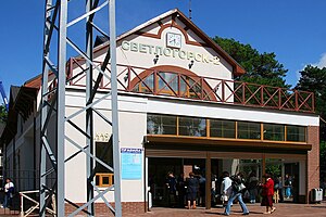
Svetlogorsk-I railway station
Distance: Approx. 808 meters
Latitude and longitude: 54.933454,20.160615
Svetlogorsk-I railway station (Russian: станция Светлогорск-1) is a railway station located in Svetlogorsk, Kaliningrad oblast, Russia. It is 41 km down-line from Kaliningrad North railway station and is situated between Pionersky kururt and Primorsk-Novy on the Kaliningrad — Baltiysk line. The station hosts suburban trains from Kaliningrad.
Svetlogorsk-II railway station
Distance: Approx. 690 meters
Latitude and longitude: 54.944107,20.146877
Svetlogorsk-II railway station (Russian: станция Светлогорск-II) is a railway station located in Svetlogorsk, Kaliningrad oblast, Russia. It is a terminal station for the Kaliningrad — Svetlogorsk railway. Electric trains ES1 Lastochka and ET2M make a passenger trips from Svetlogorsk-II. The station is located in the town center.

Water Tower, Svetlogorsk
Building in Kaliningrad Oblast, Russia
Distance: Approx. 390 meters
Latitude and longitude: 54.9434,20.1546
The Water Tower (Russian: Водононапорная башня, romanized: Vodonapornaya Bashnya) is the focal point of Svetlogorsk, Kaliningrad Oblast, Russia. The tower is one of the most prominent symbols of the city.
Weather in this IP's area
overcast clouds
19 Celsius
19 Celsius
19 Celsius
19 Celsius
1012 hPa
73 %
1012 hPa
1007 hPa
10000 meters
13.01 m/s
17.03 m/s
310 degree
100 %
04:43:40
20:47:49