Country:
 Brazil
Region:
City:
Latitude and Longitude:
Time Zone:
Postal Code:
IP information under different IP Channel
ip-api
Country
Region
City
ASN
Time Zone
ISP
Blacklist
Proxy
Latitude
Longitude
Postal
Route
IPinfo
Country
Region
City
ASN
Time Zone
ISP
Blacklist
Proxy
Latitude
Longitude
Postal
Route
MaxMind
Country
Region
City
ASN
Time Zone
ISP
Blacklist
Proxy
Latitude
Longitude
Postal
Route
Luminati
Country
BRRegion
ba
City
salvador
ASN
Time Zone
America/Bahia
ISP
BR.Digital Provider
Latitude
Longitude
Postal
db-ip
Country
Region
City
ASN
Time Zone
ISP
Blacklist
Proxy
Latitude
Longitude
Postal
Route
ipdata
Country
Region
City
ASN
Time Zone
ISP
Blacklist
Proxy
Latitude
Longitude
Postal
Route
Popular places and events near this IP address

Salvador Bahia Airport
Airport
Distance: Approx. 1662 meters
Latitude and longitude: -12.90861111,-38.3225
Salvador–Deputado Luís Eduardo Magalhães International Airport (IATA: SSA, ICAO: SBSV), formerly called Dois de Julho International Airport and known by the trade name Salvador Bahia Airport, is the airport serving Salvador, Brazil. Since 16 June 1998, by Federal Law, the airport is named after Luís Eduardo Maron Magalhães (1955–1998), an influential politician of the state of Bahia. It is operated by Vinci SA. Some of its facilities are shared with the Salvador Air Force Base of the Brazilian Air Force.
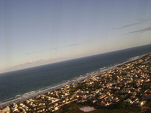
Lauro de Freitas
Municipality in Northeast, Brazil
Distance: Approx. 63 meters
Latitude and longitude: -12.89388889,-38.32694444
Lauro de Freitas is a municipality in Bahia, Brazil. It covers 57.66 km2 (22.26 sq mi) and a population of 201,635 (2020 est.). Lauro de Freitas has a population density of 3,376 inhabitants per square kilometer.
Salvador Air Force Base
Air base of the Brazilian Air Force
Distance: Approx. 1662 meters
Latitude and longitude: -12.90861111,-38.3225
Base Aérea de Salvador – BASV (IATA: SSA, ICAO: SBSV) is a base of the Brazilian Air Force, located in Salvador da Bahia, Brazil. It shares some facilities with Dep. Luís Eduardo Magalhães International Airport.
Weather in this IP's area
scattered clouds
26 Celsius
26 Celsius
26 Celsius
26 Celsius
1020 hPa
78 %
1020 hPa
1019 hPa
10000 meters
5.66 m/s
110 degree
40 %
05:54:01
17:25:21