Country:
 Brazil
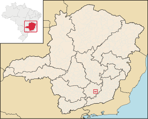
Region:
City:
Latitude and Longitude:
Time Zone:
Postal Code:
IP information under different IP Channel
ip-api
Country
Region
City
ASN
Time Zone
ISP
Blacklist
Proxy
Latitude
Longitude
Postal
Route
IPinfo
Country
Region
City
ASN
Time Zone
ISP
Blacklist
Proxy
Latitude
Longitude
Postal
Route
MaxMind
Country
Region
City
ASN
Time Zone
ISP
Blacklist
Proxy
Latitude
Longitude
Postal
Route
Luminati
Country
BRRegion
mg
City
congonhas
ASN
Time Zone
America/Sao_Paulo
ISP
AMERICAN TOWER DO BRASIL-COMUNICACAO MULTIMIDIA LT
Latitude
Longitude
Postal
db-ip
Country
Region
City
ASN
Time Zone
ISP
Blacklist
Proxy
Latitude
Longitude
Postal
Route
ipdata
Country
Region
City
ASN
Time Zone
ISP
Blacklist
Proxy
Latitude
Longitude
Postal
Route
Popular places and events near this IP address
Alfredo Vasconcelos
City in Brazilian state of Minas Gerais
Distance: Approx. 8979 meters
Latitude and longitude: -21.145,-43.77694444
Alfredo Vasconcelos is a city in the south of the Brazilian state of Minas Gerais. In 2020 its population was estimated to be 6,981 in a total area of 130.8 km2 (50.5 sq mi). It belongs to the Barbacena IBGE statistical microregion.

Barbacena
Municipality in Minas Gerais, Brazil
Distance: Approx. 1227 meters
Latitude and longitude: -21.21666667,-43.76666667
Barbacena is a municipality in the state of Minas Gerais, Brazil. As of 2020, the municipality had 138,204 inhabitants. The total area of the municipality is 788 km2 (304 sq mi).

Hospital Colônia de Barbacena
Brazilian museum set in a former psychiatric hospital
Distance: Approx. 2699 meters
Latitude and longitude: -21.20479,-43.78694
Museu da Loucura (Museum of Madness), formerly known as Hospital Colônia was a psychiatric hospital founded in 1903. The institution was located in the Brazilian city of Barbacena, Minas Gerais. From its foundation to 1980, Colônia was theater of a genocide.

Basilica of St. Joseph the Worker, Barbacena
Church in Barbacena, Brazil
Distance: Approx. 824 meters
Latitude and longitude: -21.2242,-43.7658
The Basilica of St. Joseph the Worker (or the Basilica of Barbacena; Portuguese: Basílica São José Operário) is a Catholic church located in Barbacena, Minas Gerais, Brazil. Built in 1950 and finished around 1958, its plan has the shape of a Greek cross.

Campo das Vertentes (mesoregion)
Mesoregion in Southeast, Brazil
Distance: Approx. 1227 meters
Latitude and longitude: -21.21666667,-43.76666667
Campo das Vertentes (transl. Slopes' field) is one of the twelve mesoregions of the Brazilian state of Minas Gerais. It is composed of 36 municipalities, distributed across 3 microregions.
Weather in this IP's area
clear sky
20 Celsius
20 Celsius
20 Celsius
20 Celsius
1023 hPa
50 %
1023 hPa
897 hPa
10000 meters
2.32 m/s
2.88 m/s
27 degree
06:28:09
17:34:47