Country:
 Brazil
Region:
City:
Latitude and Longitude:
Time Zone:
Postal Code:
IP information under different IP Channel
ip-api
Country
Region
City
ASN
Time Zone
ISP
Blacklist
Proxy
Latitude
Longitude
Postal
Route
IPinfo
Country
Region
City
ASN
Time Zone
ISP
Blacklist
Proxy
Latitude
Longitude
Postal
Route
MaxMind
Country
Region
City
ASN
Time Zone
ISP
Blacklist
Proxy
Latitude
Longitude
Postal
Route
Luminati
Country
BRRegion
df
City
brasilia
ASN
Time Zone
America/Sao_Paulo
ISP
BR.Digital Provider
Latitude
Longitude
Postal
db-ip
Country
Region
City
ASN
Time Zone
ISP
Blacklist
Proxy
Latitude
Longitude
Postal
Route
ipdata
Country
Region
City
ASN
Time Zone
ISP
Blacklist
Proxy
Latitude
Longitude
Postal
Route
Popular places and events near this IP address
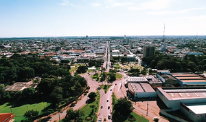
Sinop, Mato Grosso
Municipality in Central-West, Brazil
Distance: Approx. 6 meters
Latitude and longitude: -11.84805556,-55.64916667
Sinop is a city in the Brazilian state of Mato Grosso. The fourth-largest city in the state, its population in 2022 is estimated at 196,312 inhabitants, placing Sinop in 155th place in Brazil. It has an area of 3194.339 km².

Sinop Airport (Brazil)
Airport
Distance: Approx. 8007 meters
Latitude and longitude: -11.885,-55.58611111
Presidente João Figueiredo Airport (IATA: OPS, ICAO: SBSI) formerly SWSI, is the airport serving Sinop, Brazil. It is named after João Baptista de Oliveira Figueiredo, the 30th President of Brazil. It is operated by Aeroeste.
Weather in this IP's area
clear sky
36 Celsius
34 Celsius
36 Celsius
36 Celsius
1011 hPa
19 %
1011 hPa
976 hPa
10000 meters
2.15 m/s
3.38 m/s
44 degree
06:01:48
17:36:08