Country:
 Brazil
Region:
City:
Latitude and Longitude:
Time Zone:
Postal Code:
IP information under different IP Channel
ip-api
Country
Region
City
ASN
Time Zone
ISP
Blacklist
Proxy
Latitude
Longitude
Postal
Route
IPinfo
Country
Region
City
ASN
Time Zone
ISP
Blacklist
Proxy
Latitude
Longitude
Postal
Route
MaxMind
Country
Region
City
ASN
Time Zone
ISP
Blacklist
Proxy
Latitude
Longitude
Postal
Route
Luminati
Country
BRRegion
ms
City
corumba
ASN
Time Zone
America/Campo_Grande
ISP
BR.Digital Provider
Latitude
Longitude
Postal
db-ip
Country
Region
City
ASN
Time Zone
ISP
Blacklist
Proxy
Latitude
Longitude
Postal
Route
ipdata
Country
Region
City
ASN
Time Zone
ISP
Blacklist
Proxy
Latitude
Longitude
Postal
Route
Popular places and events near this IP address
Puerto Aguirre
Riverport in Bolivia
Distance: Approx. 6319 meters
Latitude and longitude: -18.985681,-57.707791
Puerto Aguirre is an important inland riverport in Bolivia near the border with Brazil. It is privately held by Central Aguirre Ltd. It is part of the municipality of Puerto Quijarro.
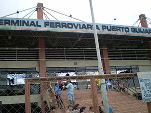
Puerto Quijarro
Bolivian city and inland river port
Distance: Approx. 6411 meters
Latitude and longitude: -19.003873,-57.713757
Puerto Quijarro is a Bolivian city and an inland river port and situated on the Tamengo Canal in Bolivia, by the border with Brazil. It is part of the province of Germán Busch in the Santa Cruz Department. The Tamengo Canal connects it to the important Paraná-Paraguay Waterway.

Corumbá International Airport
Airport in Brazil
Distance: Approx. 1951 meters
Latitude and longitude: -19.01194444,-57.67138889
Corumbá International Airport (IATA: CMG, ICAO: SBCR) is the airport serving Corumbá, Brazil.
Roman Catholic Diocese of Corumbá
Latin Catholic jurisdiction in Brazil
Distance: Approx. 1172 meters
Latitude and longitude: -18.9988,-57.6508
The Diocese of Corumbá (Latin: Dioecesis Corumbensis) is a Latin Church ecclesiastical territory or diocese of the Catholic Church located in the city of Corumbá, Brazil. It is a suffragan in the ecclesiastical province of the metropolitan Archdiocese Campo Grande.
Arroyo Concepción
Town in Bolivia
Distance: Approx. 6141 meters
Latitude and longitude: -19.0225,-57.7097
Arroyo Concepción is a town in Bolivia. In 2010 it had an estimated population of 5060.
Estádio Arthur Marinho
Distance: Approx. 1386 meters
Latitude and longitude: -19.00277778,-57.66444444
Estádio Arthur Marinho is a stadium in Corumbá, Brazil. It has a capacity of 15,000 spectators. It is the home of Pantanal Futebol Clube.

Our Lady of Candelaria Cathedral, Corumbá
Church in Corumbá, Brazil
Distance: Approx. 1166 meters
Latitude and longitude: -18.9989,-57.6506
The Our Lady of Candelaria Cathedral (Portuguese: Catedral Nossa Senhora da Candelária) Also Corumbá Cathedral Is a church located in the center of Corumbá, state of Mato Grosso do Sul, in the South American country of Brazil. It is the place where the patron saint of the city (Nossa Senhora da Candelária) is housed. A shield of the Portuguese crown is on its altar.
Weather in this IP's area
clear sky
33 Celsius
31 Celsius
33 Celsius
33 Celsius
1013 hPa
22 %
1013 hPa
996 hPa
8000 meters
3.09 m/s
50 degree
06:20:16
17:33:43