Country:
 France
Region:
City:
Latitude and Longitude:
Time Zone:
Postal Code:
IP information under different IP Channel
ip-api
Country
Region
City
ASN
Time Zone
ISP
Blacklist
Proxy
Latitude
Longitude
Postal
Route
IPinfo
Country
Region
City
ASN
Time Zone
ISP
Blacklist
Proxy
Latitude
Longitude
Postal
Route
MaxMind
Country
Region
City
ASN
Time Zone
ISP
Blacklist
Proxy
Latitude
Longitude
Postal
Route
Luminati
Country
FRASN
Time Zone
Europe/Paris
ISP
Ses Astra S.A.
Latitude
Longitude
Postal
db-ip
Country
Region
City
ASN
Time Zone
ISP
Blacklist
Proxy
Latitude
Longitude
Postal
Route
ipdata
Country
Region
City
ASN
Time Zone
ISP
Blacklist
Proxy
Latitude
Longitude
Postal
Route
Popular places and events near this IP address

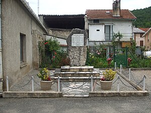
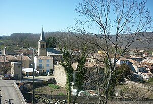
Lavelanet
Commune in Occitanie, France
Distance: Approx. 343 meters
Latitude and longitude: 42.9336,1.8494
Lavelanet (French pronunciation: [lavlanɛ]; L'Avelhanet in the Languedocian dialect of Occitan) is a commune in the Ariège department in the Occitanie region in southwestern France.
L'Aiguillon
Commune in Occitanie, France
Distance: Approx. 4531 meters
Latitude and longitude: 42.92,1.9
L'Aiguillon (French pronunciation: [lɛɡɥijɔ̃]; Occitan: L'Agulhon) is a commune in the Ariège department in the Occitanie region of southwestern France.
Bénaix
Commune in Occitanie, France
Distance: Approx. 2854 meters
Latitude and longitude: 42.9078,1.8606
Bénaix is a commune in the Ariège department of southwestern France.
Dreuilhe
Commune in Occitanie, France
Distance: Approx. 2162 meters
Latitude and longitude: 42.9478,1.8606
Dreuilhe (French pronunciation: [dʁœj]; Occitan: Drulha) is a commune in the Ariège department in southwestern France.
Esclagne
Commune in Occitanie, France
Distance: Approx. 5614 meters
Latitude and longitude: 42.9817,1.8489
Esclagne (French pronunciation: [ɛsklaɲ]; Occitan: Esclanha) is a commune in the Ariège department in southwestern France.

Laroque-d'Olmes
Commune in Occitanie, France
Distance: Approx. 4918 meters
Latitude and longitude: 42.9711,1.8728
Laroque-d'Olmes (French pronunciation: [laʁɔk dɔlm]; Occitan: La Ròca d'Òlmes) is a commune in the Ariège department in southwestern France.

Lesparrou
Commune in Occitanie, France
Distance: Approx. 4784 meters
Latitude and longitude: 42.9314,1.9053
Lesparrou (French pronunciation: [lɛspaʁu]; Occitan: L'Esparron) is a commune in the Ariège department in southwestern France.
Péreille
Commune in Occitanie, France
Distance: Approx. 3714 meters
Latitude and longitude: 42.9397,1.8025
Péreille (French pronunciation: [peʁɛj]; Occitan: Perelha) is a commune in the Ariège department in southwestern France.
Raissac
Commune in Occitanie, France
Distance: Approx. 2964 meters
Latitude and longitude: 42.9425,1.8136
Raissac (French pronunciation: [ʁɛsak]) is a commune in the Ariège department in southwestern France.
Saint-Jean-d'Aigues-Vives
Commune in Occitanie, France
Distance: Approx. 2021 meters
Latitude and longitude: 42.9253,1.87
Saint-Jean-d'Aigues-Vives (French pronunciation: [sɛ̃ ʒɑ̃ dɛɡ viv]; Languedocien: Sant Joan d'Aigasvivas) is a commune in the Ariège department in southwestern France.
Villeneuve-d'Olmes
Commune in Occitanie, France
Distance: Approx. 3298 meters
Latitude and longitude: 42.9083,1.8211
Villeneuve-d'Olmes (French pronunciation: [vilnœv dɔlm]; Occitan: Vilanòva d'Òlmes) is a commune in the Ariège department in southwestern France.

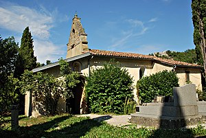
Canton of Pays d'Olmes
Canton in Occitania, France
Distance: Approx. 313 meters
Latitude and longitude: 42.93,1.85
The canton of Pays d'Olmes is an administrative division of the Ariège department, southern France. It was created at the French canton reorganisation which came into effect in March 2015. Its seat is in Lavelanet.
Weather in this IP's area
few clouds
31 Celsius
33 Celsius
28 Celsius
31 Celsius
1013 hPa
55 %
1013 hPa
953 hPa
10000 meters
0.89 m/s
3.58 m/s
22 degree
21 %
06:38:41
21:19:19