Country:
 USA
USARegion:
City:
Latitude and Longitude:
Time Zone:
Postal Code:
IP information under different IP Channel
ip-api
Country
Region
City
ASN
Time Zone
ISP
Blacklist
Proxy
Latitude
Longitude
Postal
Route
IPinfo
Country
Region
City
ASN
Time Zone
ISP
Blacklist
Proxy
Latitude
Longitude
Postal
Route
MaxMind
Country
Region
City
ASN
Time Zone
ISP
Blacklist
Proxy
Latitude
Longitude
Postal
Route
Luminati
Country
USASN
Time Zone
America/Chicago
ISP
UNITAS
Latitude
Longitude
Postal
db-ip
Country
Region
City
ASN
Time Zone
ISP
Blacklist
Proxy
Latitude
Longitude
Postal
Route
ipdata
Country
Region
City
ASN
Time Zone
ISP
Blacklist
Proxy
Latitude
Longitude
Postal
Route
Popular places and events near this IP address

Eastern State Penitentiary
Historic American prison
Distance: Approx. 70 meters
Latitude and longitude: 39.96833333,-75.1725
The Eastern State Penitentiary (ESP) is a former American prison in Philadelphia, Pennsylvania. It is located in the Fairmount section of the city, and was operational from 1829 until 1971. The penitentiary refined the revolutionary system of separate incarceration, first pioneered at the Walnut Street Jail, which emphasized principles of reform rather than punishment.

Francisville, Philadelphia
Neighborhood of Philadelphia in Pennsylvania, United States
Distance: Approx. 353 meters
Latitude and longitude: 39.97,-75.17
Francisville is a neighborhood in North Philadelphia, a section of the city of Philadelphia, Pennsylvania, United States. Its boundaries are Fairmount Avenue to the south, Girard Avenue to the north, Broad Street to the east, and Corinthian Avenue to the west. In 2000, it had a population of about 4,500.
Philadelphia Freedom Concert
2005 fundraiser
Distance: Approx. 598 meters
Latitude and longitude: 39.965,-75.179
The Philadelphia Freedom Concert and Ball was an HIV/AIDS awareness fund raising event that was held in Philadelphia, United States, on July 4, 2005.
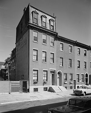
Thomas Eakins House
Historic house in Pennsylvania, United States
Distance: Approx. 565 meters
Latitude and longitude: 39.96555556,-75.16722222
The Thomas Eakins House is a historic house at 1727-29 Mount Vernon Street in the Spring Garden section of Philadelphia, Pennsylvania, US. Built about 1854, it was for most of his life the home of Thomas Eakins (1844-1916), one of the most influential American artist of the late 19th century. It was designated a National Historic Landmark in 1965, and is now home to a local artist cooperative.

Spring Garden, Philadelphia
Historic neighborhood in Pennsylvania, United States
Distance: Approx. 350 meters
Latitude and longitude: 39.96611111,-75.16972222
Spring Garden is a neighborhood in central Philadelphia, Pennsylvania, bordering Center City on the north. Spring Garden is a neighborhood that combines diverse residential neighborhoods and significant cultural attractions. The residential areas on the north side of the neighborhood, located north of Spring Garden Street.

Philadelphia Mennonite High School
Private school in Philadelphia, Pennsylvania, United States
Distance: Approx. 499 meters
Latitude and longitude: 39.9716,-75.1764
Philadelphia Mennonite High School was a private Mennonite high school in the Fairmount neighborhood of Philadelphia, Pennsylvania. It ran from 1997 to 2014. The school merged with The City School - another Mennonite school - in 2014.

Perelman Building
United States historic place
Distance: Approx. 538 meters
Latitude and longitude: 39.967594,-75.179395
The Ruth and Raymond G. Perelman Building—originally the Fidelity Mutual Life Insurance Company Building—is an annex of the Philadelphia Museum of Art containing exhibition galleries, offices, conservation labs, and the museum library. It is an Art Deco building that features cathedral-like entrances and is adorned with sculpture and gilding. The building is listed on the National Register of Historic Places.
Iroquois (di Suvero)
Distance: Approx. 515 meters
Latitude and longitude: 39.965,-75.1778
Iroquois is a sculpture by American artist Mark di Suvero, owned by the Association for Public Art. The artwork is located at the Benjamin Franklin Parkway, at Eakins Oval and 24th Street, Philadelphia, United States. Iroquois is one of the many sculptures included in the Association's for Public Art's Museum Without Walls: AUDIO™ interpretive audio program for Philadelphia's outdoor sculpture.

Bache-Martin Elementary School
United States historic place
Distance: Approx. 228 meters
Latitude and longitude: 39.9699,-75.1737
The Bache-Martin Elementary School is a pre-kindergarten to eighth grade school which is located in the Fairmount neighborhood of Philadelphia, Pennsylvania. It is part of the School District of Philadelphia. The school campus comprises two distinct buildings along 22nd Street, both of which were listed on the National Register of Historic Places in 1986.

Mulford Building
United States historic place
Distance: Approx. 240 meters
Latitude and longitude: 39.96583333,-75.17388889
The Mulford Building is an historic, American, light manufacturing, loft building that is located in the Spring Garden neighborhood of Philadelphia, Pennsylvania. It was added to the National Register of Historic Places in 2004.
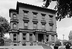
Bergdoll Mansion
Historic house in Pennsylvania, United States
Distance: Approx. 295 meters
Latitude and longitude: 39.96555556,-75.17472222
The Bergdoll Mansion is a historic house located in the Spring Garden neighborhood of Philadelphia. It was designed by architect James H. Windrim and built in 1886. It is in a Beaux Arts / Italianate style.
2022 Philadelphia apartment fire
Fatal blaze in Pennsylvania
Distance: Approx. 412 meters
Latitude and longitude: 39.97147222,-75.17436111
On the morning of January 5, 2022, a fire tore through a row house converted into apartments in the Fairmount neighborhood of Philadelphia, Pennsylvania. Twelve people died, nine of them children, and two others were injured. Five additional people escaped from the first floor unit with minor injuries.
Weather in this IP's area
broken clouds
30 Celsius
30 Celsius
28 Celsius
31 Celsius
1016 hPa
43 %
1016 hPa
1013 hPa
10000 meters
2.57 m/s
190 degree
75 %
05:55:50
20:18:18