Country:
 USA
USARegion:
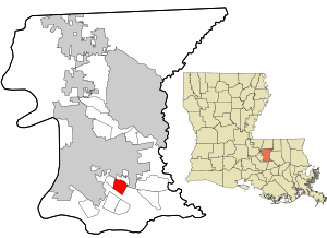
City:
Latitude and Longitude:
Time Zone:
Postal Code:
IP information under different IP Channel
ip-api
Country
Region
City
ASN
Time Zone
ISP
Blacklist
Proxy
Latitude
Longitude
Postal
Route
IPinfo
Country
Region
City
ASN
Time Zone
ISP
Blacklist
Proxy
Latitude
Longitude
Postal
Route
MaxMind
Country
Region
City
ASN
Time Zone
ISP
Blacklist
Proxy
Latitude
Longitude
Postal
Route
Luminati
Country
USRegion
al
City
mobile
ASN
Time Zone
America/Chicago
ISP
UNITI-FIBER
Latitude
Longitude
Postal
db-ip
Country
Region
City
ASN
Time Zone
ISP
Blacklist
Proxy
Latitude
Longitude
Postal
Route
ipdata
Country
Region
City
ASN
Time Zone
ISP
Blacklist
Proxy
Latitude
Longitude
Postal
Route
Popular places and events near this IP address
Inniswold, Louisiana
Census-designated place in Louisiana, United States
Distance: Approx. 1439 meters
Latitude and longitude: 30.40055556,-91.07166667
Inniswold is an unincorporated area and census-designated place (CDP) in East Baton Rouge Parish, Louisiana, United States. The population was 6,180 at the 2010 census, up from 4,944 in 2000. In 2020, its population was 5,987.
Westminster, Louisiana
Census-designated place in Louisiana, United States
Distance: Approx. 509 meters
Latitude and longitude: 30.40944444,-91.08861111
Westminster is a census-designated place (CDP) in East Baton Rouge Parish, Louisiana, United States. The population was 3,008 at the 2010 census, up from 2,515 in 2000. It is part of the Baton Rouge Metropolitan Statistical Area.
WJFM
SonLife Radio Network flagship station in Baton Rouge, Louisiana, United States
Distance: Approx. 2696 meters
Latitude and longitude: 30.385,-91.08972222
WJFM (88.5 FM) is a radio station broadcasting a Christian radio format. Licensed to Baton Rouge, Louisiana, United States, the station is currently owned by Jimmy Swaggart Ministries. The listener-supported station is run by SonLife Radio, a ministry of Jimmy Swaggart Ministries.
Franciscan Missionaries of Our Lady University
Private Catholic university in Baton Rouge, Louisiana
Distance: Approx. 2769 meters
Latitude and longitude: 30.4001,-91.1105
Franciscan Missionaries of Our Lady University, formerly Our Lady of the Lake College, is a private Catholic university in Baton Rouge, Louisiana. It was founded in 1923 and is sponsored by the Franciscan Missionaries of Our Lady, North American Province. The university has an enrollment of approximately 1700 students.

Mall of Louisiana
Shopping mall in Baton Rouge, Louisiana
Distance: Approx. 2193 meters
Latitude and longitude: 30.3893,-91.088
The Mall of Louisiana is a mid-scale shopping mall in Baton Rouge, Louisiana, between I-10 and Bluebonnet Blvd. It is the largest mall in Louisiana and contains the third largest indoor carousel in the world. It is the only regional mall in Baton Rouge.
Louisiana Culinary Institute
Distance: Approx. 1670 meters
Latitude and longitude: 30.41027778,-91.06611111
The Louisiana Culinary Institute is a for-profit junior culinary college in Baton Rouge, Louisiana. It offers Associate degrees in Culinary Arts and Hospitality and Culinary Management. In 2013, The Cooking Channel hosted a series of "The Freshman Class" program, at the institute, which followed four freshman through their studies.
Louisiana State Archive and Research Library
Distance: Approx. 1488 meters
Latitude and longitude: 30.414461,-91.097331
The Louisiana State Archives, established 1956, is the agency under the Secretary of State of Louisiana "designated to fulfill the function of directing a program of collecting, preserving, and making available for use the state's historical records" Located in Baton Rouge, Louisiana, the archives house records from the Spanish, French, and early American past of the state, including vital records, immigration, military, and legislative documents ranging back into the 18th century. The five-panel facade on the building, sculpted by Baton Rouge artist Al Lavergne, offers a panoramic "study in stone" of Louisiana's unique history both as a colony and as a state.
Baton Rouge General Medical Center – Bluebonnet Campus
Hospital in Louisiana, United States
Distance: Approx. 1997 meters
Latitude and longitude: 30.39362,-91.09485
Baton Rouge General Medical Center – Bluebonnet Campus is a 201-bed, private hospital located at 8585 Picardy Avenue in Baton Rouge, Louisiana. The hospital offers various medical services and surgical procedures in addition to an Emergency Department. The hospital is a subsidiary of General Health System (GHS), the corporate parent of Baton Rouge General that handles some administrative functions for the hospital.
Our Lady of the Lake Regional Medical Center
Hospital in Louisiana, United States
Distance: Approx. 2321 meters
Latitude and longitude: 30.40388889,-91.10694444
Our Lady of the Lake Regional Medical Center (OLOLRMC) is a general medical and surgical facility located in Baton Rouge, Louisiana. It is a Catholic hospital member of the Franciscan Missionaries of Our Lady Health System (FMOLHS). The hospital is accredited by the Joint Commission, and it serves as a teaching hospital to Our Lady of the Lake College, Louisiana State University, Tulane University, and Southern University.
Mary Bird Perkins Cancer Center
Hospital in Louisiana, United States
Distance: Approx. 2134 meters
Latitude and longitude: 30.404,-91.104979
Mary Bird Perkins Cancer Center is a cancer care organization based in Baton Rouge with satellite locations in Louisiana and Mississippi.
2016 shooting of Baton Rouge police officers
Mass shooting in Baton Rouge, Louisiana
Distance: Approx. 2810 meters
Latitude and longitude: 30.4338,-91.0817
On July 17, 2016, Gavin Eugene Long shot six police officers in Baton Rouge, Louisiana in an ambush attack, in the wake of the shooting of Alton Sterling. Four died, including one who was critically wounded and died from complications in 2022, and two others were hospitalized; of the officers who initially died, two were members of the Baton Rouge Police Department, while the third worked for the East Baton Rouge Parish Sheriff's Office. Long, who associated himself with organizations linked to black separatism and the sovereign citizen movement, was shot and killed by a SWAT officer during a shootout with police at the scene.
Aubin, Louisiana
Unincorporated community in Louisiana
Distance: Approx. 2296 meters
Latitude and longitude: 30.41944444,-91.06305556
Aubin is an unincorporated community in East Baton Rouge Parish, Louisiana, United States. The community is located 4 miles (6.4 kilometres) to the southeast of Baton Rouge and less than 2 miles (3.2 kilometres) northeast of Westminster and 7 miles (11 kilometres) east of the Mississippi River.
Weather in this IP's area
few clouds
34 Celsius
41 Celsius
33 Celsius
34 Celsius
1017 hPa
64 %
1017 hPa
1016 hPa
10000 meters
4.12 m/s
210 degree
20 %
06:20:23
20:01:02