Country:
 USA
USARegion:
City:
Latitude and Longitude:
Time Zone:
Postal Code:
IP information under different IP Channel
ip-api
Country
Region
City
ASN
Time Zone
ISP
Blacklist
Proxy
Latitude
Longitude
Postal
Route
IPinfo
Country
Region
City
ASN
Time Zone
ISP
Blacklist
Proxy
Latitude
Longitude
Postal
Route
MaxMind
Country
Region
City
ASN
Time Zone
ISP
Blacklist
Proxy
Latitude
Longitude
Postal
Route
Luminati
Country
USRegion
al
City
orangebeach
ASN
Time Zone
America/Chicago
ISP
UNITI-FIBER
Latitude
Longitude
Postal
db-ip
Country
Region
City
ASN
Time Zone
ISP
Blacklist
Proxy
Latitude
Longitude
Postal
Route
ipdata
Country
Region
City
ASN
Time Zone
ISP
Blacklist
Proxy
Latitude
Longitude
Postal
Route
Popular places and events near this IP address

Fairhope, Alabama
City in Alabama, United States
Distance: Approx. 814 meters
Latitude and longitude: 30.52638889,-87.89555556
Fairhope is a city in Baldwin County, Alabama, United States, located on the eastern shoreline of Mobile Bay. The population was 22,477 at the 2020 census. Fairhope is a principal city of the Daphne-Fairhope-Foley metropolitan area, which includes all of Baldwin County.

Point Clear, Alabama
Census-designated place & Unincorporated community in Alabama, United States
Distance: Approx. 3026 meters
Latitude and longitude: 30.496807,-87.909858
Point Clear is an unincorporated census-designated place (CDP) in Baldwin County, Alabama, United States. As of the 2010 census, the population was 2,125. It is part of the Daphne-Fairhope-Foley metropolitan area.
Eastern Shore (Alabama)
Distance: Approx. 2150 meters
Latitude and longitude: 30.54222222,-87.90833333
Eastern Shore is the geographic eastern shoreline of Mobile Bay in southwest Alabama. It extends from just north of Interstate 10 to the southeastern end of the bay near Weeks Bay. Since there is no official boundary set for the "Eastern Shore" its usage is subject to change.
Fairhope High School
Public school in Fairhope, Alabama, United States
Distance: Approx. 3405 meters
Latitude and longitude: 30.49792,-87.88366
Fairhope High School (FHS) is a public secondary school located in Fairhope, Alabama. Fairhope High School is a part of the Baldwin County Public Schools system. They service grades 9–12.

United States Post Office (Fairhope, Alabama)
United States historic place
Distance: Approx. 92 meters
Latitude and longitude: 30.52305556,-87.90416667
The United States Post Office in Fairhope, Alabama, is a historic United States Post Office building built in 1932, in the Italian Renaissance Revival architectural style. It currently houses the offices of the Fairhope Courier. The building was listed on the National Register of Historic Places in 1988.
Central Baldwin
Area in Baldwin County, Alabama
Distance: Approx. 2150 meters
Latitude and longitude: 30.54222222,-87.90833333
Central Baldwin is a colloquial term referring to an area of Baldwin County, Alabama along Alabama State Highway 59. The area begins at the Interstate 10 exit in Loxley, Alabama including Robertsdale, Alabama and ending with Summerdale, Alabama. The unofficial boundary is generally considered to be the public school district served by Robertsdale High School.

Lebanon Chapel AME Church
Historic church in Alabama, United States
Distance: Approx. 1422 meters
Latitude and longitude: 30.51333333,-87.89416667
Lebanon Chapel AME Church is a historic African Methodist Episcopal church bounded by Young Street on the West and Middle Street on the North in Fairhope, Alabama. It was built in 1923 and added to the National Register of Historic Places in 1988.

Twin Beach AME Church
Historic church in Alabama, United States
Distance: Approx. 2550 meters
Latitude and longitude: 30.50111111,-87.90944444
Twin Beech AME Zion Church, listed as Twin Beach AME Church, is a historic African Methodist Episcopal church on the east side of CR 44 in Fairhope, Alabama. It was built in 1925 and added to the National Register of Historic Places in 1988.
Seacliff, Alabama
Unincorporated community in Alabama, United States
Distance: Approx. 2436 meters
Latitude and longitude: 30.54527778,-87.90277778
Seacliff is an unincorporated community in Baldwin County, Alabama, United States.

Bank of Fairhope
United States historic place
Distance: Approx. 69 meters
Latitude and longitude: 30.52277778,-87.90333333
The Bank of Fairhope, at 396 Fairhope Ave. in Fairhope, Alabama, was built in 1927. It was listed on the National Register of Historic Places in 1988.
American Legion Post 199
US Legion post in Alabama
Distance: Approx. 1838 meters
Latitude and longitude: 30.5133,-87.91846
The American Legion Post 199 in Fairhope, Alabama is situated on a bluff overlooking Mobile Bay. It was listed on the National Register of Historic Places in 2018. It has also been known as Pine Needles and as the Mobile Business Women's Club.

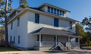
Beckner House
United States historic place
Distance: Approx. 317 meters
Latitude and longitude: 30.52083333,-87.90472222
The Beckner House (also known as the Baker House) is a historic residence in Fairhope, Alabama. The house was built in 1906 for J. M. Beckner, a single-taxer from Illinois. The house sustained minor damage in the 1906 hurricane.
Weather in this IP's area
broken clouds
26 Celsius
27 Celsius
24 Celsius
28 Celsius
1017 hPa
94 %
1017 hPa
1013 hPa
10000 meters
75 %
06:07:26
19:48:32