Country:
 Turkey
Region:
City:
Latitude and Longitude:
Time Zone:
Postal Code:
IP information under different IP Channel
ip-api
Country
Region
City
ASN
Time Zone
ISP
Blacklist
Proxy
Latitude
Longitude
Postal
Route
IPinfo
Country
Region
City
ASN
Time Zone
ISP
Blacklist
Proxy
Latitude
Longitude
Postal
Route
MaxMind
Country
Region
City
ASN
Time Zone
ISP
Blacklist
Proxy
Latitude
Longitude
Postal
Route
Luminati
Country
TRRegion
34
City
esenler
ASN
Time Zone
Europe/Istanbul
ISP
TurkNet Iletisim Hizmetleri A.S.
Latitude
Longitude
Postal
db-ip
Country
Region
City
ASN
Time Zone
ISP
Blacklist
Proxy
Latitude
Longitude
Postal
Route
ipdata
Country
Region
City
ASN
Time Zone
ISP
Blacklist
Proxy
Latitude
Longitude
Postal
Route
Popular places and events near this IP address
Cyzicus
Ancient town in Erdek, Balıkesir Province, Turkey
Distance: Approx. 6656 meters
Latitude and longitude: 40.387751,27.870445
Cyzicus (; Ancient Greek: Κύζικος Kúzikos; Ottoman Turkish: آیدینجق, Aydıncıḳ) was an ancient Greek town in Mysia in Anatolia in the current Balıkesir Province of Turkey. It was located on the shoreward side of the present Kapıdağ Peninsula (the classical Arctonnesus), a tombolo which is said to have originally been an island in the Sea of Marmara only to be connected to the mainland in historic times either by artificial means or an earthquake. The site of Cyzicus, located on the Erdek and Bandırma roads, is protected by Turkey's Ministry of Culture.
Battle of Cyzicus
Land and sea battle between Athens and Sparta in 410 BC
Distance: Approx. 8468 meters
Latitude and longitude: 40.38,27.89
The Battle of Cyzicus (Greek: Kyzikos) took place in May or June 410 BC during the Peloponnesian War. During the battle, an Athenian fleet commanded by Alcibiades, Thrasybulus, and Theramenes routed and destroyed a Spartan fleet commanded by Mindarus. The victory allowed Athens to recover control over a number of cities in the Hellespont over the next year.

Battle of Cyzicus (193)
Battle between Septimius Severus and Pescennius Niger (193)
Distance: Approx. 8468 meters
Latitude and longitude: 40.38,27.89
The Battle of Cyzicus was fought in 193 between the forces of Septimius Severus and his rival for the empire, Pescennius Niger, who was defeated. The battle took place in the context of the Year of the Five Emperors, a tumultuous period in the Roman Empire when Emperor Pertinax was assassinated by the Praetorian Guards. The Praetorian Guards then held an auction for the throne, which was won by Didius Julianus, who became emperor.
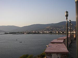
Erdek
District and municipality in Balıkesir, Turkey
Distance: Approx. 116 meters
Latitude and longitude: 40.39861111,27.79305556
Erdek (formerly known as Artàke, Greek: Αρτάκη) is a municipality and district of Balıkesir Province, Turkey. Its area is 307 km2, and its population is 31,902 (2022). Located on the Kapıdağ Peninsula, on the north coast of the Gulf of Erdek at the south of the Sea of Marmara, Erdek is a popular domestic holiday destination with several hotels dating back to the 1960s.
Erdek Naval Base
Distance: Approx. 1307 meters
Latitude and longitude: 40.39088,27.80382
Erdek Naval Base (Turkish: Erdek Deniz Üssü) is a base of the Turkish Navy on the south coast of the Sea of Marmara 1.2 km (0.75 mi) south-east of Erdek in Balıkesir Province. It is the principal base for mine warfare vessels.

Kapıdağ Peninsula
Tombolo in Balıkesir Province, northwestern Turkey
Distance: Approx. 8294 meters
Latitude and longitude: 40.45949,27.85172
Kapıdağ Peninsula (Turkish: Kapıdağ Yarımadası) (Greek: Χερσόνησος της Κυζίκου) is a tied island in northwestern Anatolia extending into the Sea of Marmara in Balıkesir Province, Turkey. The peninsula forms the Gulf of Bandırma on its east and the Gulf of Erdek on its west. Kapıdağ was the classical island of ancient Greek Arctonnesus, but was joined to the mainland by a narrow isthmus in historic times either by an earthquake or (according to legend) by Alexander the Great.
Battle of the Cyzicus
Distance: Approx. 8354 meters
Latitude and longitude: 40.38,27.88861111
The Battle of the Cyzicus (Catalan: Batalla del riu Cízic) was fought in October 1303 between the Catalan Company of the East under Roger de Flor, acting as mercenaries on behalf of the Byzantine Empire, and the Oghuz Turks (likely Karasids). It was the first of several engagements between the two sides during the Catalan Company's Anatolian Campaign against the Turks. The result was a crushing Catalan victory.
Artace (Mysia)
Ancient city on the Propontis, Turkey
Distance: Approx. 441 meters
Latitude and longitude: 40.402952,27.796268
Artace or Artake (Ancient Greek: Ἀρτάκη) was a town of ancient Mysia, near Cyzicus. It was a Milesian colony. It was a seaport, and on the same peninsula on which Cyzicus stood, and about 40 stadia from it.
Weather in this IP's area
clear sky
21 Celsius
21 Celsius
21 Celsius
21 Celsius
1018 hPa
83 %
1018 hPa
1016 hPa
10000 meters
0.51 m/s
06:02:36
20:27:48