Country:
 Turkey
Region:
City:
Latitude and Longitude:
Time Zone:
Postal Code:
IP information under different IP Channel
ip-api
Country
Region
City
ASN
Time Zone
ISP
Blacklist
Proxy
Latitude
Longitude
Postal
Route
IPinfo
Country
Region
City
ASN
Time Zone
ISP
Blacklist
Proxy
Latitude
Longitude
Postal
Route
MaxMind
Country
Region
City
ASN
Time Zone
ISP
Blacklist
Proxy
Latitude
Longitude
Postal
Route
Luminati
Country
TRRegion
42
City
konya
ASN
Time Zone
Europe/Istanbul
ISP
TurkNet Iletisim Hizmetleri A.S.
Latitude
Longitude
Postal
db-ip
Country
Region
City
ASN
Time Zone
ISP
Blacklist
Proxy
Latitude
Longitude
Postal
Route
ipdata
Country
Region
City
ASN
Time Zone
ISP
Blacklist
Proxy
Latitude
Longitude
Postal
Route
Popular places and events near this IP address

Siirt
Provincial capital in Turkey
Distance: Approx. 976 meters
Latitude and longitude: 37.925,41.94583333
Siirt (Arabic: سِعِرْد, romanized: Siʿird; Armenian: Սղերդ, romanized: S'gherd; Syriac: ܣܥܪܬ, romanized: Siirt; Kurdish: Sêrt) is a city in the Siirt District of Siirt Province in Turkey. It had a population of 160,340 in 2021.

Tillo
Municipality in Siirt Province, Turkey
Distance: Approx. 6725 meters
Latitude and longitude: 37.95083333,42.01333333
Tillo or Aydınlar (Arabic: تل) is a town in the Tillo District of Siirt Province in Turkey. Its population is 2,022 (2022). The town is inhabited by Arabs and Kurds.
Siirt Atatürk Stadium
Distance: Approx. 481 meters
Latitude and longitude: 37.92888889,41.9375
Siirt Atatürk Stadium is a multi-purpose stadium in Siirt, Turkey. It is currently used mostly for football matches and is the home ground of Siirtspor. The stadium was built in 1969 and currently holds 7000 people.
Akyamaç, Siirt
Village in Siirt Province, Turkey
Distance: Approx. 6623 meters
Latitude and longitude: 37.992,41.936
Akyamaç is a village in the Siirt District of Siirt Province in Turkey. The village is populated by Arabs and had a population of 156 in 2022.
Doluharman, Siirt
Village in Siirt Province, Turkey
Distance: Approx. 6315 meters
Latitude and longitude: 37.986,41.916
Doluharman or Fiskin is a village in the Siirt District of Siirt Province in Turkey. The village is populated by Arabs and had a population of 898 in 2021.
Kayaboğaz, Siirt
Village in Siirt Province, Turkey
Distance: Approx. 6015 meters
Latitude and longitude: 37.891,41.984
Kayaboğaz (Kurdish: Xêrtê) is a village in the Siirt District of Siirt Province in Turkey. The village is populated by Kurds of the Botikan tribe and had a population of 62 in 2021. The hamlet of Tapınak is attached to the village.
Gökçebağ, Siirt
Village in Siirt Province, Turkey
Distance: Approx. 6462 meters
Latitude and longitude: 37.903,41.877
Gökçebağ (Kurdish: Ciwanika) is a belde in the Siirt District of Siirt Province in Turkey. It is populated by Kurds and had a population of 1,741 in 2021. Its neighborhoods are Bağlar, Koçpınar and Yenimahalle.
Yerlibahçe, Siirt
Village in Siirt Province, Turkey
Distance: Approx. 6758 meters
Latitude and longitude: 37.875,41.916
Yerlibahçe (Kurdish: Kutmis, Syriac: Kitmis, Qetmos) is a village in the Siirt District of Siirt Province in Turkey. The village had a population of 99 in 2021.
Yağmurtepe, Siirt
Village in Siirt Province, Turkey
Distance: Approx. 5784 meters
Latitude and longitude: 37.947,41.877
Yağmurtepe (Armenian: Khoshenan; Kurdish: Xuşena) is a village in the Siirt District of Siirt Province in Turkey. The village had a population of 277 in 2021. It was populated by Armenians until the Armenian genocide.
Hatrant, Tillo
Village in Siirt Province, Turkey
Distance: Approx. 5965 meters
Latitude and longitude: 37.914,42.004
Hatrant, formerly Çınarlısu, is a village in the Tillo District of Siirt Province in Turkey. The village is populated by Kurds of the Keşkoliyan tribe and had a population of 306 in 2022. The hamlets of Çavuşlu and Erenler are attached to Akyayla.
İkizbağlar, Tillo
Village in Siirt Province, Turkey
Distance: Approx. 5909 meters
Latitude and longitude: 37.979,41.973
İkizbağlar or Tom is a village in the Tillo District of Siirt Province in Turkey. The village is populated by Arabs and had a population of 490 in 2022.
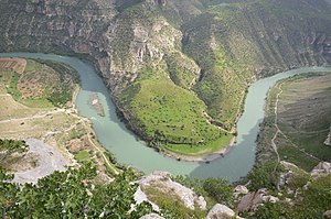
Botan Valley National Park
Largest and the most biodiverse national park in Turkey
Distance: Approx. 3295 meters
Latitude and longitude: 37.91138889,41.96647222
The Botan Valley National Park (Turkish: Botan Vadisi Milli Parkı), is a historical area with the status of a national park within the borders of Siirt province of Turkey. According to the decision published in the Resmî Gazete on August 15, 2019, it was declared a national park.
Weather in this IP's area
clear sky
35 Celsius
33 Celsius
35 Celsius
35 Celsius
1000 hPa
17 %
1000 hPa
906 hPa
10000 meters
3.66 m/s
4.37 m/s
184 degree
05:11:12
19:26:02