Country:
 Turkey
Region:
City:
Latitude and Longitude:
Time Zone:
Postal Code:
IP information under different IP Channel
ip-api
Country
Region
City
ASN
Time Zone
ISP
Blacklist
Proxy
Latitude
Longitude
Postal
Route
IPinfo
Country
Region
City
ASN
Time Zone
ISP
Blacklist
Proxy
Latitude
Longitude
Postal
Route
MaxMind
Country
Region
City
ASN
Time Zone
ISP
Blacklist
Proxy
Latitude
Longitude
Postal
Route
Luminati
Country
TRRegion
34
City
istanbul
ASN
Time Zone
Europe/Istanbul
ISP
TurkNet Iletisim Hizmetleri A.S.
Latitude
Longitude
Postal
db-ip
Country
Region
City
ASN
Time Zone
ISP
Blacklist
Proxy
Latitude
Longitude
Postal
Route
ipdata
Country
Region
City
ASN
Time Zone
ISP
Blacklist
Proxy
Latitude
Longitude
Postal
Route
Popular places and events near this IP address

Osmaniye
Municipality in Turkey
Distance: Approx. 215 meters
Latitude and longitude: 37.075,36.25
Osmaniye (pronounced [osˈmaːnije]) is a city on the eastern edge of the Çukurova plain in southern Turkey. It is the seat of Osmaniye Province and Osmaniye District. Its population is 252,186 (2022).
Toprakkale, Osmaniye
Municipality in Osmaniye, Turkey
Distance: Approx. 9044 meters
Latitude and longitude: 37.06694444,36.14638889
Toprakkale is a town in Osmaniye Province in the Mediterranean region of Turkey. It is the seat of Toprakkale District. Its population is 11,411 (2022).
Cevdetiye
Municipality in Osmaniye, Turkey
Distance: Approx. 7832 meters
Latitude and longitude: 37.13333333,36.2
Cevdetiye is a town (belde) in the Osmaniye District, Osmaniye Province, Turkey. Its population is 6,239 (2022). It is 8 kilometres (5.0 mi) north of Osmaniye, on the road connecting Osmaniye to Kadirli at the east end of the Çukurova (Cilicia) plains.
Osmaniye City Museum
Museum on Turkey
Distance: Approx. 148 meters
Latitude and longitude: 37.07305556,36.24694444
Osmaniye City Museum (Turkish: Osmaniye Kent Müzesi) is a museum in Osmaniye, Turkey. It is in Osmaniye at 37°04′23″N 36°14′49″E on Karaoğlan Street. Two lion sculptures at the entrance, represent the Hittite dominance in the antiquity.
Toprakkale District
District of Osmaniye Province, Turkey
Distance: Approx. 8727 meters
Latitude and longitude: 37.06666667,36.15
Toprakkale District is a district of the Osmaniye Province of Turkey. Its seat is the town of Toprakkale. Its area is 112 km2, and its population is 20,674 (2022).

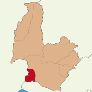
Osmaniye District
District of Osmaniye Province, Turkey
Distance: Approx. 1035 meters
Latitude and longitude: 37.08333333,36.25
Osmaniye District (also: Merkez, meaning "central" in Turkish) is a district of the Osmaniye Province of Turkey. Its seat is the city of Osmaniye. Its area is 859 km2, and its population is 285,430 (2022).
Weather in this IP's area
clear sky
37 Celsius
36 Celsius
37 Celsius
37 Celsius
1007 hPa
24 %
1007 hPa
993 hPa
10000 meters
4.31 m/s
4.86 m/s
316 degree
05:36:50
19:45:56