Country:
 USA
USARegion:
City:
Latitude and Longitude:
Time Zone:
Postal Code:
IP information under different IP Channel
ip-api
Country
Region
City
ASN
Time Zone
ISP
Blacklist
Proxy
Latitude
Longitude
Postal
Route
IPinfo
Country
Region
City
ASN
Time Zone
ISP
Blacklist
Proxy
Latitude
Longitude
Postal
Route
MaxMind
Country
Region
City
ASN
Time Zone
ISP
Blacklist
Proxy
Latitude
Longitude
Postal
Route
Luminati
Country
USASN
Time Zone
America/Chicago
ISP
EDGECAST
Latitude
Longitude
Postal
db-ip
Country
Region
City
ASN
Time Zone
ISP
Blacklist
Proxy
Latitude
Longitude
Postal
Route
ipdata
Country
Region
City
ASN
Time Zone
ISP
Blacklist
Proxy
Latitude
Longitude
Postal
Route
Popular places and events near this IP address

Information Sciences Institute
University of Southern California research institute
Distance: Approx. 1273 meters
Latitude and longitude: 33.9802,-118.440031
The USC Information Sciences Institute (ISI) is a component of the University of Southern California (USC) Viterbi School of Engineering, and specializes in research and development in information processing, computing, and communications technologies. It is located in Marina del Rey, California. ISI actively participated in the information revolution, and it played a leading role in developing and managing the early Internet and its predecessor ARPAnet.
Loyola Marymount University
Jesuit university in Los Angeles, California
Distance: Approx. 1159 meters
Latitude and longitude: 33.97,-118.418
Loyola Marymount University (LMU) is a private Jesuit and Marymount research university in Los Angeles, California. It is located on the west side of the city near Playa Vista. LMU is the parent school to Loyola Law School.

Hughes Airport (California)
US private airport operating 1940–1985
Distance: Approx. 1270 meters
Latitude and longitude: 33.975,-118.417
The Hughes Airport (IATA: CVR) was a private airport owned by Howard Hughes for the Hughes Aircraft Company. It was located just north of the Westchester bluffs and district of Los Angeles, California, from 1940 until its closure in 1985. It was directly south of and along Jefferson Boulevard and Ballona Creek, the location of the present-day neighborhood of Playa Vista.
Gersten Pavilion
Sports arena at Loyola Marymount University
Distance: Approx. 1454 meters
Latitude and longitude: 33.9675,-118.41555556
The Gersten Pavilion is a 3,900-seat multi-purpose arena in Los Angeles, California. It is the home of the Loyola Marymount University Lions. It was built in 1981 and has been used for home games by the university's men's basketball, women's basketball, and volleyball teams since January 1982.
Westside Neighborhood School
School in Los Angeles, California, United States
Distance: Approx. 945 meters
Latitude and longitude: 33.9775,-118.4224
Westside Neighborhood School is a private independent school in Los Angeles, California. Founded in 1980, the school operates preschool, elementary school, and middle school grades (K-8). WNS is notable for a program of "Family Groups," collections of students from all grades who meet several times a year during school hours to work as a team on projects such as dramatic programs, organizing school functions, and work on community service projects.
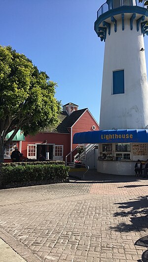
Fisherman's Village
Tourist attraction in Marina del Rey, California, USA
Distance: Approx. 1482 meters
Latitude and longitude: 33.9728,-118.44633
Fisherman's Village is a waterfront mall, commercial boat anchorage, and tourist attraction in Marina del Rey, Los Angeles County. Constructed in the style of a New England fishing village, Fisherman's Village consists of five brightly painted wooden buildings, a waterfront promenade, a lighthouse, a water fountain and commercial boat docks. Tourist attractions include live music concerts, restaurant and café dining, harbor and fishing cruises, boat and bicycle rentals, a Catalina Island ferry service, souvenir shops, a nightclub and a public water shuttle service.

Los Angeles Motordrome
Racetrack and airfield (1910-1913)
Distance: Approx. 924 meters
Latitude and longitude: 33.968,-118.439
The Los Angeles Motordrome was a circular 1-mile (1.6 km) wood board race track. It was located in Playa del Rey, California, and opened in 1910. In addition to automobile racing, it was used for motorcycle competition and aviation activities.

Marina Del Rey Hospital
Hospital in California, United States
Distance: Approx. 1399 meters
Latitude and longitude: 33.98194444,-118.43972222
Marina Del Rey Hospital is a 133-bed acute care, Joint Commission accredited hospital in Los Angeles offering general acute medical services and 24/7 emergency care. Marina Del Rey Hospital, originally known as Marina Mercy Hospital underwent construction in 1969 and became a part of Cedars-Sinai Health System in September 2015.
George C. Page Stadium
Distance: Approx. 1527 meters
Latitude and longitude: 33.967055,-118.414921
George C. Page Stadium is a baseball venue in Los Angeles, California, USA. It is home to the Loyola Marymount Lions baseball team of the NCAA's Division I West Coast Conference. Opened in 1983, it has a capacity of 1,200 spectators. The stadium is named for George C. Page, head of the Incentive Aid Foundation, which covered much of the venue's construction costs.
Call of Duty: Experience 2011
Video game convention
Distance: Approx. 344 meters
Latitude and longitude: 33.97277778,-118.42666667
Call of Duty: XP 2011 was the first annual convention hosted by Activision to celebrate their video game series Call of Duty. The convention was held in Los Angeles, California from September 2–3, 2011 in and around a 12-acre hangar where developer Infinity Ward (coupled with Sledgehammer Games) showcased their upcoming game, Call of Duty: Modern Warfare 3 and online service Call of Duty: Elite. The convention offered fans an opportunity to observe and participate in various events and attractions such as a $1 million tournament, live performances from various artists, Call of Duty: Modern Warfare 3 multiplayer, paintball, jeep off-roading, zip-lining, and a full-scale replica of Burger Town from Call of Duty: Modern Warfare 2.
USC-Lockheed Martin Quantum Computing Center
Joint research facility between Lockheed Martin and the University of Southern California
Distance: Approx. 1278 meters
Latitude and longitude: 33.980295,-118.440003
The USC-Lockheed Martin Quantum Computing Center (QCC) is a joint scientific research effort between Lockheed Martin Corporation and the University of Southern California (USC). The QCC is housed at the Information Sciences Institute (ISI), a computer science and engineering research unit of the USC Viterbi School of Engineering, and is jointly operated by ISI and Lockheed Martin. USC faculty, ISI researchers and students are performing basic and applied research into quantum computing, and are collaborating with researchers around the world.

Los Angeles County Department of Beaches and Harbors
County Department of Beaches and Harbors
Distance: Approx. 1460 meters
Latitude and longitude: 33.9705,-118.446
The Los Angeles County Department of Beaches and Harbors is responsible for 20 beaches and the Marina Del Rey small-craft harbor in Los Angeles County, California.
Weather in this IP's area
few clouds
27 Celsius
30 Celsius
23 Celsius
34 Celsius
1011 hPa
76 %
1011 hPa
1010 hPa
8934 meters
2.24 m/s
4.02 m/s
214 degree
21 %
06:01:58
19:58:15