Country:
 Canada
Region:
City:
Latitude and Longitude:
Time Zone:
Postal Code:
IP information under different IP Channel
ip-api
Country
Region
City
ASN
Time Zone
ISP
Blacklist
Proxy
Latitude
Longitude
Postal
Route
IPinfo
Country
Region
City
ASN
Time Zone
ISP
Blacklist
Proxy
Latitude
Longitude
Postal
Route
MaxMind
Country
Region
City
ASN
Time Zone
ISP
Blacklist
Proxy
Latitude
Longitude
Postal
Route
Luminati
Country
CARegion
ab
City
calgary
ASN
Time Zone
America/Edmonton
ISP
Equinix (EMEA) Acquisition Enterprises B.V.
Latitude
Longitude
Postal
db-ip
Country
Region
City
ASN
Time Zone
ISP
Blacklist
Proxy
Latitude
Longitude
Postal
Route
ipdata
Country
Region
City
ASN
Time Zone
ISP
Blacklist
Proxy
Latitude
Longitude
Postal
Route
Popular places and events near this IP address
Victoria-Hillside
Defunct provincial electoral district in British Columbia, Canada
Distance: Approx. 1392 meters
Latitude and longitude: 48.443,-123.3609
Victoria-Hillside was a provincial electoral district for the Legislative Assembly of British Columbia, Canada from 1991 to 2009.

CBCV-FM
CBC Radio One station in Victoria, British Columbia
Distance: Approx. 1928 meters
Latitude and longitude: 48.437101,-123.363466
CBCV-FM is a Canadian radio station, which broadcasts the programming of the CBC Radio One network in Victoria, British Columbia, and throughout Vancouver Island, the Southern Gulf Islands, and the Sunshine Coast. It also reaches out to parts of Washington north of Everett, but is harder to listen to because of KSER on 90.7. It was the most listened to radio station in the Victoria Market in the Fall 2018 Numeris Diary Survey.
Disappearance of Michael Dunahee
Missing child from British Columbia, Canada
Distance: Approx. 1934 meters
Latitude and longitude: 48.43770833,-123.36052778
Michael Wayne Dunahee (May 12, 1986 – disappeared March 24, 1991) is a Canadian missing child who disappeared from the playground at Blanshard Park Elementary School in Victoria, British Columbia, on March 24, 1991, and has never been found or seen since. Michael was last seen that day around 12:30 pm at the playground as his mother Crystal Dunahee was participating in a women's football practice where his father was a spectator. Although he disappeared metres (yards) from his parents, no witnesses to his disappearance have ever been identified.
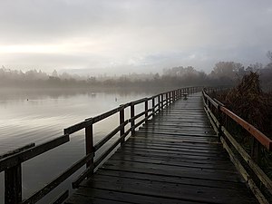
Swan Lake Nature Sanctuary
Nature reserve in British Columbia
Distance: Approx. 1108 meters
Latitude and longitude: 48.4636,-123.373
Swan Lake Christmas Hill Nature Sanctuary is a nature reserve located in Saanich, British Columbia. The sanctuary includes a lake, adjacent marshy lowlands, and the Nature House, as well as a good part of the summit regions of Christmas Hill. The nature sanctuary consists of two physically and ecologically distinct areas: the low wetland area surrounding Swan Lake, and the rocky Garry oak-forested hilltop of Christmas Hill.

Reynolds Secondary School
High school in Saanich, British Columbia, Canada
Distance: Approx. 1837 meters
Latitude and longitude: 48.4687,-123.3597
École Secondaire Reynolds Secondary School is a public secondary school in the Greater Victoria suburb of Saanich, British Columbia, Canada. The school is known for its numerous specialized programs, including flexible studies, French immersion, robotics club, band, and its Centre for Soccer Excellence program. Reynolds also offers many career planning programs such as CP Theatre, CP Art, CP Recreation, CP Tourism, CP Journalism and co-op.
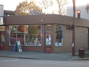
Camas Bookstore and Infoshop
Anarchist bookshop in Victoria, Canada
Distance: Approx. 2009 meters
Latitude and longitude: 48.437475,-123.35880556
The Camas Bookstore and Infoshop is a not-for-profit infoshop located at 2620 Quadra Street in Victoria, British Columbia, Canada.
St. Andrew's Regional High School
Independent school in Victoria, British Columbia, Canada
Distance: Approx. 1747 meters
Latitude and longitude: 48.46929,-123.37416
St. Andrew's, an independent co-educational Catholic High School of 380 Grade 8–12 students, serves young men and women in Greater Victoria.

Vancouver Island School of Art
Art school in Victoria, Canada
Distance: Approx. 2122 meters
Latitude and longitude: 48.4366,-123.358
The Vancouver Island School of Art (VISA) is a private, non-profit post-secondary art school founded in 2004 and located in Victoria, British Columbia, Canada. It is accredited by the Private Training Institutions Branch (PTIB) of the British Columbia Ministry of Advanced Education, Skills & Training and offers a PTIB-approved Certificate program in Visual Arts as well as individual courses and workshops.

Bay Street Armoury
Distance: Approx. 2124 meters
Latitude and longitude: 48.43520833,-123.36393333
Bay Street Armoury is located at 715 Bay Street in Victoria, British Columbia. The Bay Street Drill Hall was completed in 1915. It was created to provide training facilities for local militia units such as the Fifth Regiment of artillery, as well as to provide a home for two newly formed units, the 50th Gordon Highlanders of Canada and HQ Military District No.

1114 Arthur Currie Lane
Historic house in Victoria, British Columbia, Canada
Distance: Approx. 2112 meters
Latitude and longitude: 48.437,-123.3837
1114 Arthur Currie Lane is an historic building in Victoria, British Columbia, Canada. It was the pre-World War I home of General Sir Arthur William Currie . Currie became Canada's first full general in 1915, and was placed in charge of the entire Canadian Corps, independent of the British Army, by 1917.
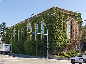
Bay Street Substation
Distance: Approx. 2043 meters
Latitude and longitude: 48.4356,-123.3668
The Bay Street Substation is an historic building in Victoria, British Columbia, Canada. It is located downtown, at the intersection of Bay and Government Streets.

Point Ellice House
Historic site in British Columbia, Canada
Distance: Approx. 2033 meters
Latitude and longitude: 48.4361,-123.3772
Point Ellice House is located in the Rock Bay neighbourhood of Victoria, British Columbia, Canada. Point Ellice House was designated a National Historic Site in 1966 and became a Provincial Historic Site in 1975. The house is also listed on the City of Victoria's heritage registry.
Weather in this IP's area
scattered clouds
18 Celsius
17 Celsius
16 Celsius
21 Celsius
1012 hPa
73 %
1012 hPa
1010 hPa
10000 meters
4.63 m/s
150 degree
40 %
05:43:43
20:55:59