Country:
 Canada
Region:
City:
Latitude and Longitude:
Time Zone:
Postal Code:
IP information under different IP Channel
ip-api
Country
Region
City
ASN
Time Zone
ISP
Blacklist
Proxy
Latitude
Longitude
Postal
Route
IPinfo
Country
Region
City
ASN
Time Zone
ISP
Blacklist
Proxy
Latitude
Longitude
Postal
Route
MaxMind
Country
Region
City
ASN
Time Zone
ISP
Blacklist
Proxy
Latitude
Longitude
Postal
Route
Luminati
Country
CARegion
bc
City
kamloops
ASN
Time Zone
America/Vancouver
ISP
Equinix (EMEA) Acquisition Enterprises B.V.
Latitude
Longitude
Postal
db-ip
Country
Region
City
ASN
Time Zone
ISP
Blacklist
Proxy
Latitude
Longitude
Postal
Route
ipdata
Country
Region
City
ASN
Time Zone
ISP
Blacklist
Proxy
Latitude
Longitude
Postal
Route
Popular places and events near this IP address
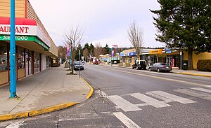
Sechelt
Town on the Sunshine Coast of British Columbia, Canada
Distance: Approx. 167 meters
Latitude and longitude: 49.47416667,-123.75416667
Sechelt (, shíshálh Language: ch'atlich) is a district municipality located on the lower Sunshine Coast of British Columbia. Approximately 50 km (30 miles) northwest of Vancouver, it is accessible from mainland British Columbia by a 40-minute ferry trip between Horseshoe Bay and Langdale, and a 25-minute drive from Langdale along Highway 101, also known as the Sunshine Coast Highway. The name Sechelt is derived from the she shashishalhem word shíshálh, the name of the First Nations people who first settled the area thousands of years ago.
Sechelt/Porpoise Bay Water Aerodrome
Airport in Sechelt, British Columbia
Distance: Approx. 1519 meters
Latitude and longitude: 49.48333333,-123.76666667
Sechelt/Porpoise Bay Water Aerodrome (TC LID: CAX3) was an aerodrome located adjacent to Sechelt, British Columbia, Canada. The airport was listed as abandoned in the 15 March 2007 Canada Flight Supplement.
Sechelt Aerodrome
Airport in Sechelt, British Columbia
Distance: Approx. 2989 meters
Latitude and longitude: 49.46,-123.71638889
Sechelt Aerodrome (IATA: YHS, TC LID: CAP3) is located 1.3 nautical miles (2.4 km; 1.5 mi) south southeast of the centre of Sechelt, British Columbia, Canada.
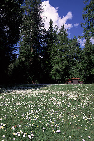
Porpoise Bay Provincial Park
Provincial park in British Columbia, Canada
Distance: Approx. 3712 meters
Latitude and longitude: 49.506652,-123.746524
Porpoise Bay Provincial Park is a provincial park in British Columbia, Canada near the town of Sechelt. Features of the park include a campsite with group and walk-in camping opportunities, as well as opportunities for paddling, swimming and observing nature. The area of Porpoise Bay Provincial Park has historically been used by peoples of the Shíshálh Nation.
Roberts Creek Provincial Park
Provincial park in British Columbia, Canada
Distance: Approx. 7630 meters
Latitude and longitude: 49.43333333,-123.66666667
Roberts Creek Provincial Park is a provincial park in British Columbia, Canada, located northwest of the community of Roberts Creek, between Gibsons and Sechelt. First created in 1947 with an area of 100 acres (0.40 km2), it was modified in size in 2000 to approximately 40 ha.
Sargeant Bay Provincial Park
Provincial park in British Columbia, Canada
Distance: Approx. 8311 meters
Latitude and longitude: 49.47916667,-123.86666667
Sargeant Bay Provincial Park, is a provincial park in British Columbia, Canada, located just west of the community of Sechelt on the southern Sunshine Coast. Created in 1990 at 57 ha. in size, the park was expanded to approximately 146 ha.
École du Pacifique
Elementary/secondary school in Sechelt, British Columbia, Canada
Distance: Approx. 874 meters
Latitude and longitude: 49.47305556,-123.76416667
L'École du Pacifique is a French first language elementary school located in Sechelt, British Columbia, Canada. It serves the Francophone population of the Sunshine Coast, British Columbia. It includes a French Program at Chatelech Secondary School.

Cowichan (steamship)
Distance: Approx. 8787 meters
Latitude and longitude: 49.399,-123.712
Cowichan was a steamship which was operated in British Columbia under the ownership of the Union Steamship Company. Cowichan sank in 1925 following a collision with another ship.
Lighthouse Pub
Pub / Restaurant / Marina / Float Plane Base in Sechelt, British Columbia
Distance: Approx. 946 meters
Latitude and longitude: 49.481143,-123.75782
The Lighthouse Pub is a Transportation Corridor / Restaurant and Pub at the southern tip of Sechelt Inlet. The building was originally a restaurant from Expo 86 and has since been slowly transformed into an air and sea gateway to Sechelt.
St. Augustine's Indian Residential School
School in Sechelt, British Columbia, Canada
Distance: Approx. 97 meters
Latitude and longitude: 49.474,-123.751
St. Augustine's Indian Residential School was a school in Sechelt, British Columbia, Canada, from 1904 to 1975, which was part of the Canadian Indian residential school system. Former pupils include actor Pat John who played in The Beachcombers for 19 years.
Tems swiya Museum
First Nations museum in Canada
Distance: Approx. 97 meters
Latitude and longitude: 49.474,-123.751
The tems swiya Museum is a First Nations museum owned and operated by the shíshálh Nation, and located in Sechelt (ch'atlich), British Columbia, Canada. The museum's name means "Our World" in she shashishalhem, the shíshálh language. Its collection includes cedar baskets, art, photographs, audio recordings, and archaeological collections which include stone tools and the prehistoric sculpture known as The Grieving Mother.
Weather in this IP's area
overcast clouds
19 Celsius
19 Celsius
19 Celsius
21 Celsius
1013 hPa
81 %
1013 hPa
1011 hPa
10000 meters
4.45 m/s
4.6 m/s
128 degree
99 %
05:41:35
21:01:10