Country:
 USA
USARegion:
City:
Latitude and Longitude:
Time Zone:
Postal Code:
IP information under different IP Channel
ip-api
Country
Region
City
ASN
Time Zone
ISP
Blacklist
Proxy
Latitude
Longitude
Postal
Route
IPinfo
Country
Region
City
ASN
Time Zone
ISP
Blacklist
Proxy
Latitude
Longitude
Postal
Route
MaxMind
Country
Region
City
ASN
Time Zone
ISP
Blacklist
Proxy
Latitude
Longitude
Postal
Route
Luminati
Country
USASN
Time Zone
America/Chicago
ISP
Equinix (EMEA) Acquisition Enterprises B.V.
Latitude
Longitude
Postal
db-ip
Country
Region
City
ASN
Time Zone
ISP
Blacklist
Proxy
Latitude
Longitude
Postal
Route
ipdata
Country
Region
City
ASN
Time Zone
ISP
Blacklist
Proxy
Latitude
Longitude
Postal
Route
Popular places and events near this IP address

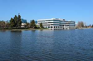
Redwood Shores, California
Place in California, United States
Distance: Approx. 90 meters
Latitude and longitude: 37.5318804,-122.2480219
Redwood Shores is a waterfront community in Redwood City, California, along the western shore of San Francisco Bay on the San Francisco Peninsula in San Mateo County. Redwood Shores is the home of several major technology companies, including Oracle Corporation (which relocated its headquarters in 2020), Electronic Arts, Nintendo, Zuora, Qualys, Crystal Dynamics and Shutterfly.

Hiller Aviation Museum
Aviation museum in San Carlos, California
Distance: Approx. 2259 meters
Latitude and longitude: 37.5124,-122.2531
The Hiller Aviation Museum is an aviation museum located at the San Carlos Airport in San Carlos, California focused on Northern California aviation history, Hiller Aircraft and helicopter history.

San Carlos Airport (California)
Municipal airport in San Carlos, California, United States
Distance: Approx. 2278 meters
Latitude and longitude: 37.51194444,-122.24944444
San Carlos Airport (IATA: SQL, ICAO: KSQL, FAA LID: SQL) is a public airfield located two miles (3.2 km; 1.7 nmi) northeast of San Carlos, California, in San Mateo County and serves the San Francisco Bay Area. The airport lies off U.S. Route 101. The airport is home to Civil Air Patrol West Bay Composite Squadron 192.
KNBR (AM)
Sports radio station in San Francisco
Distance: Approx. 2142 meters
Latitude and longitude: 37.54722222,-122.23333333
KNBR (680 kHz) is a AM radio station in San Francisco, California, broadcasting on a clear channel from transmitting facilities in Redwood City, California. KNBR's non-directional 50,000-watt class-A signal can be heard throughout much of the western United States and as far west as the Hawaiian Islands at night. For several decades, KNBR enjoyed a long history as the flagship station of NBC's West Coast radio operations.
Model N (company)
American software company
Distance: Approx. 990 meters
Latitude and longitude: 37.537,-122.2584
Model N, Inc. is an American software company founded in 1999 and headquartered in San Mateo, California. The company offers revenue management software technology and life sciences companies.

Marine World/Africa USA
Zoo in California, United States
Distance: Approx. 1581 meters
Latitude and longitude: 37.53333333,-122.26666667
Marine World/Africa USA was an animal theme park located in the Redwood Shores area of Redwood City, California. The park was named Marine World when it first opened in 1968, before merging with a land-animal park called Africa USA in 1972. In 1986, the park relocated to Vallejo, California, and is now known as Six Flags Discovery Kingdom.

Ray of Light (sculpture)
Distance: Approx. 935 meters
Latitude and longitude: 37.53074,-122.25918
Ray of Light, is a public artwork by artist Barton Rubenstein, located on the north side of the Redwood Shores Library, in Redwood City, California, United States. The sculpture, constructed from stainless steel, was commissioned as part of the G. R. Cress Bird Bath Project.
Rocketship Education
Charter schools school
Distance: Approx. 1583 meters
Latitude and longitude: 37.5200564,-122.2577127
Rocketship Public Schools (RPS) is a non-profit charter school network headquartered in Redwood City, California.
Peninsula Athletic League
High school athletic conference in California
Distance: Approx. 1461 meters
Latitude and longitude: 37.5258,-122.2631
Peninsula Athletic League (PAL) is a high school athletic conference in California, part of the CIF Central Coast Section of the California Interscholastic Federation. It comprises 17 high schools generally around San Mateo County, California. There are also nine smaller schools, designated supplemental members, of which four are located in Santa Clara County.

Design Tech High School
Public charter high school in Redwood City, California, United States
Distance: Approx. 1342 meters
Latitude and longitude: 37.5326,-122.264
Design Tech High School, commonly referred to as d.tech, is a public charter high school in the San Francisco Bay Area. The school is located on the Oracle Corporation campus in Redwood City, California, and is part of the San Mateo Union High School District. Founded in 2014, the school has roughly 562 students (as of Spring 2022) and focuses on implementing technology, self-direction, and the process of design thinking into its curriculum.
Agiloft
Distance: Approx. 1310 meters
Latitude and longitude: 37.523472,-122.258472
Agiloft, Inc. is a technology company specializing in contract lifecycle management and business process management software in Redwood City, California. It was originally founded in October 1990 as Integral Solutions Corporation by Colin Earl.
Belmont Creek
Creek in California
Distance: Approx. 1886 meters
Latitude and longitude: 37.5289,-122.2697
Belmont Creek is a creek in San Mateo County, California. The creek rises in Belmont and flows east under the Bayshore Freeway entering the Belmont Slough in Redwood Shores.
Weather in this IP's area
few clouds
21 Celsius
21 Celsius
18 Celsius
25 Celsius
1014 hPa
62 %
1014 hPa
1013 hPa
10000 meters
2.68 m/s
6.71 m/s
231 degree
20 %
06:10:07
20:20:37