Country:
 USA
USARegion:
City:
Latitude and Longitude:
Time Zone:
Postal Code:
IP information under different IP Channel
ip-api
Country
Region
City
ASN
Time Zone
ISP
Blacklist
Proxy
Latitude
Longitude
Postal
Route
IPinfo
Country
Region
City
ASN
Time Zone
ISP
Blacklist
Proxy
Latitude
Longitude
Postal
Route
MaxMind
Country
Region
City
ASN
Time Zone
ISP
Blacklist
Proxy
Latitude
Longitude
Postal
Route
Luminati
Country
USRegion
al
City
tuscaloosa
ASN
Time Zone
America/Chicago
ISP
UNITI-FIBER
Latitude
Longitude
Postal
db-ip
Country
Region
City
ASN
Time Zone
ISP
Blacklist
Proxy
Latitude
Longitude
Postal
Route
ipdata
Country
Region
City
ASN
Time Zone
ISP
Blacklist
Proxy
Latitude
Longitude
Postal
Route
Popular places and events near this IP address
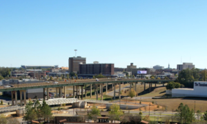
Tuscaloosa, Alabama
City in Alabama, United States
Distance: Approx. 7 meters
Latitude and longitude: 33.20972222,-87.56916667
Tuscaloosa ( TUS-kə-LOO-sə) is a city in and the county seat of Tuscaloosa County in west-central Alabama, United States, on the Black Warrior River where the Gulf Coastal and Piedmont plains meet. Alabama's fifth-most populous city, the population was 99,600 at the 2020 census, and was estimated to be 110,602 in 2022. It was known as Tuskaloosa until the early 20th century.
Christ Episcopal Church (Tuscaloosa, Alabama)
Historic site in Tuscaloosa, Alabama
Distance: Approx. 276 meters
Latitude and longitude: 33.20772,-87.57089
Christ Episcopal Church is a historic church building in Tuscaloosa, Alabama. It was organized on January 7, 1828, by thirteen men who elected the first vestry that night. In the first year, the vestry hired the architect William Nichols to design the building and oversee its construction.
Alabama Stage and Screen Hall of Fame
Distance: Approx. 228 meters
Latitude and longitude: 33.20770556,-87.56966111
The Alabama Stage and Screen Hall of Fame was founded in 1998 for the purpose of honoring Alabamians who have made significant contributions to film, television or theatre. The organization is sponsored jointly by Theatre Tuscaloosa and Shelton State Community College in Tuscaloosa, Alabama.

Battle–Friedman House
Historic house in Alabama, United States
Distance: Approx. 627 meters
Latitude and longitude: 33.20444444,-87.56666667
The Battle–Friedman House (also known as Battle House or Friedman Home) is an antebellum town home located in Tuscaloosa, Alabama. The house was built in 1835 by Alfred Battle and his wife, Millicent Battle. The house's grounds include the only remaining documented antebellum garden in the state.

Bama Theatre
Historic movie theater in Tuscaloosa, Alabama
Distance: Approx. 155 meters
Latitude and longitude: 33.20861111,-87.56805556
The Bama Theatre is a historic theatre in Tuscaloosa, Alabama that currently serves as the city's performing arts center. Its modern redevelopment is the result of cooperation between the Arts Council of Tuscaloosa and the Tuscaloosa County Parks and Recreation Authority. The three-story brick and limestone building is located at the corner of Gary Fitts Street (formerly Sixth Street) and Greensboro Avenue in downtown Tuscaloosa.

Tuscaloosa Amphitheater
Outdoor amphitheater in Tuscaloosa, Alabama
Distance: Approx. 597 meters
Latitude and longitude: 33.21219444,-87.57476944
The Tuscaloosa Amphitheater is an outdoor amphitheater in Tuscaloosa, Alabama, USA that is used primarily for music performances. It has a seating capacity of 7,470. The amphitheater is located on Jack Warner Parkway, just beside the Hugh R. Thomas Bridge, only minutes away from the University of Alabama campus and blocks from downtown Tuscaloosa.

City National Bank (Tuscaloosa, Alabama)
United States historic place
Distance: Approx. 204 meters
Latitude and longitude: 33.21,-87.56694444
The City National Bank is an historic building in Tuscaloosa, Alabama. It was designed in the Classical Revival Style by William Leslie Welton and was built in 1922. It was listed on the National Register of Historic Places in 1985.

First African Baptist Church (Tuscaloosa, Alabama)
Historic church in Alabama, United States
Distance: Approx. 570 meters
Latitude and longitude: 33.20472222,-87.57055556
First African Baptist Church is a Baptist church located in Tuscaloosa, Alabama. It is affiliated with the National Baptist Convention, USA. It was built in 1907 from a congregation established in 1866, and was added to the National Register of Historic Places in 1988.
Black Warrior Brewing Company
Craft brewery in Tuscaloosa, Alabama
Distance: Approx. 279 meters
Latitude and longitude: 33.21064444,-87.56632778
Black Warrior Brewing Company is a craft brewery in Tuscaloosa, Alabama.

Downtown Tuscaloosa Historic District
United States historic place
Distance: Approx. 175 meters
Latitude and longitude: 33.20972222,-87.56722222
The Downtown Tuscaloosa Historic District is a historic district which was first listed on the National Register of Historic Places in 1986. The listing included 50 contributing buildings on 27 acres (11 ha), including the historic city hall of Tuscaloosa. It included a total of 91 buildings, with non-contributing buildings and ones deemed marginally contributing.

United States Federal Building and Courthouse (Tuscaloosa, Alabama)
Federal courthouse in Tuscaloosa, Alabama
Distance: Approx. 555 meters
Latitude and longitude: 33.21023,-87.56317
The Tuscaloosa Federal Building and Courthouse is a building in downtown Tuscaloosa, Alabama that houses the United States District Court, United States Bankruptcy Court, the U.S. Marshal Service, the Federal Bureau of Investigation, and the offices of the Social Security Administration. It also includes offices for Alabama's senators and congressional representatives.

Capitol Park (Tuscaloosa, Alabama)
Distance: Approx. 524 meters
Latitude and longitude: 33.2079,-87.5743
Capitol Park on Childress Hill is a park in Tuscaloosa, Alabama, on a bluff above the Black Warrior River. It was the site of the Alabama State Capitol from 1826 to 1846, when the capitol was moved to Montgomery. The capitol building was subsequently used for Alabama Central Female College.
Weather in this IP's area
overcast clouds
25 Celsius
26 Celsius
24 Celsius
26 Celsius
1015 hPa
79 %
1015 hPa
1007 hPa
10000 meters
100 %
06:00:04
19:53:15