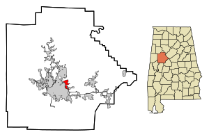
Country:
 USA
USARegion:
City:
Latitude and Longitude:
Time Zone:
Postal Code:
IP information under different IP Channel
ip-api
Country
Region
City
ASN
Time Zone
ISP
Blacklist
Proxy
Latitude
Longitude
Postal
Route
IPinfo
Country
Region
City
ASN
Time Zone
ISP
Blacklist
Proxy
Latitude
Longitude
Postal
Route
MaxMind
Country
Region
City
ASN
Time Zone
ISP
Blacklist
Proxy
Latitude
Longitude
Postal
Route
Luminati
Country
USRegion
al
City
birmingham
ASN
Time Zone
America/Chicago
ISP
UNITI-FIBER
Latitude
Longitude
Postal
db-ip
Country
Region
City
ASN
Time Zone
ISP
Blacklist
Proxy
Latitude
Longitude
Postal
Route
ipdata
Country
Region
City
ASN
Time Zone
ISP
Blacklist
Proxy
Latitude
Longitude
Postal
Route
Popular places and events near this IP address
Holt, Alabama
Census-designated place & Unincorporated community in Alabama, United States
Distance: Approx. 4642 meters
Latitude and longitude: 33.230467,-87.486303
Holt is an unincorporated community and census-designated place (CDP) in Tuscaloosa County, Alabama, United States. At the 2020 census, the population was 3,413. It is part of the Tuscaloosa, Alabama Metropolitan Statistical Area.

Bryce Hospital
Hospital in Alabama, United States
Distance: Approx. 4221 meters
Latitude and longitude: 33.21626,-87.53831
Bryce Hospital opened in 1861 in Tuscaloosa, Alabama, United States. It is Alabama's oldest and largest inpatient psychiatric facility. First known as the Alabama State Hospital for the Insane and later as the Alabama Insane Hospital, the building is considered an architectural model.

North River (Alabama)
River in Alabama, United States
Distance: Approx. 2499 meters
Latitude and longitude: 33.24456,-87.50333
The North River is a 77-mile-long (124 km) river in the western portion of the state of Alabama, United States. It is a tributary of the Black Warrior River, joining it just north of Tuscaloosa.

Paul Bryant Bridge
Bridge in Tuscaloosa, Alabama
Distance: Approx. 2482 meters
Latitude and longitude: 33.2415,-87.5054
The Paul Bryant Bridge is a four-lane, 150-foot-tall (46 m), $28 million bridge spanning the Black Warrior River along Alabama State Route 297 in Tuscaloosa, Alabama. Construction of the 3,785-foot-long (1,154 m), twin-span bridge commenced in March 2000. Originally slated to open in December 2003, construction delays resulted in its opening on April 23, 2004.
Northridge High School (Alabama)
Public school in Tuscaloosa, Alabama, United States
Distance: Approx. 931 meters
Latitude and longitude: 33.24484,-87.52771
Northridge High School is a public high school in Tuscaloosa, Alabama, United States, enrolling just over 1000 students in grades 9–12 as of spring 2021. It is one of three high schools in the Tuscaloosa City School District. It offers technical and academic programs, as well as joint enrollment with Shelton State Community College and the University of Alabama.
WRTR
Radio station in Brookwood, Alabama
Distance: Approx. 4352 meters
Latitude and longitude: 33.23805556,-87.485
WRTR (105.9 FM, "Talk Radio 105.9") is a radio station broadcasting a news/talk radio format. Licensed to Brookwood, Alabama, United States, the station serves the Tuscaloosa area. The station is currently owned by iHeartMedia, Inc.
WTBC (AM)
Radio station in Alabama, United States
Distance: Approx. 4189 meters
Latitude and longitude: 33.21928611,-87.50861667
WTBC (1230 AM) is a radio station broadcasting a sports radio format. Licensed to Tuscaloosa, Alabama, United States, the station serves the greater Tuscaloosa area. The station is owned by Townsquare Media.
Woolsey Finnell Bridge
Bridge in Tuscaloosa, Alabama
Distance: Approx. 3368 meters
Latitude and longitude: 33.223182,-87.532625
The Woolsey Finnell Bridge is a four-lane, girder bridge spanning the Black Warrior River along U.S. Route 82 (McFarland Boulevard) in Tuscaloosa, Alabama that opened in 1961. The bridge takes its name from the former state director of highways for Alabama, Woolsey Finnell. This is one of only four vehicular bridges spanning the Black Warrior in Tuscaloosa.

Alabama Museum of Natural History
Museum in Tuscaloosa, Alabama, United States
Distance: Approx. 4819 meters
Latitude and longitude: 33.212,-87.544
The Alabama Museum of Natural History is the state's natural history museum, located in Smith Hall at the University of Alabama campus in Tuscaloosa. The oldest museum in the state, it was founded in 1831. The exhibits depict the natural diversity of Alabama from the Age of Dinosaurs, the Coal Age, and the Ice Age.
Alabama Soccer Stadium
Soccer stadium in Alabama, United States
Distance: Approx. 4745 meters
Latitude and longitude: 33.21074722,-87.53265833
The Alabama Soccer Stadium was built in 2004. The complex features covered bench areas for both teams and a press box with seating for 1,500 spectators and standing room for many more. The University of Alabama soccer field was the first home of Alabama soccer and it saw its first action on Oct.
Ol' Colony Golf Complex
Public golf course in Tuscaloosa, Alabama USA
Distance: Approx. 966 meters
Latitude and longitude: 33.25568056,-87.53804444
Ol' Colony Golf Complex is a municipal public golf course in Tuscaloosa, Alabama. The 18-hole course opened in December 2000 on 597 acres that was once a farm plantation for a mental institution named Cain's Colony. Ol' Colony was designed by professional golfer Jerry Pate, who played golf for The University of Alabama.
Tuscaloosa Academy
Private school
Distance: Approx. 1407 meters
Latitude and longitude: 33.2451,-87.5397
Tuscaloosa Academy (TA) is a private school in Tuscaloosa, Alabama. It has been described as a segregation academy.
Weather in this IP's area
broken clouds
33 Celsius
40 Celsius
32 Celsius
33 Celsius
1015 hPa
63 %
1015 hPa
1007 hPa
10000 meters
2.57 m/s
75 %
05:59:48
19:53:11