Country:
Region:
City:
Latitude and Longitude:
Time Zone:
Postal Code:
IP information under different IP Channel
ip-api
Country
Region
City
ASN
Time Zone
ISP
Blacklist
Proxy
Latitude
Longitude
Postal
Route
IPinfo
Country
Region
City
ASN
Time Zone
ISP
Blacklist
Proxy
Latitude
Longitude
Postal
Route
MaxMind
Country
Region
City
ASN
Time Zone
ISP
Blacklist
Proxy
Latitude
Longitude
Postal
Route
Luminati
Country
Region
00
City
pasig
ASN
Time Zone
Asia/Manila
ISP
Converge ICT Solutions Inc.
Latitude
Longitude
Postal
db-ip
Country
Region
City
ASN
Time Zone
ISP
Blacklist
Proxy
Latitude
Longitude
Postal
Route
ipdata
Country
Region
City
ASN
Time Zone
ISP
Blacklist
Proxy
Latitude
Longitude
Postal
Route
Popular places and events near this IP address

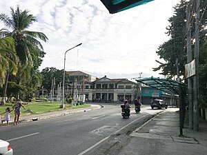
Mangaldan
Municipality in Pangasinan, Philippines
Distance: Approx. 149 meters
Latitude and longitude: 16.07,120.40388889
Mangaldan, officially the Municipality of Mangaldan (Pangasinan: Baley na Mangaldan; Ilocano: Ili ti Mangaldan; Tagalog: Bayan ng Mangaldan), is a 1st class municipality in the province of Pangasinan, Philippines. According to the 2020 census, it has a population of 113,185 people.

Calasiao
Municipality in Pangasinan, Philippines
Distance: Approx. 6563 meters
Latitude and longitude: 16.02,120.37
Calasiao, officially the Municipality of Calasiao (Pangasinan: Baley na Calasiao; Ilocano: Ili ti Calasiao; Tagalog: Bayan ng Calasiao), is a 1st class municipality in the province of Pangasinan, Philippines. According to the 2020 census, it has a population of 100,471 people. Today, Calasiao is known as a first class, highly commercialized municipality and is strategically located at the heart of Pangasinan.
Mapandan
Municipality in Pangasinan, Philippines
Distance: Approx. 7372 meters
Latitude and longitude: 16.026,120.454
Mapandan, officially the Municipality of Mapandan (Pangasinan: Baley na Mapandan; Ilocano: Ili ti Mapandan; Tagalog: Bayan ng Mapandan), is a 3rd class municipality in the province of Pangasinan, Philippines. According to the 2020 census, it has a population of 38,058 people. Mapandan is known for its yearly Pandan Festival.

San Jacinto, Pangasinan
Municipality in Pangasinan, Philippines
Distance: Approx. 4139 meters
Latitude and longitude: 16.0725,120.44111
San Jacinto, officially the Municipality of San Jacinto (Pangasinan: Baley na San Jacinto; Ilocano: Ili ti San Jacinto; Tagalog: Bayan ng San Jacinto), is a 3rd class municipality in the province of Pangasinan, Philippines. According to the 2020 census, it has a population of 44,351 people. San Jacinto is 26 kilometres (16 mi) from Lingayen and 208 kilometres (129 mi) from Manila.
Santa Barbara, Pangasinan
Municipality in Pangasinan, Philippines
Distance: Approx. 7454 meters
Latitude and longitude: 16.00306,120.40083
Santa Barbara, officially the Municipality of Santa Barbara (Pangasinan: Baley na Santa Barbara; Ilocano: Ili ti Santa Barbara; Tagalog: Bayan ng Santa Barbara), is a 1st class municipality in the province of Pangasinan, Philippines. According to the 2020 census, it has a population of 92,187 people.
University of Pangasinan
Private university in Pangasinan, Philippines
Distance: Approx. 6992 meters
Latitude and longitude: 16.0467,120.3418
The PHINMA – University of Pangasinan, also known as UPang, is a private and non-sectarian university located at Dagupan, Pangasinan, Philippines. It is a member of the PHINMA Education Network (PEN). It offers practically all undergraduate and graduate courses that Metro Manila universities offer.

Universidad de Dagupan
Private university in Pangasinan, Philippines
Distance: Approx. 6933 meters
Latitude and longitude: 16.05082,120.34084
Universidad de Dagupan (formerly Colegio de Dagupan, Computronix College) is a private non-sectarian college located in Dagupan, Philippines.

Dagupan station
Distance: Approx. 6695 meters
Latitude and longitude: 16.04584,120.34519
Dagupan station was a terminus of the Philippine National Railways Northrail in Dagupan, Pangasinan.

Bued River
River in Luzon, Philippines
Distance: Approx. 1818 meters
Latitude and longitude: 16.0804,120.4156
The Bued River is a river in the island of Luzon in the Philippines with a total length of 80 km (50 mi). It covers primarily the provinces of Benguet and Pangasinan, and a few parts of La Union. The river originates from the city of Baguio and joins with the Angalacan River in the municipality of Mangaldan, Pangasinan to form the Cayanga River.

Living Temple Ministries
Evangelical church based in the Philippines
Distance: Approx. 2185 meters
Latitude and longitude: 16.05446,120.39002
The Living Temple of God in Christ Jesus Fellowship or Living Temple Ministries or LTM is an Evangelical church based in the Philippines. With Two branches and still increasing, is located at Malabago, Mangaldan, Pangasinan.
PiliPinas Debate 2016 – Luzon leg
Distance: Approx. 6579 meters
Latitude and longitude: 16.06333333,120.34138889
The Luzon leg of the PiliPinas Debates 2016 is the third and final presidential debate of the 2016 Philippine elections, was held at the University of Pangasinan in Dagupan on April 24, 2016. It was organized by COMELEC and KBP with ABS-CBN, and Manila Bulletin as media partners. The debate was moderated by ABS-CBN News and Current Affairs anchors Karen Davila and Tony Velasquez.
Region I Medical Center
Government hospital in Dagupan, Philippines
Distance: Approx. 6996 meters
Latitude and longitude: 16.04852,120.34104
The Region I Medical Center is a tertiary level government hospital in the Philippines with an authorized bed capacity of six hundred (600). It is located along Arellano Street, Dagupan.
Weather in this IP's area
overcast clouds
26 Celsius
26 Celsius
26 Celsius
26 Celsius
1010 hPa
85 %
1010 hPa
1009 hPa
10000 meters
1.24 m/s
2.97 m/s
306 degree
100 %
05:38:40
18:30:50

