Country:
 The Philippines
Region:
City:
Latitude and Longitude:
Time Zone:
Postal Code:
IP information under different IP Channel
ip-api
Country
Region
City
ASN
Time Zone
ISP
Blacklist
Proxy
Latitude
Longitude
Postal
Route
IPinfo
Country
Region
City
ASN
Time Zone
ISP
Blacklist
Proxy
Latitude
Longitude
Postal
Route
MaxMind
Country
Region
City
ASN
Time Zone
ISP
Blacklist
Proxy
Latitude
Longitude
Postal
Route
Luminati
Country
PHRegion
00
City
pasig
ASN
Time Zone
Asia/Manila
ISP
Converge ICT Solutions Inc.
Latitude
Longitude
Postal
db-ip
Country
Region
City
ASN
Time Zone
ISP
Blacklist
Proxy
Latitude
Longitude
Postal
Route
ipdata
Country
Region
City
ASN
Time Zone
ISP
Blacklist
Proxy
Latitude
Longitude
Postal
Route
Popular places and events near this IP address

Aguinaldo Shrine
National shrine in Cavite, Philippines
Distance: Approx. 2834 meters
Latitude and longitude: 14.445,120.90694444
The Emilio Aguinaldo Shrine (or the Cavite El Viejo Shrine) is a national shrine located in Kawit, Cavite in the Philippines, where the Philippine Declaration of Independence from Spain was declared on June 12, 1898, or Independence Day. To commemorate the event, now known as Araw ng Kalayaan or Independence Day, a national holiday, the Philippine flag is raised here by top government officials on June 12 each year. The house is now a museum.
Bacoor Bay
Bay in Cavite, Philippines
Distance: Approx. 2618 meters
Latitude and longitude: 14.46833333,120.90694444
Bacoor Bay is a large inlet of southeastern Manila Bay, situated within the province of Cavite in the Philippines.

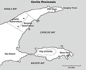
Naval Base Cavite
Distance: Approx. 2915 meters
Latitude and longitude: 14.48166667,120.91611111
Naval Station Pascual Ledesma, also known as Cavite Naval Base or Cavite Navy Yard, is a military installation of the Philippine Navy in Cavite City. In the 1940s and '50s, it was called Philippine Navy Operating Base. The 9-hectare (22-acre) naval base is located at the easternmost end of Cavite Point in the San Roque district (specifically Fort San Felipe) of the city.

St. Mary Magdalene Church (Kawit)
Roman Catholic church in Cavite, Philippines
Distance: Approx. 3159 meters
Latitude and longitude: 14.444739,120.90359
The Diocesan Shrine and Parish of Saint Mary Magdalene, commonly known as Kawit Church, is the parish church of the municipality of Kawit, Cavite in the Philippines. It is under the jurisdiction of the Diocese of Imus. The Roman Catholic church is one of the oldest churches in the Philippines, construction of the present church was started in 1737.
Fort San Felipe (Cavite)
Military fortress in Cavite, Philippines
Distance: Approx. 2900 meters
Latitude and longitude: 14.48180556,120.91666667
Fort San Felipe (Spanish: Fortaleza de San Felipe; Filipino: Moog ng San Felipe Neri) is a military fortress in Cavite City, Philippines. It was constructed by the Spanish military in 1609 in the first port town of Cavite, the historic core of the present and larger Cavite City, for its protection. Less than half of the original historic structure survives today.

St. Michael the Archangel Parish of Binakayan
Church in Cavite, Philippines
Distance: Approx. 1397 meters
Latitude and longitude: 14.44731,120.92367
The Iglesia Catolica Apostolica Filipina Independiente – also known as Iglesia Filipina Independiente de Binakayan, is a Christian Church organized in Kawit, Cavite, Philippines, in 1902, under the Diocese of Cavite of the Philippine Independent Church.

Baldomero Aguinaldo Shrine
Historic house in Cavite, Philippines
Distance: Approx. 1361 meters
Latitude and longitude: 14.447709,120.923573
The Baldomero Aguinaldo Shrine is a single-detached house built by Baldomero Aguinaldo, cousin of Emilio Aguinaldo during the American colonial period in 1906 at Binakayan, Kawit, Cavite. Baldomero held several positions at the revolutionary government during the early 1900s. He became the head of the Kawit Chapter of the Katipunan, President of the KKK Magdalo Council, and Secretary of the Treasury in the 1897 Biak-na-Bato Republic.
Emiliano Tria Tirona Memorial National High School
Public high school in Cavite, Philippines
Distance: Approx. 2896 meters
Latitude and longitude: 14.44171,120.90875
The Emiliano Tria Tirona Memorial National Integrated High School is a secondary public high school located in Gahak, Kawit, Cavite in the Philippines.
Naval Base Manila
Former Major United States Navy Base
Distance: Approx. 2915 meters
Latitude and longitude: 14.48166667,120.91611111
Naval Base Manila, Naval Air Base Manila was a major United States Navy base south of the City of Manila, on Luzon Island in the Philippines. Some of the bases dates back to 1898, the end of the Spanish–American War. Starting in 1938 civilian contractors were used to build new facilities in Manila to prepare for World War II. Work stopped on December 23, 1941, when Manila was declared not defendable against the Empire of Japan southward advance, which took over the city on January 2, 1942, after the US declared it an open city.

Cuenca Ancestral House
Distance: Approx. 1480 meters
Latitude and longitude: 14.45967222,120.94278889
The Cuenca Ancestral House (Bahay na Tisa) is a historic residential building in Bacoor, Cavite, Philippines.
Southern Tagalog Regional Hospital
Government hospital in Cavite, Philippines
Distance: Approx. 2736 meters
Latitude and longitude: 14.4414,120.94713
The Southern Tagalog Regional Hospital (STRH) is a tertiary level government hospital in the Philippines with an authorized bed capacity of one hundred (100). It is located in Bacoor, Cavite.
Island Cove (Cavite)
Island and gambling complex in Cavite, Philippines
Distance: Approx. 692 meters
Latitude and longitude: 14.46117,120.92321
PAGCOR POGO Hub Covelandia is an online gambling complex hosted in Island Cove and Animal Island in Kawit, Cavite, Philippines. It formerly hosted a resort and leisure park owned by the Remulla political family. It now hosts a hub for Philippine Offshore Gaming Operators (POGOs).
Weather in this IP's area
scattered clouds
26 Celsius
26 Celsius
26 Celsius
27 Celsius
1009 hPa
94 %
1009 hPa
1009 hPa
10000 meters
0.51 m/s
40 %
05:39:13
18:26:02