Country:
 The Philippines
Region:
City:
Latitude and Longitude:
Time Zone:
Postal Code:
IP information under different IP Channel
ip-api
Country
Region
City
ASN
Time Zone
ISP
Blacklist
Proxy
Latitude
Longitude
Postal
Route
IPinfo
Country
Region
City
ASN
Time Zone
ISP
Blacklist
Proxy
Latitude
Longitude
Postal
Route
MaxMind
Country
Region
City
ASN
Time Zone
ISP
Blacklist
Proxy
Latitude
Longitude
Postal
Route
Luminati
Country
PHRegion
00
City
pasig
ASN
Time Zone
Asia/Manila
ISP
Converge ICT Solutions Inc.
Latitude
Longitude
Postal
db-ip
Country
Region
City
ASN
Time Zone
ISP
Blacklist
Proxy
Latitude
Longitude
Postal
Route
ipdata
Country
Region
City
ASN
Time Zone
ISP
Blacklist
Proxy
Latitude
Longitude
Postal
Route
Popular places and events near this IP address
Rodriguez, Rizal
Municipality in Rizal, Philippines
Distance: Approx. 2458 meters
Latitude and longitude: 14.72,121.12
Rodriguez, officially the Municipality of Rodriguez (Tagalog: Bayan ng Rodriguez) and commonly known by its former name Montalban, is a 1st class urban municipality in the province of Rizal, Philippines. According to the 2020 census, it has a population of 443,954 people making it the most populous municipality in the country. Pending an affirmation through plebiscite, Republic Act No.
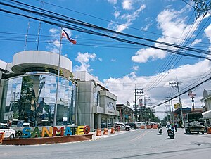
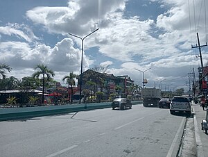
San Mateo, Rizal
Municipality in Rizal, Philippines
Distance: Approx. 227 meters
Latitude and longitude: 14.69694,121.12194
San Mateo, officially the Municipality of San Mateo (Tagalog: Bayan ng San Mateo), is a 1st class urban municipality in the province of Rizal, Philippines. According to the 2020 census, it has a population of 273,306. It is bordered by Quezon City to the west, Marikina and Antipolo to the south, and by the Municipality of Rodriguez to the north.
Bagong Silangan
Barangay in Quezon City, Metro Manila, Philippines
Distance: Approx. 2833 meters
Latitude and longitude: 14.70944444,121.1
Bagong Silangan is a barangay located in the 2nd district of Quezon City, Philippines. Nearby barangays are Commonwealth, Batasan Hills and Payatas. Separated by a river in the east, the barangay leads to the Municipality of San Mateo in the province of Rizal.
2007 Batasang Pambansa bombing
Distance: Approx. 3176 meters
Latitude and longitude: 14.6925,121.0947
The 2007 Batasang Pambansa bombing occurred on the night of November 13, 2007, at the Batasang Pambansa Complex in Quezon City, Philippines—the seat of the country's House of Representatives. As Representatives Wahab Akbar (Basilan lone), Luzviminda Ilagan (Gabriela), and Pryde Henry Teves (Negros Oriental 3rd) were exiting the south wing of the building after a session, explosives in a nearby parked motorcycle were detonated. Akbar and a staffer of Ilagan were killed in the blast.
Batasan Road
Road in Quezon City, Philippines
Distance: Approx. 3174 meters
Latitude and longitude: 14.69666667,121.09416667
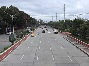
Batasan Road (formerly and still known as IBP Road), is a six-to-ten lane circumferential highway located in the barangays of Batasan Hills, Bagong Silangan, Payatas, and Commonwealth, which are located all in Quezon City, Philippines. The road serves as a route towards the Batasang Pambansa Complex, where the House of Representatives of the Philippines is located.
Batasan–San Mateo Road
Road in the Philippines
Distance: Approx. 2673 meters
Latitude and longitude: 14.68555556,121.1025
The Batasan–San Mateo Road, also known as the IBP–San Mateo Road and formerly as the Constitutional Road, is a four-lane east–west highway connecting Quezon City and San Mateo, Rizal in the Philippines. The road begins at the intersection with the Batasan Road in Batasan Hills, Quezon City adjacent to the Batasang Pambansa complex. It passes through the areas of Filinvest II Subdivision which also includes Northview I and II, the former site of Batasan Hills Elementary School, San Antonio de Padua Church, a temple of the Church of Jesus Christ of Latter-day Saints, a branch of Puregold Jr.
Payatas
Barangay in Quezon City, Metro Manila, Philippines
Distance: Approx. 2887 meters
Latitude and longitude: 14.70988889,121.09966667
Payatas is an administrative division in eastern Metro Manila, the Philippines. It is an urban barangay located in the 2nd district of Quezon City adjacent to the barangays of Commonwealth, Batasan Hills and Bagong Silangan.

Batasang Pambansa Complex
Headquarters of the House of Representatives of the Philippines
Distance: Approx. 3191 meters
Latitude and longitude: 14.69331389,121.09439722
The Batasang Pambansa Complex, or simply the Batasan (lit. 'legislature'), is the seat of the House of Representatives of the Philippines. It is located along the Batasan Road in Batasan Hills, Quezon City. The complex was initially the home of the Batasang Pambansa, the former legislature of the Philippines which was established as an interim assembly in 1978 and finally as an official body in 1984.
San Mateo National High School
Public high school in Rizal, Philippines
Distance: Approx. 479 meters
Latitude and longitude: 14.69469,121.12103
San Mateo National High School (SMNHS) is a government-funded secondary educational institution located in the Municipality of San Mateo, Rizal in the Philippines.
Jose F. Diaz Memorial National High School
Public high school in Rizal, Philippines
Distance: Approx. 2257 meters
Latitude and longitude: 14.67842,121.12822
Jose F. Diaz Memorial National High School (JFDMNHS), formerly known as Sto. Niño National High School and founded in 1997, is a public secondary school located in San Mateo, Rizal, Philippines. It is recognized by the Department of Education (DepEd).

SM City San Mateo
Shopping mall in the Philippines
Distance: Approx. 2285 meters
Latitude and longitude: 14.67968461,121.11445001
SM City San Mateo is a shopping mall owned by the largest mall developer in the Philippines, SM Prime Holdings. It is located along Gen. Luna Avenue, Brgy.

Payatas dumpsite
Former open dumpsite in Quezon City, the Philippines
Distance: Approx. 2846 meters
Latitude and longitude: 14.71683333,121.1055
The Payatas dumpsite, also known as the Payatas Controlled Disposal Facility (PCDF), is a former garbage dump in the barangay of the same name in Quezon City, Metro Manila, the Philippines. Originally established in the 1970s, the former open dumpsite was home to scavengers who migrated to the area after the closure of the Smokey Mountain landfill in Tondo, Manila. After the Payatas landslide happened in 2000, the newly passed Ecological Solid Waste Management Act mandated the closure of open and controlled dumpsites.
Weather in this IP's area
moderate rain
28 Celsius
32 Celsius
27 Celsius
28 Celsius
1010 hPa
85 %
1010 hPa
1008 hPa
10000 meters
0.76 m/s
1.58 m/s
307 degree
100 %
05:37:49
18:25:55